There should have been a “History of the Offworld Colonies” post this weekend, but in its absence we bring you this special report on how I spent my weekend instead of writing one…
 |
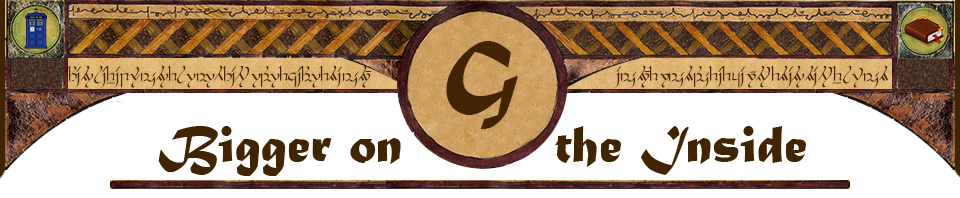
Mules have been carrying tourists down into the Grand Canyon since 1887— long before it was a National Park. At left, Teddy Roosevelt takes the trip, in a photo taken by the Kolb brothers sometime around 1906. Mules first came to the Grand Canyon with the prospectors who staked hopeful mining claims on its cliffs, but as prospecting gave way to tourism at the canyon, prospector John Hance saw an opportunity and turned his failed mining outpost into a hotel and the mules that had hauled ore out of the canyon into a way to take tourists into it. Hance’s operation at Grandview Point eventually lost out to competition with the Grand Canyon Village growing up around Bright Angel Trail, where railroad/hotel tycoon Fred Harvey was building the hotels Bright Angel Lodge and El Tovar, still in operation today. Harvey took over the mule ride business but staged his rides down Hermit Trail, since the owner of Bright Angel at the time (another former prospector) was charging prohibitive tolls for the use of his trail. |
Eventually Bright Angel Trail opened up and the mule rides began setting out from the Grand Canyon village, as they still do today. When Grand Canyon became a National Park, the park service kept the tradition going, and it’s still going strong.
At one point during all those years, the Goodnight family visited the Canyon and Jim Goodnight, then around 12 years old, got a standby ticket for the mule rides, which even then booked up their reservations long in advance. As it happened, one of the ticketed riders chickened out at the last minute, and Jim thought he had it made. He was actually on the mule when the other rider’s friends talked him into going after all, and so Jim didn’t get to go.
Now, as far as I’m concerned, when a 12-year-old kid is actually on the mule, it’s too late to change your mind about backing out. But that’s the way it happened.
Jim Goodnight’s my Dad. So a year ago, when I was making reservations for my “Epic July Road Trip” (see earlier blog posts about that), I made an extra reservation for a year further out, which is how far ahead you have to make your plans for that mule ride. So this past weekend, my Dad and I visited the Grand Canyon, and he finally got that mule ride.
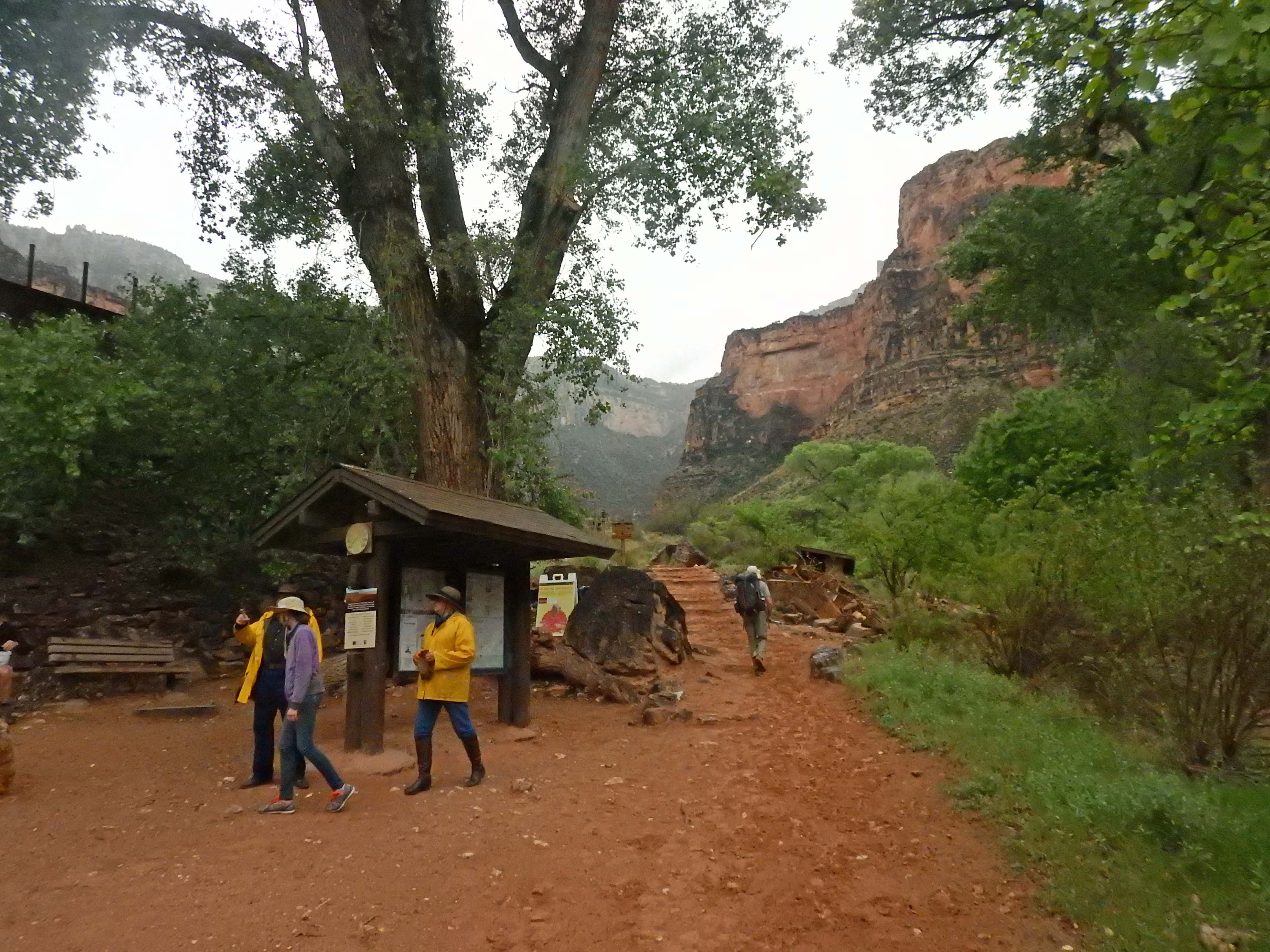
| Okay, so all that sounds needlessly sentimental and although I’m a writer, sob stories aren’t really my forte. So let’s get on with the ride! MY Dad and I arrived at the Grand Canyon on Thursday April 7, with our mule ride down to the bottom of the canyon, including an overnight stay at Phantom Rance, scheduled for Friday-Saturday. |  (Throughout this post, click on any thumbnail to see the full-size image.) (Throughout this post, click on any thumbnail to see the full-size image.) |
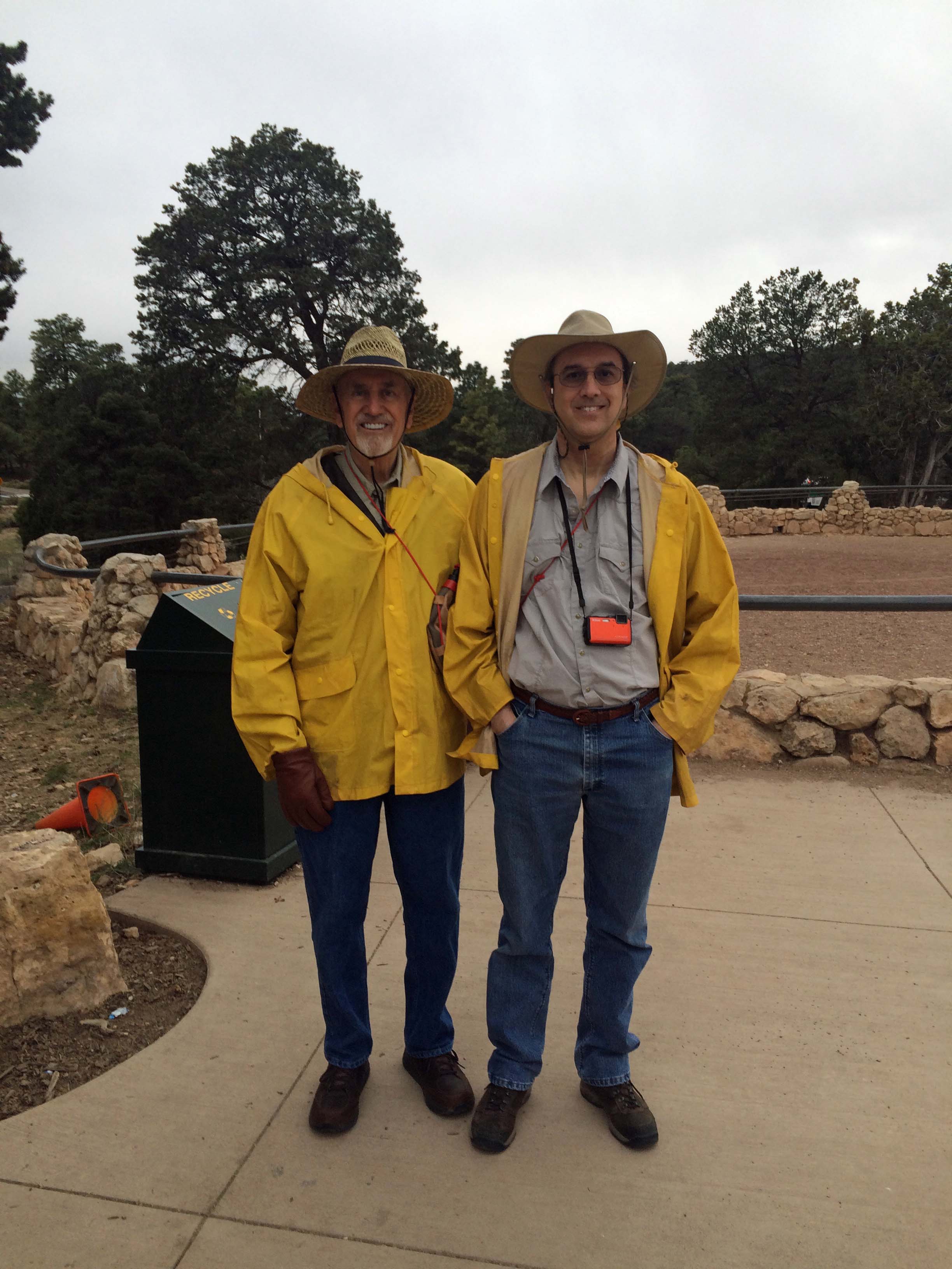 |
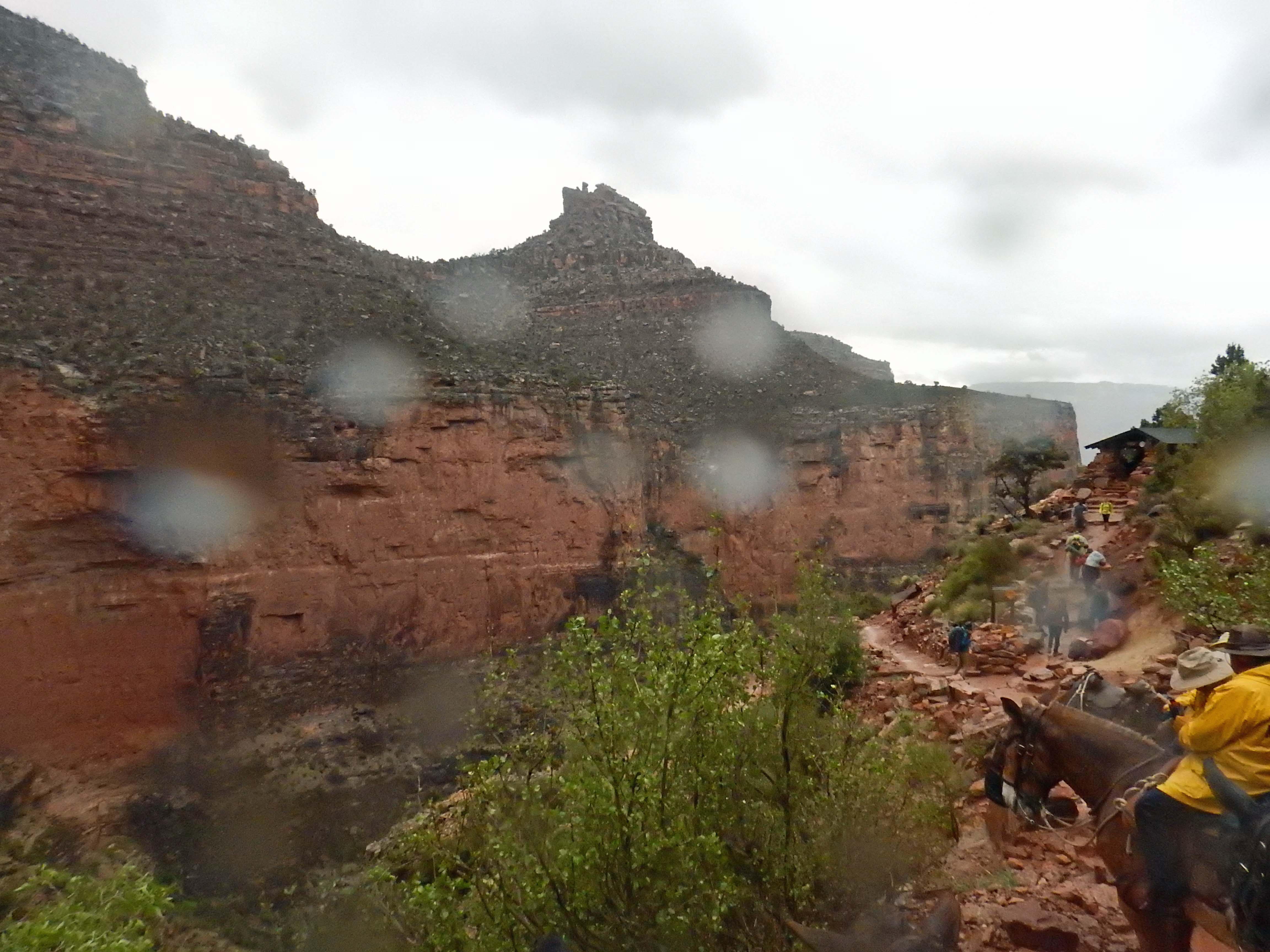
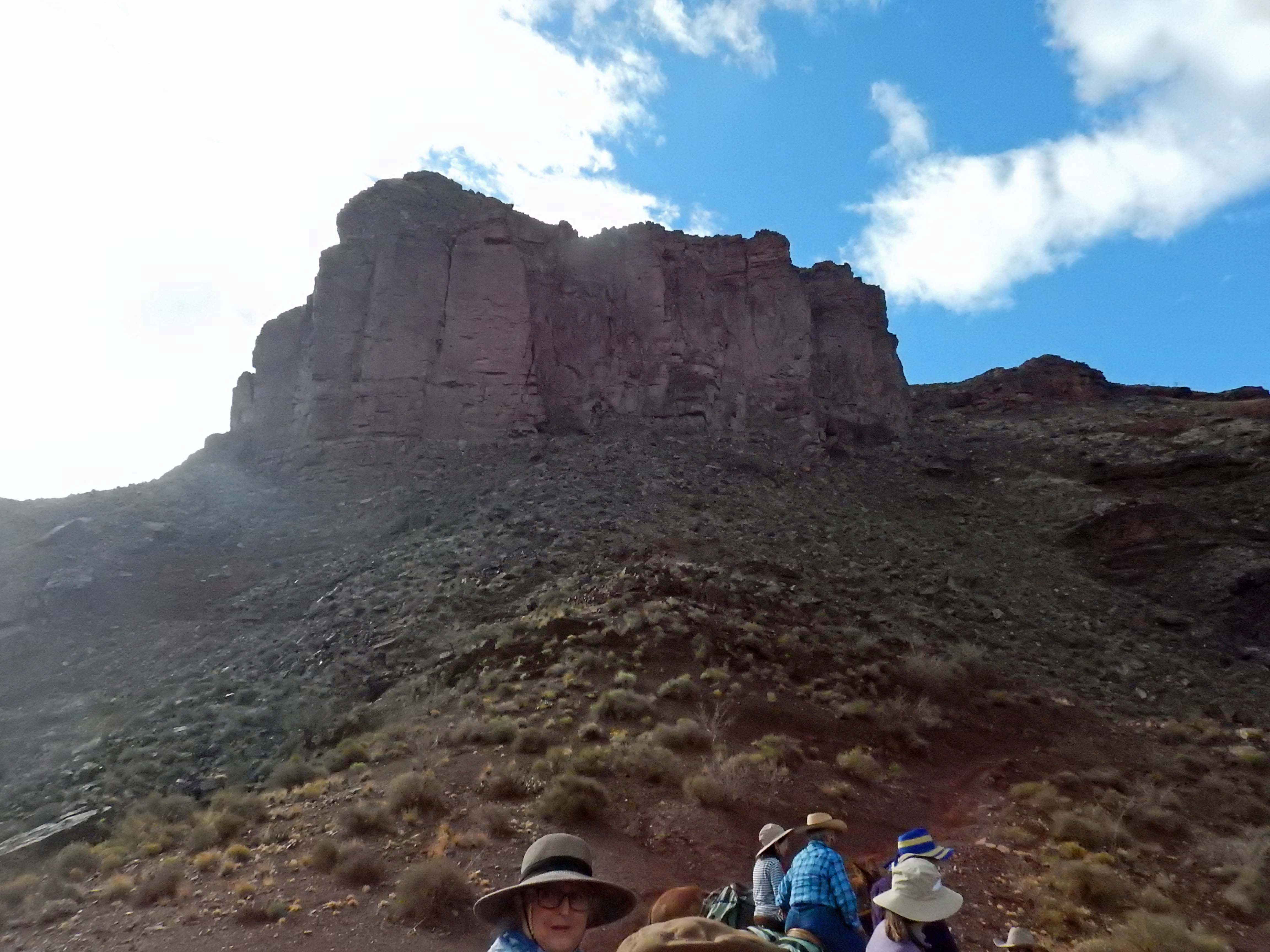
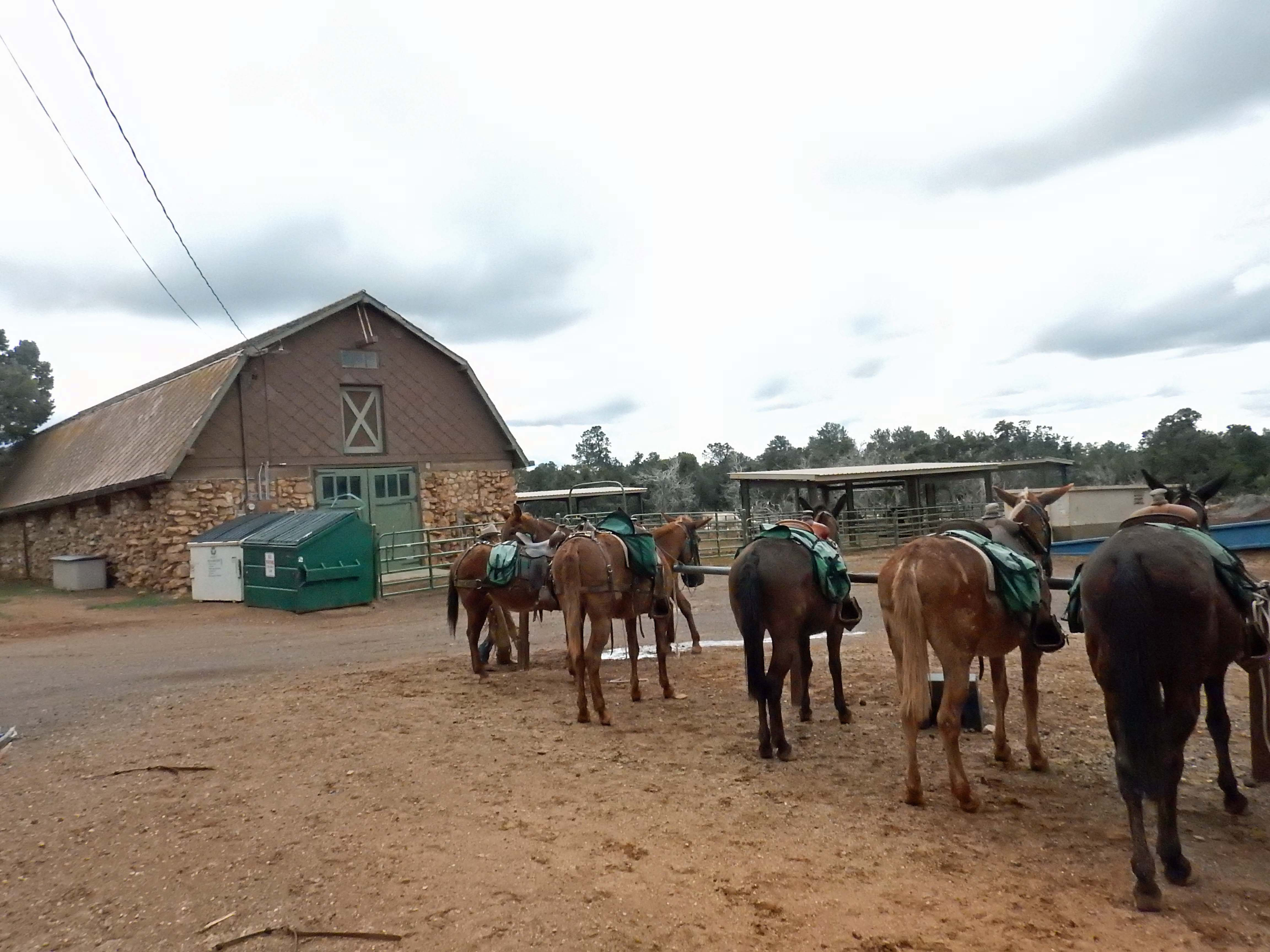
The weather for our departure wasn’t great. A cold front came through with cloudy skies, rain, and frigid temperatures. But we were at the corral at 6:45 AM, equipped with recommended cowboy clothes, and tour-supplied rain slickers and canteens. |
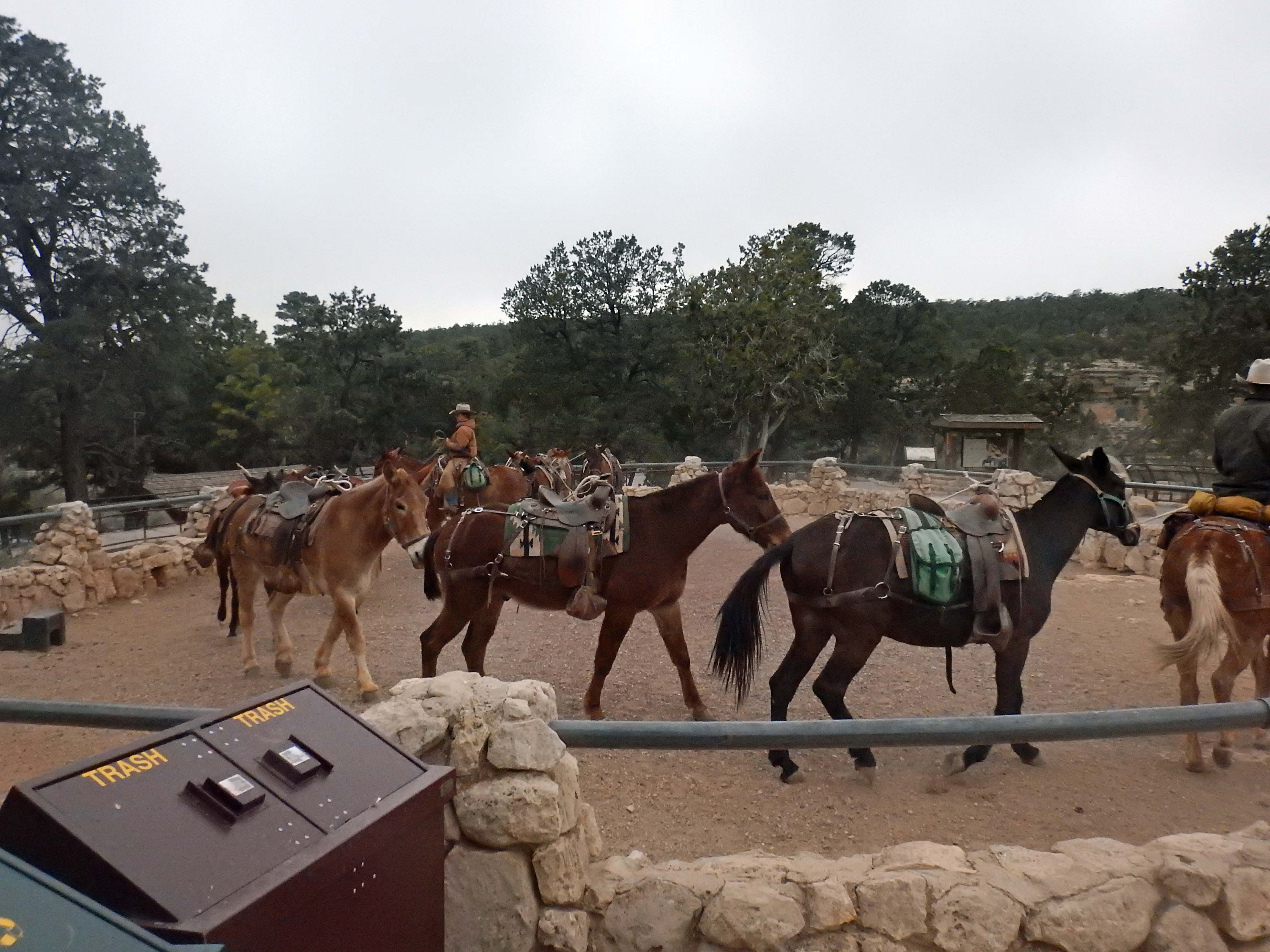
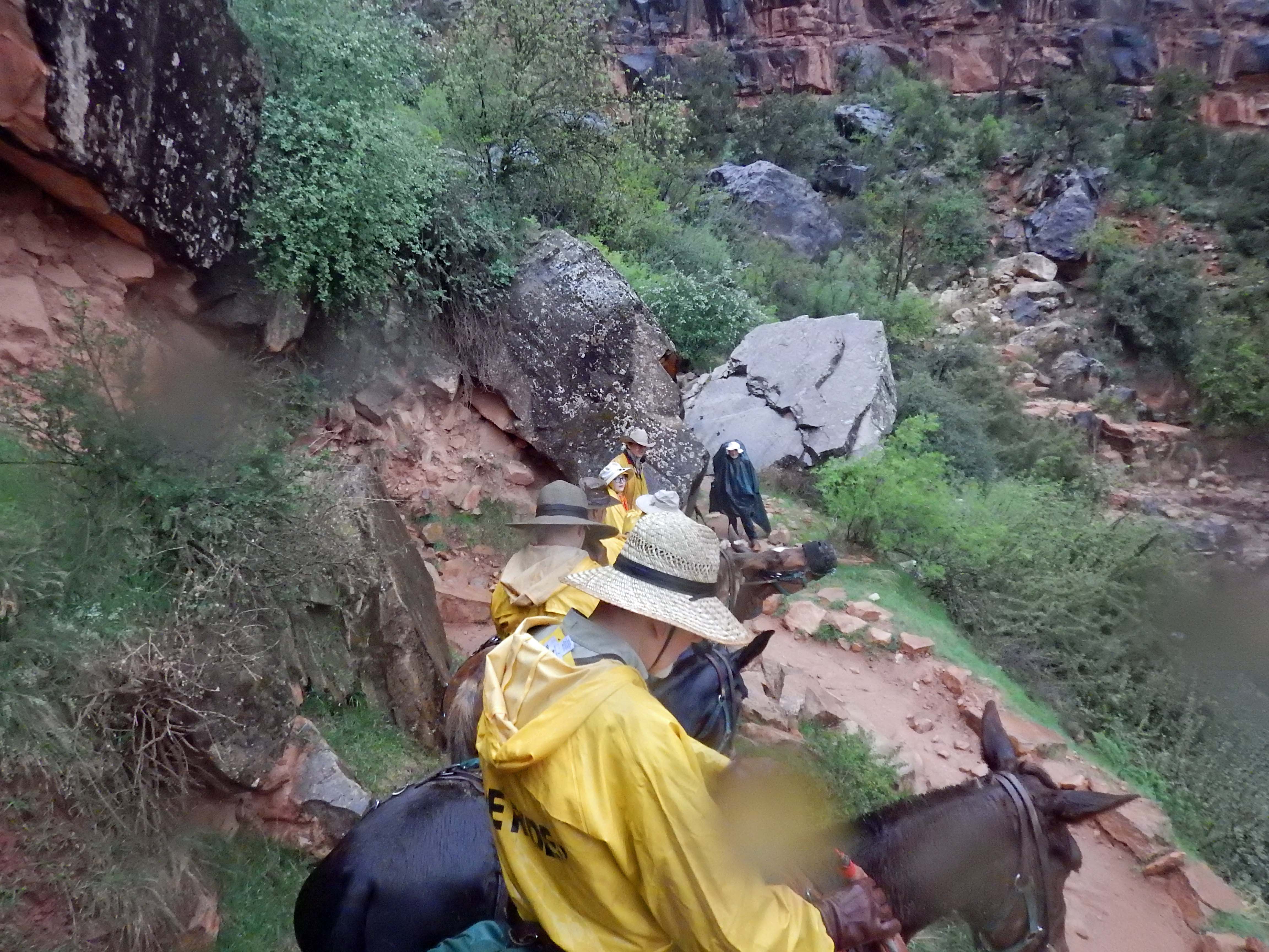
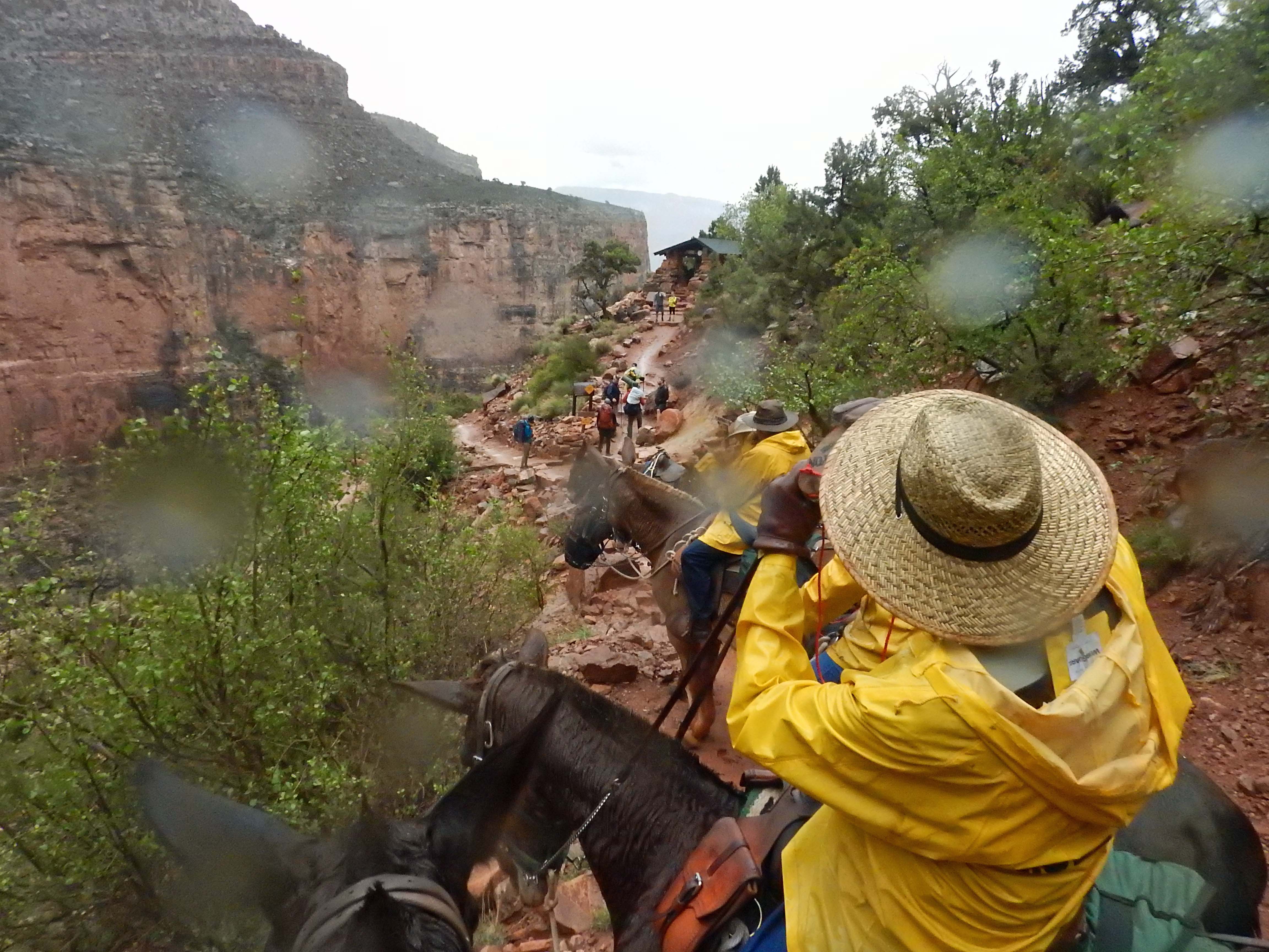
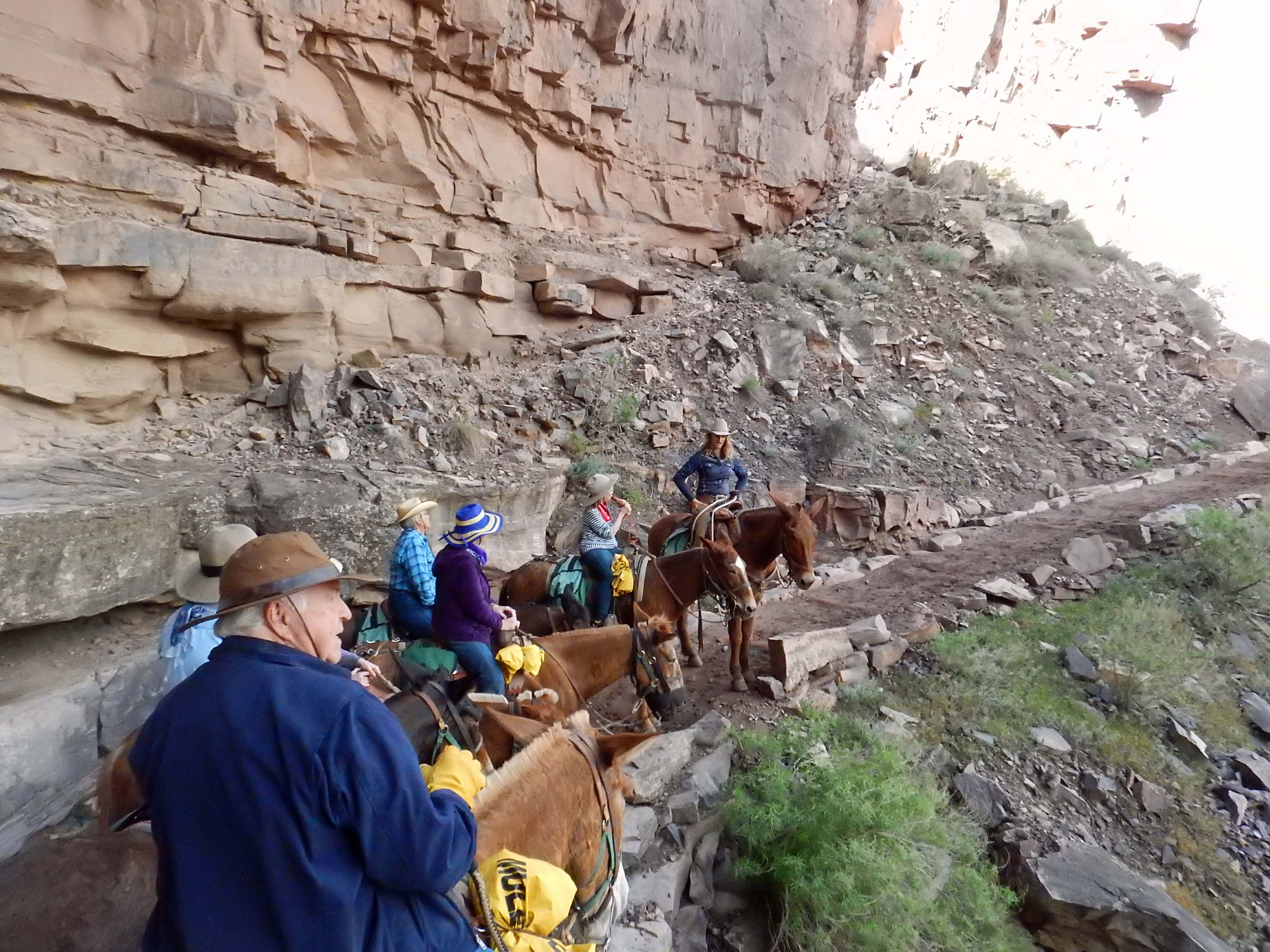
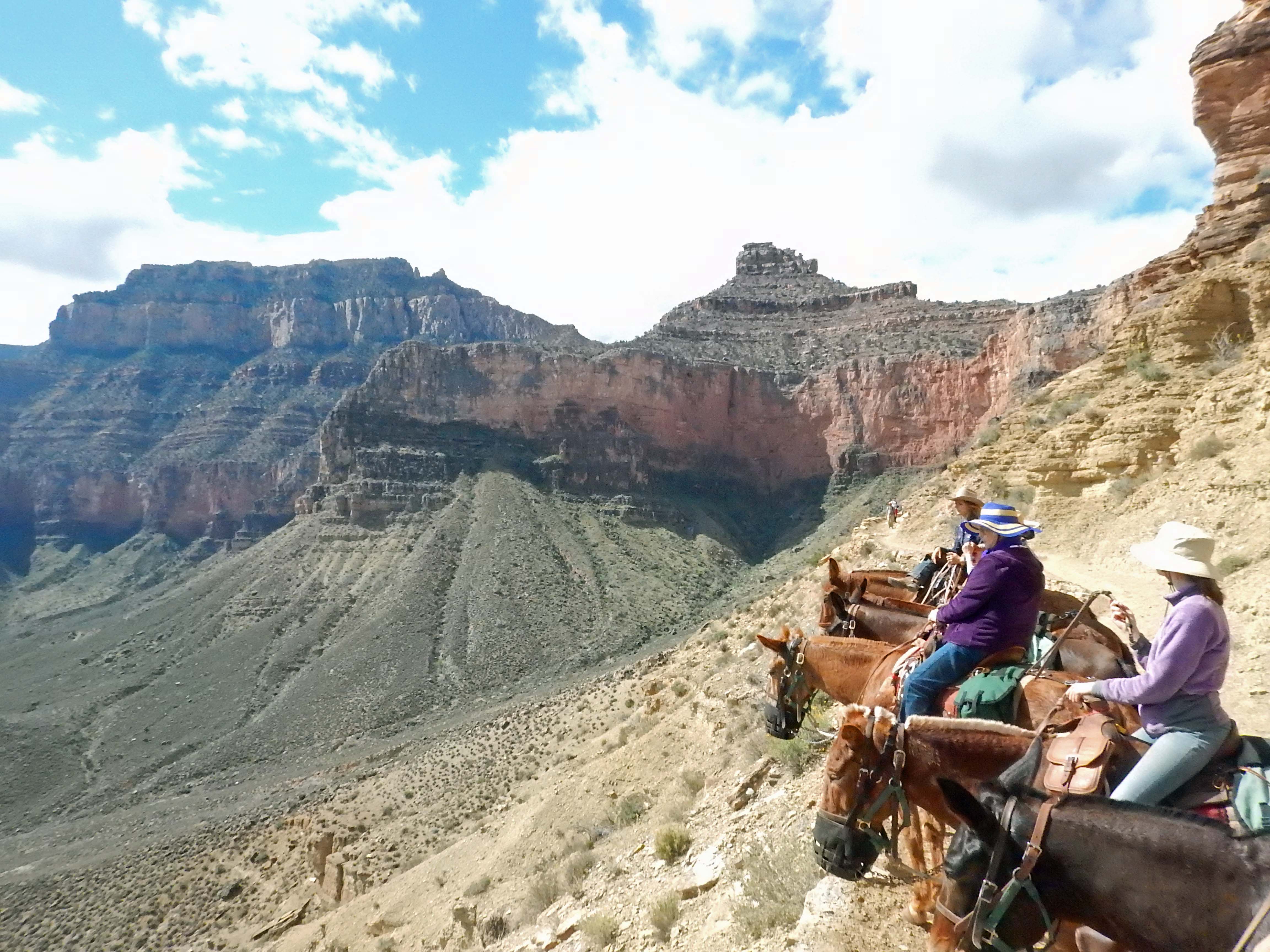
The mules were actually a bit late— the wrangler said while leading them over from the stables all on one line, the mules managed to wrap themselves around a telephone pole and took a while to untangle. While this wasn’t the best thing to hear about animals we were about to trust along narrow trails beside sheer drops, we were undaunted! The wrangler gave our group an orientation talk, we mounted the mules, and set out down Bright Angel trail with our trail guides Josiah and Darby (the most Western-y names possible for a trip like this).
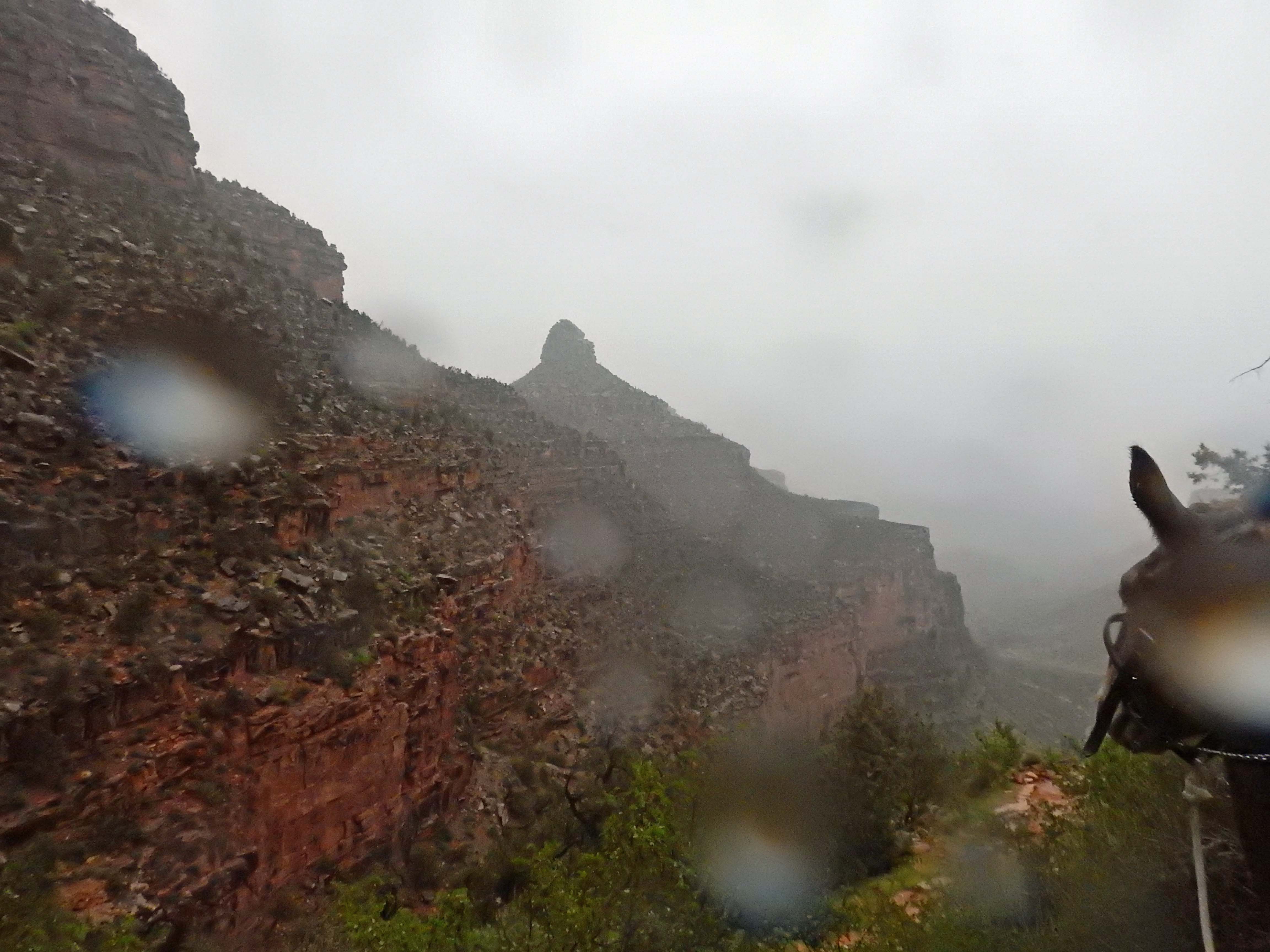
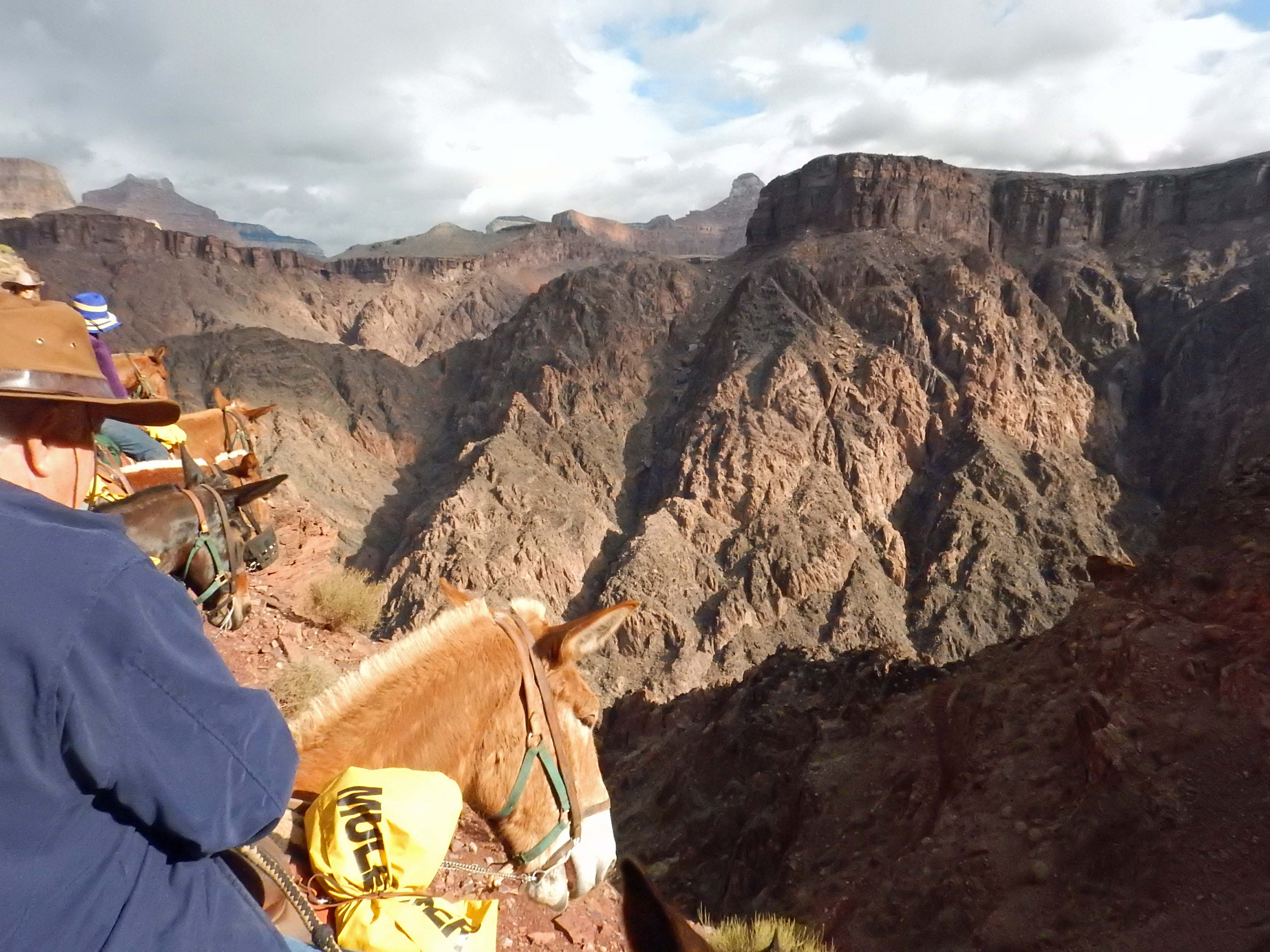
I couldn’t take as many pictures on the trail as I’d like: it’s only possible to take pictures when the mules stop for a rest, when you hook the reins over your saddle horn (which the guides call “putting the mules in park”) and have your hands free. Still, I took as many as I could. The rain left beads of water on the camera lens, as you can see below, but fortunately the camera itself was waterproof and had no trouble.
 |
 |
 |
 |
Indian Garden is a campground halfway down (measured vertically) Bright Angel trail. As the Grand Canyon formed, the softer sedimentary rocks above eroded more quickly than the harder granite below, so the walls of the upper canyon receded and left large stretches of relatively flat land between them and the inner canyon. Run-off streams water these areas in some places, producing oases in the Grand Canyon’s desert ecosystem. Indian Garden is one, so named because it was once home to farms of the Ancestral Puebloans— the same people who built the cliff dwellings at Mesa Verde National Park. Like those at Mesa Verde, the Puebloans of the Grand Canyon abandoned the area somewhere between 1100 and 1400 AD.
 |
 |
At Indian Garden we stopped and dismounted our mules, for a lunch (and bathroom) break. By now the rain had mostly stopped (though it sprinkled on and off again for the rest of the ride), and although it was still chilly the temperature was getting more moderate as we descended into the canyon. Temperatures at the very bottom are typically twenty degrees warmer than on the rim.
Last year, during my Epic July Road Trip, I hiked down Bright Angel Trail as far as Indian Garden, had lunch, and then hiked back out again— this is as far as the Park Service recommends anyone try to hike in one day. So Indian Garden was as far into the Grand Canyon as I’d ever been. It was all new from here.
 |
Below Indian Garden the geology changes. Above, the Grand Canyon is carved out of layers of sedimentary rock of varying colors. Not far pas Indian Garden, and we’re below all sediments and descending through layers of granite. |
| Riding the mules to the bottom is a ride into history in more ways than one: not only are the mules a historic feature of the canyon, but you’re riding back in geologic time. The inner canyon is below the earliest layers of sediment; it’s the foundation of the North American continent, granite 1.8 billion years old. | 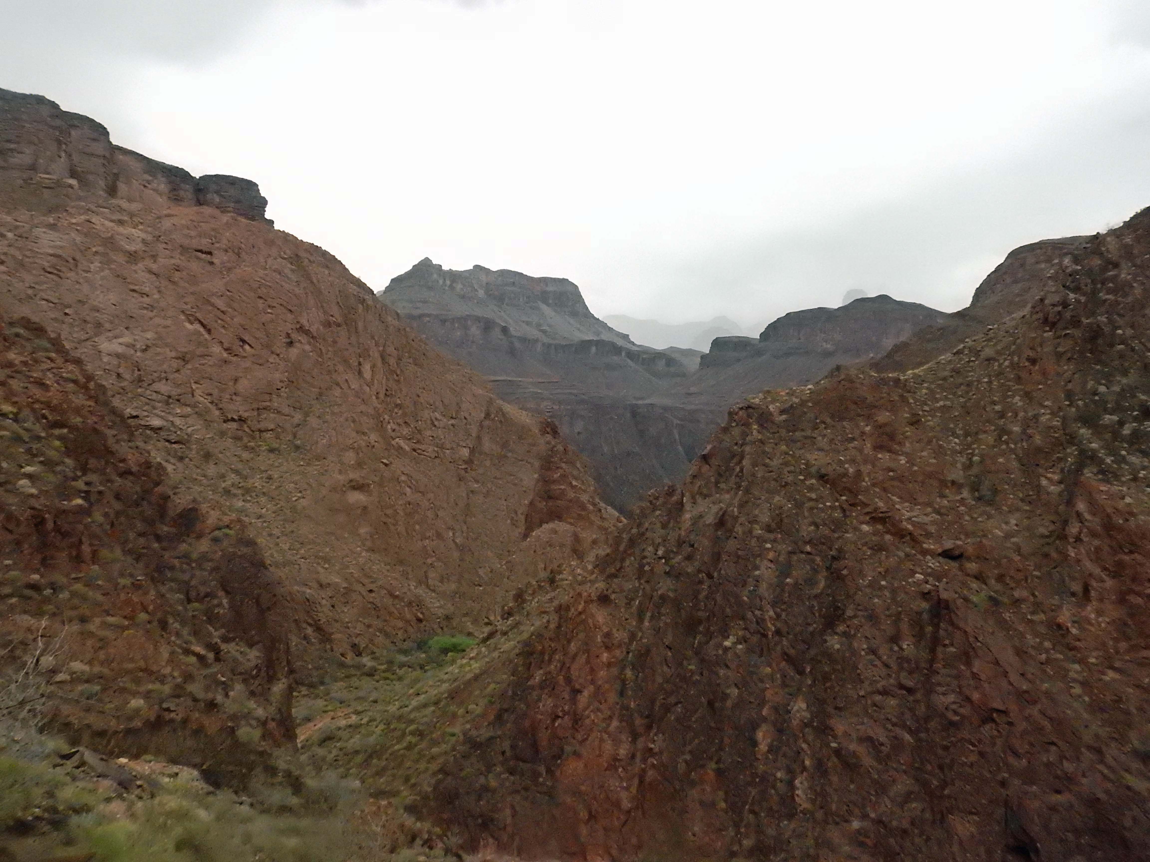 |
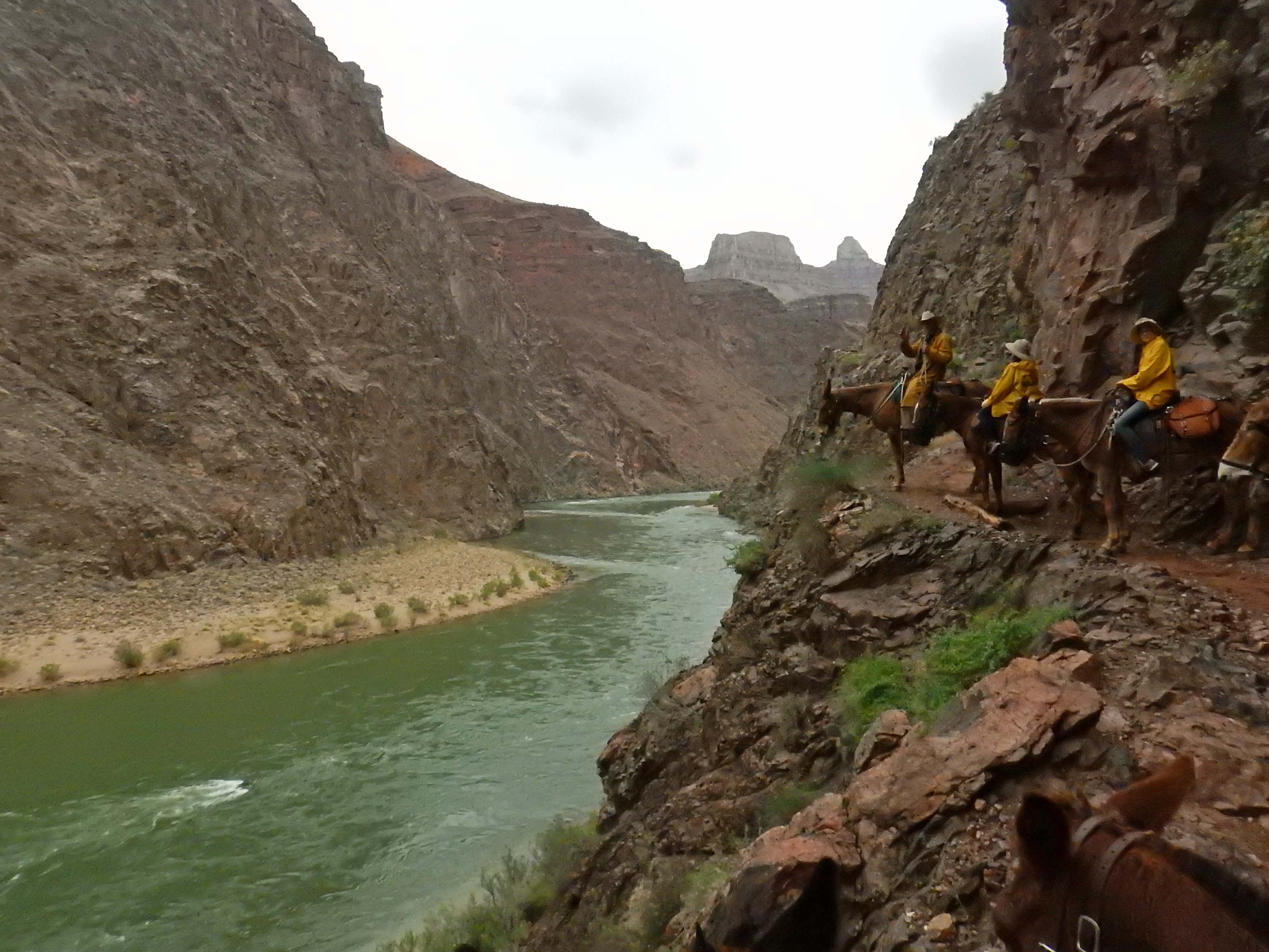 |
The Colorado River at last, a full mile below the rim. In the lead of the mule train, guide Josiah points out we still have a ways to go, as the trail runs beside the river for some distance to reach Phantom Ranch. |
Nestled in another oasis within the canyon, Phantom Ranch lies on the north side of the river— I didn’t get a picture of the bridge we crossed from the south side on the way down, but look below for one I took looking back. The campground was built in the 1920s by the Fred Harvey company (in times before the National Park), with cabins designed by architect Mary Colter (one of the few woman architects in her time, and the designer of most of the historic buildings on the south rim of the canyon).
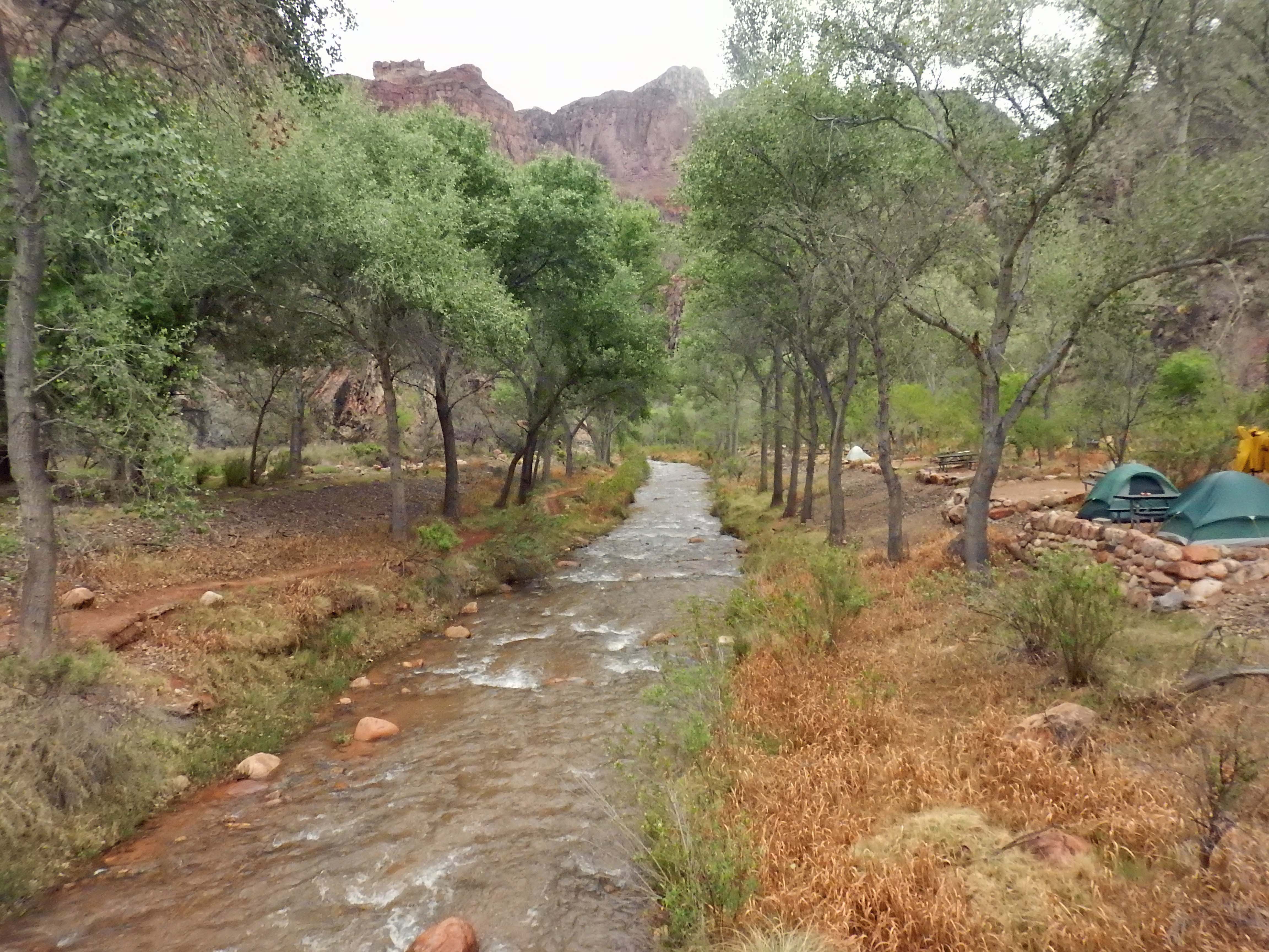 |
Bright Angel Creek flows down from the North Rim, while Bright Angel Trail comes down from the south. I’m not sure which one got the “Bright Angel” name first, but they share it now because they meet the Colorado River at the same place. The fact that Bright Angel creek, and other small tributaries of the Colorado, have dug their canyons just as deep as that of the main river gave geologists the clue that it’s not the volume of water that determines how a stream carves a canyon. |
| The cabin Dad and I shared in Phantom Ranch— set up to sleep four in bunks beds, though we only used two of them. | 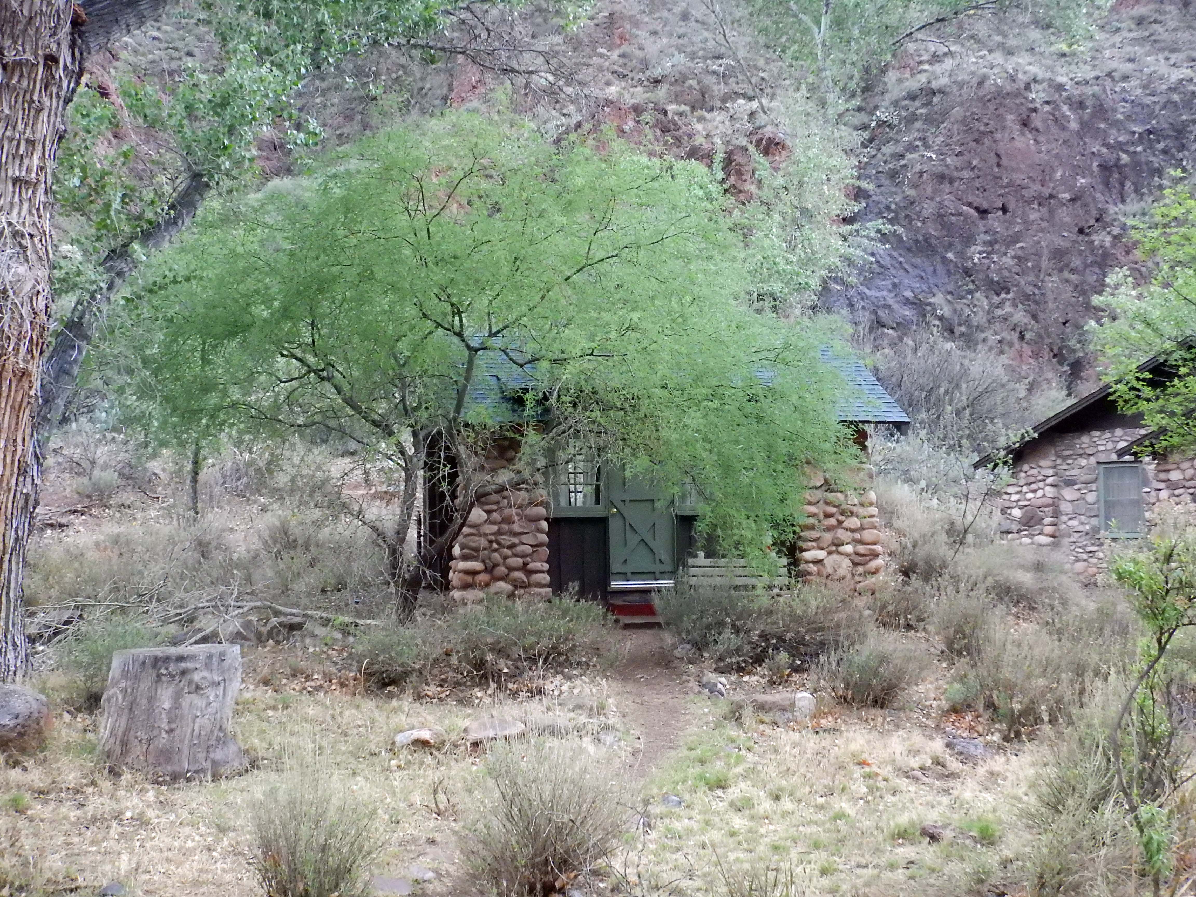 |
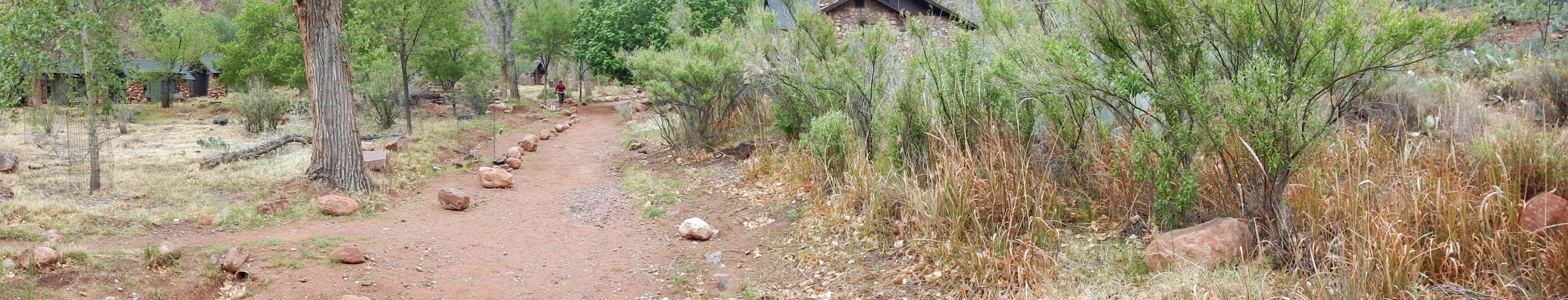
Some scenes around Phantom Ranch:
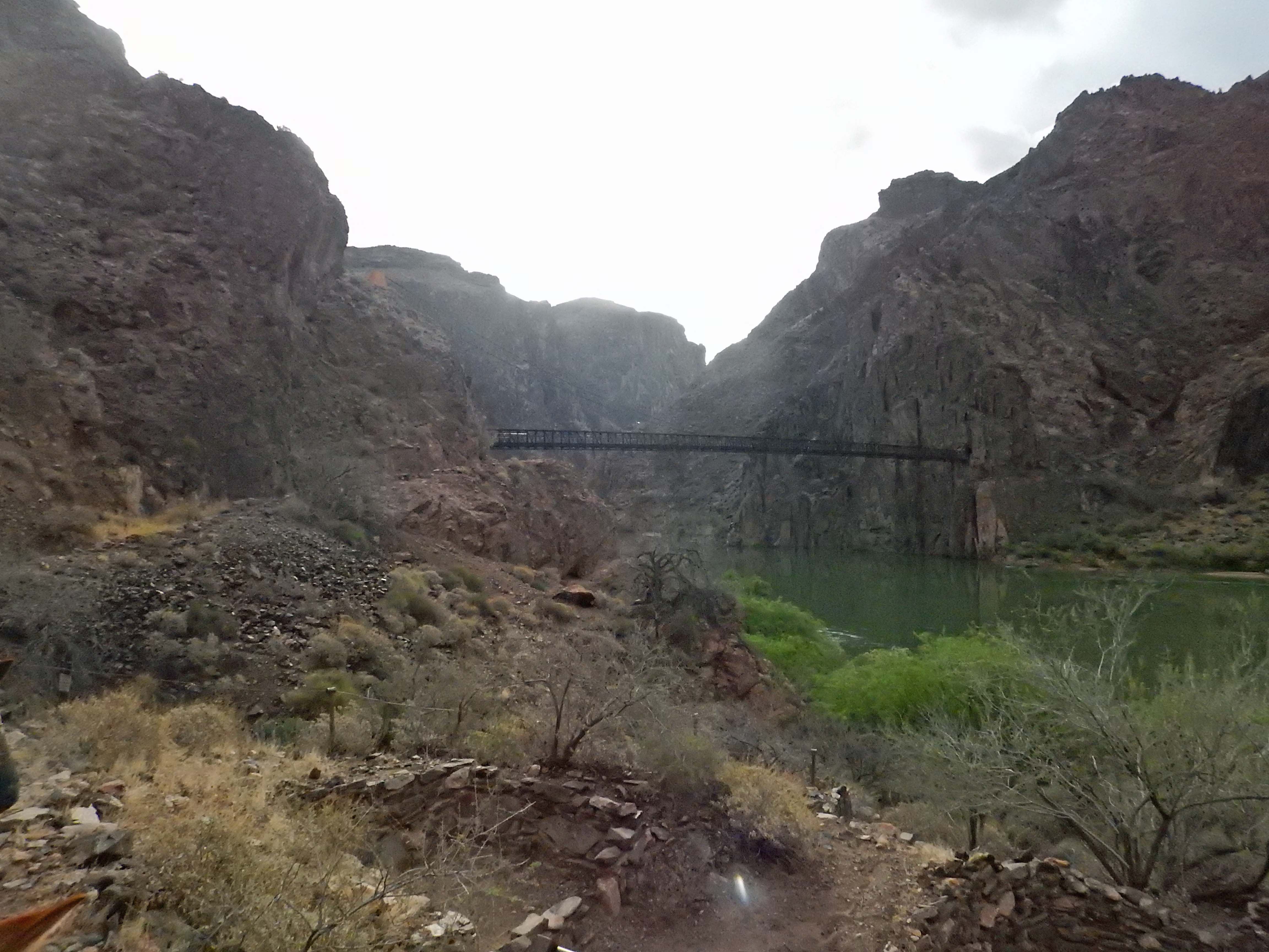 The suspension bridge the mules take across the Colorado River. Built in the 1920’s, the wood for the bridge itself was carried down on mules but the long suspension cables couldn’t be loaded on mules— they came down Birght Angel Trail on the shoulders of long lines of construction workers. The suspension bridge the mules take across the Colorado River. Built in the 1920’s, the wood for the bridge itself was carried down on mules but the long suspension cables couldn’t be loaded on mules— they came down Birght Angel Trail on the shoulders of long lines of construction workers. |
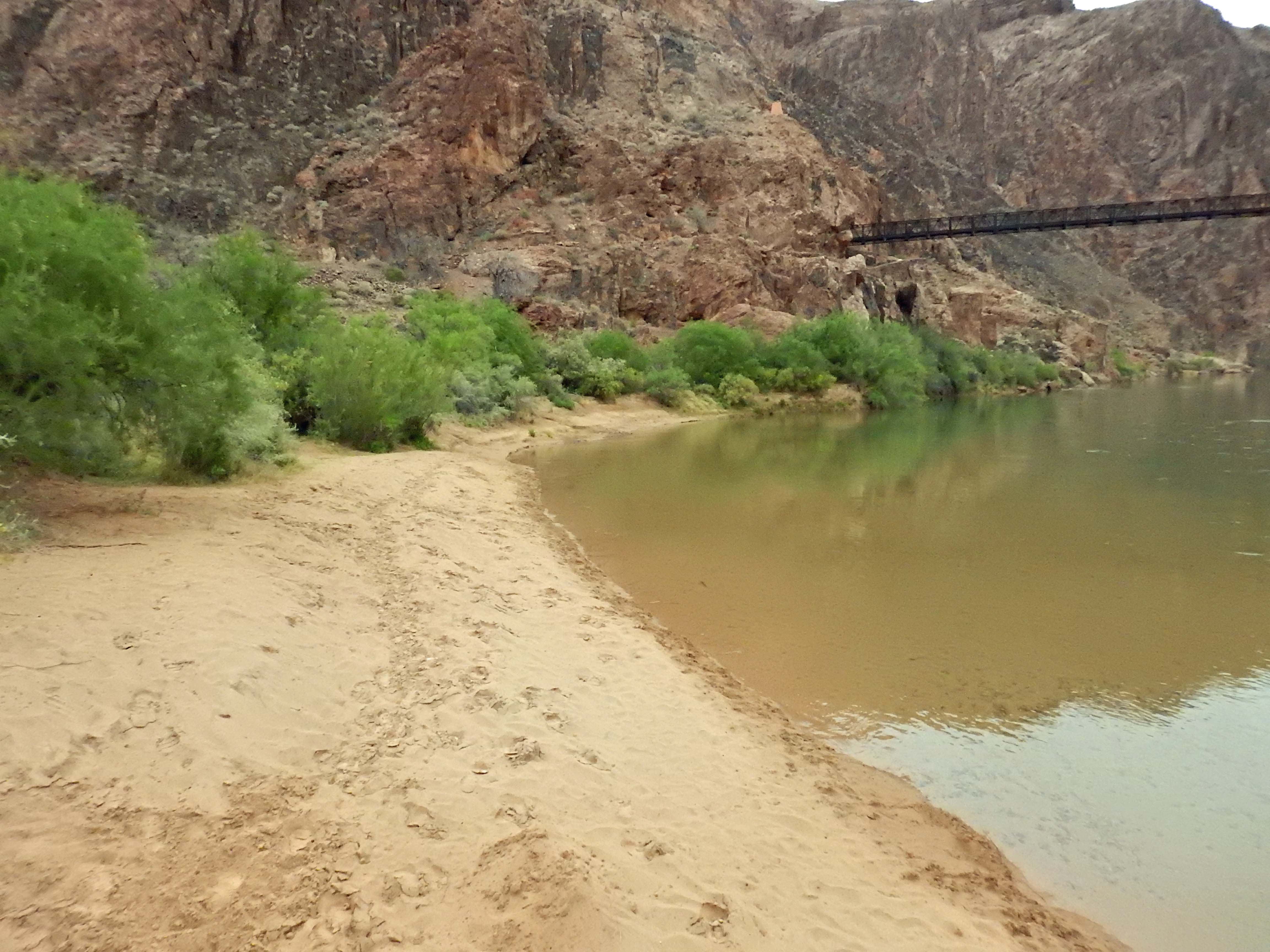 Boat Beach— in the summer, boaters traveling down the Colorado come ashore here for an overnight stay at Phantom Ranch. Some end their trip here and hike out Bright Angel, others continue on to the end of the canyon where the Colorado empties into Lake Mead. Boat Beach— in the summer, boaters traveling down the Colorado come ashore here for an overnight stay at Phantom Ranch. Some end their trip here and hike out Bright Angel, others continue on to the end of the canyon where the Colorado empties into Lake Mead. |
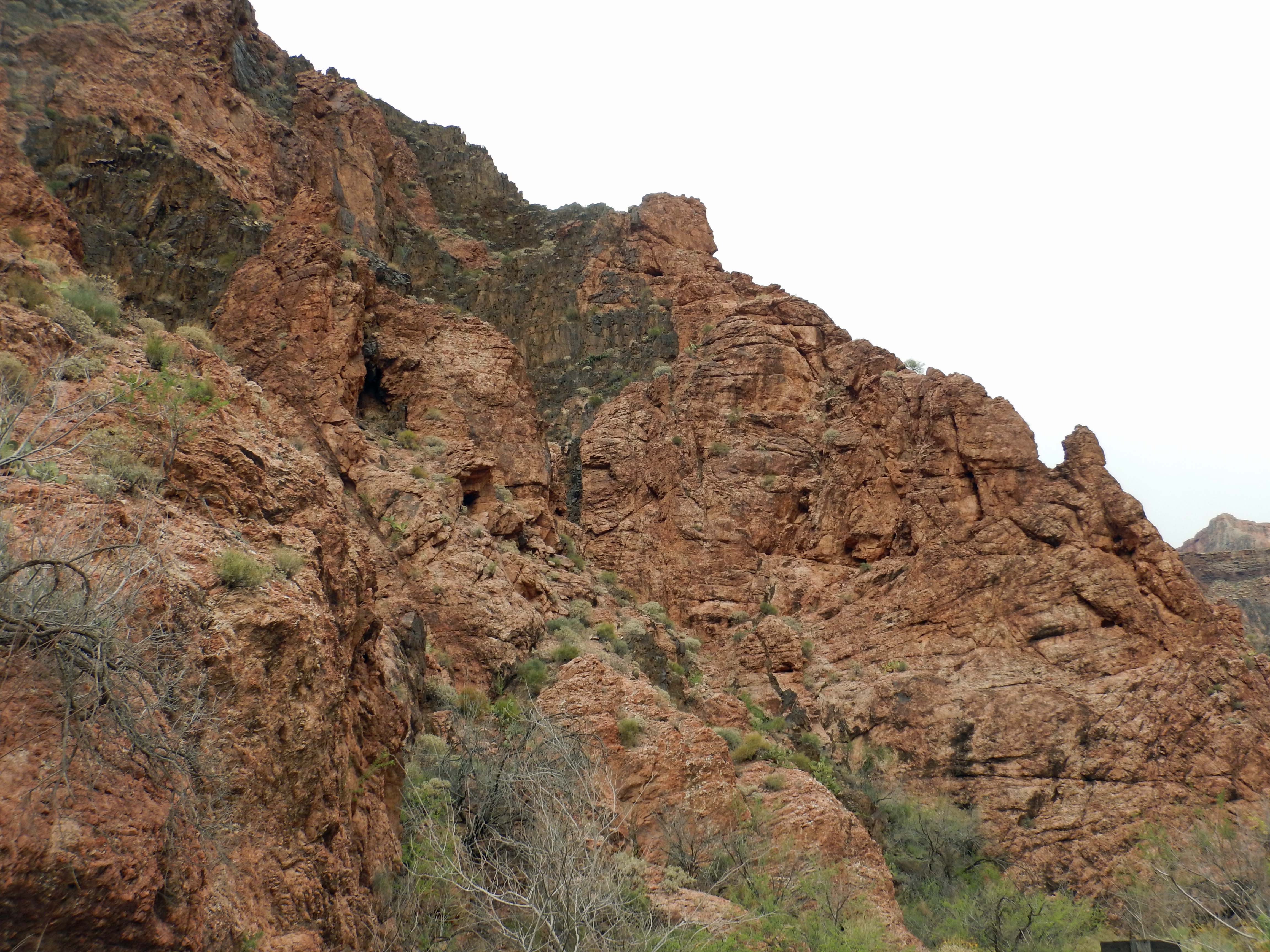 Geology! Two different volcanic events in the formation of the continent left behind two different-colored granites side by side in the walls. Geology! Two different volcanic events in the formation of the continent left behind two different-colored granites side by side in the walls. |
 Bright Angel Creek’s canyon: an oasis in the desert. Bright Angel Creek’s canyon: an oasis in the desert. |
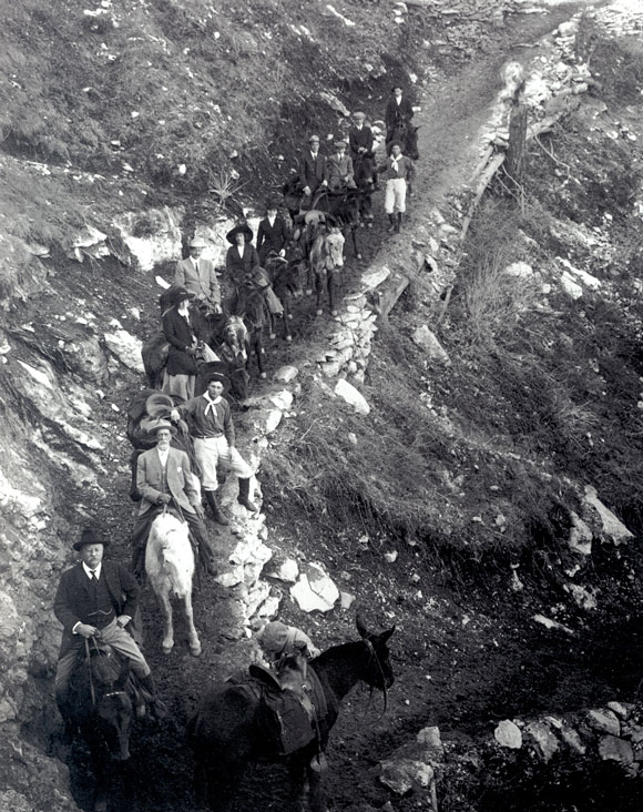
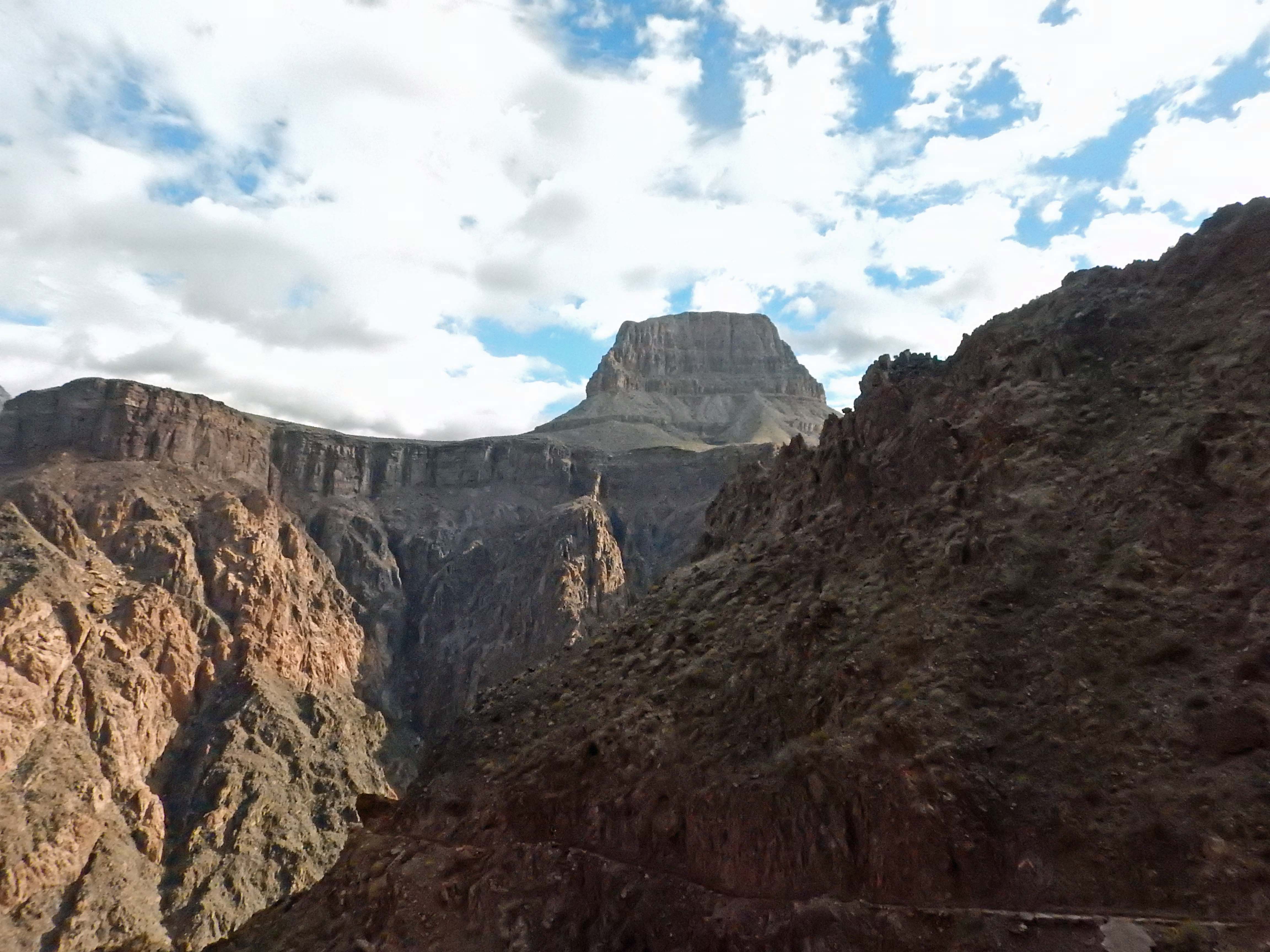
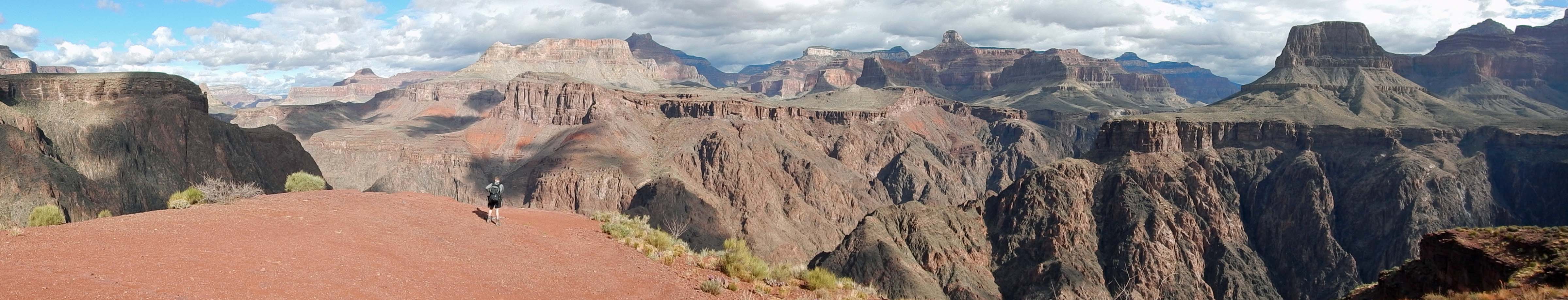
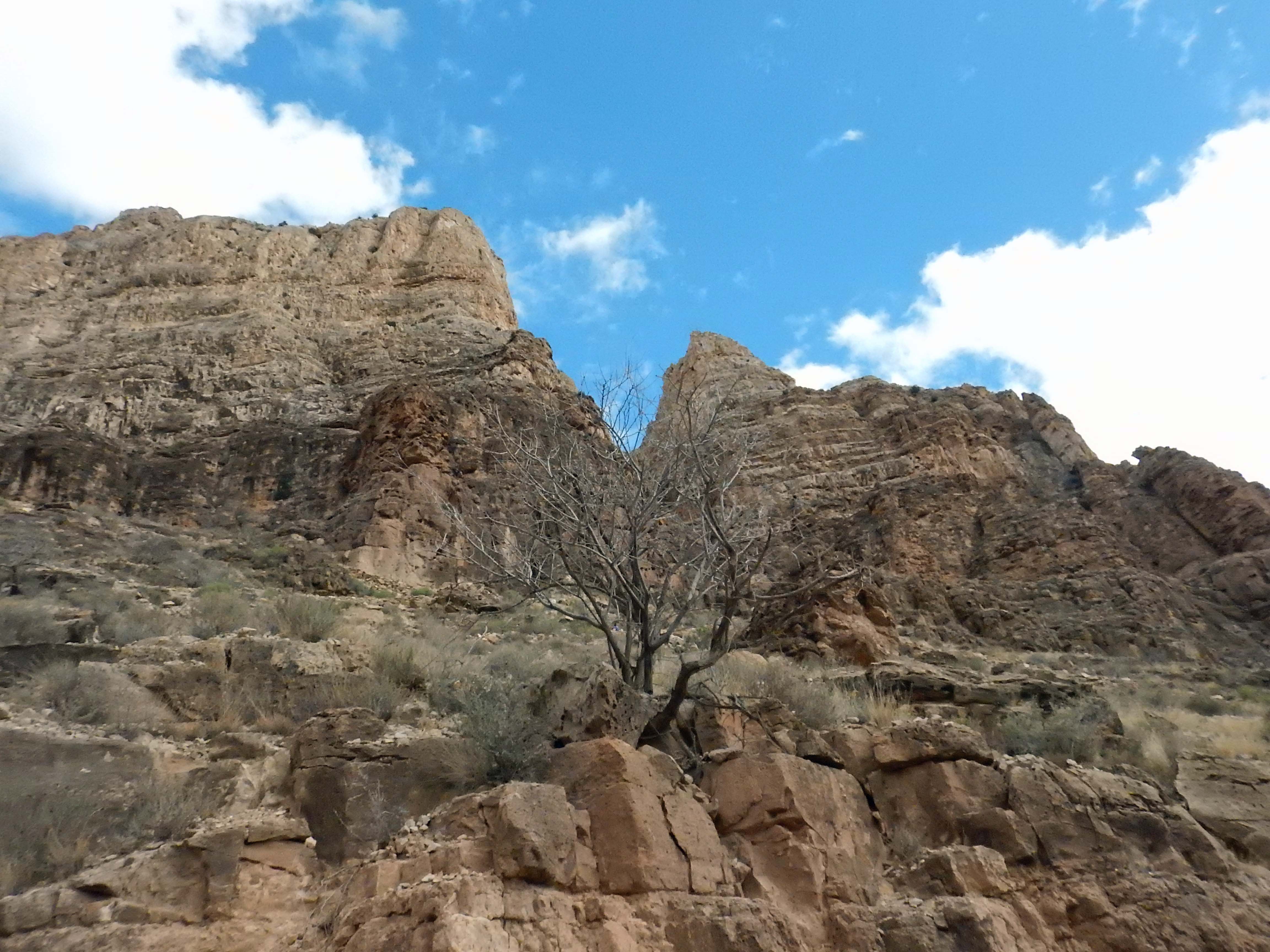
It’s impossible to understand the scale of the Grand Canyon when viewing it from the rim, despite how impressive the view. When a side expedition from Coronado’s force in the 1500s became the first Europeans to see the canyon, the commander sent scouts down to look for a place to ford what seemed like a small river down at the bottom. Today, you can know how that story turned out but still not really see it. You can see Indian Garden from the south rim and know it’s only halfway down: but your eye insists that it’s close to the bottom. It looks like it’s a long horizontal distance from the rim as well, but it’s actually huddled quite close to it, but you can’t make yourself see that either. Only when you get to the bottom do you start to realize the true size of the Grand Canyon. This illustration might help:
 |
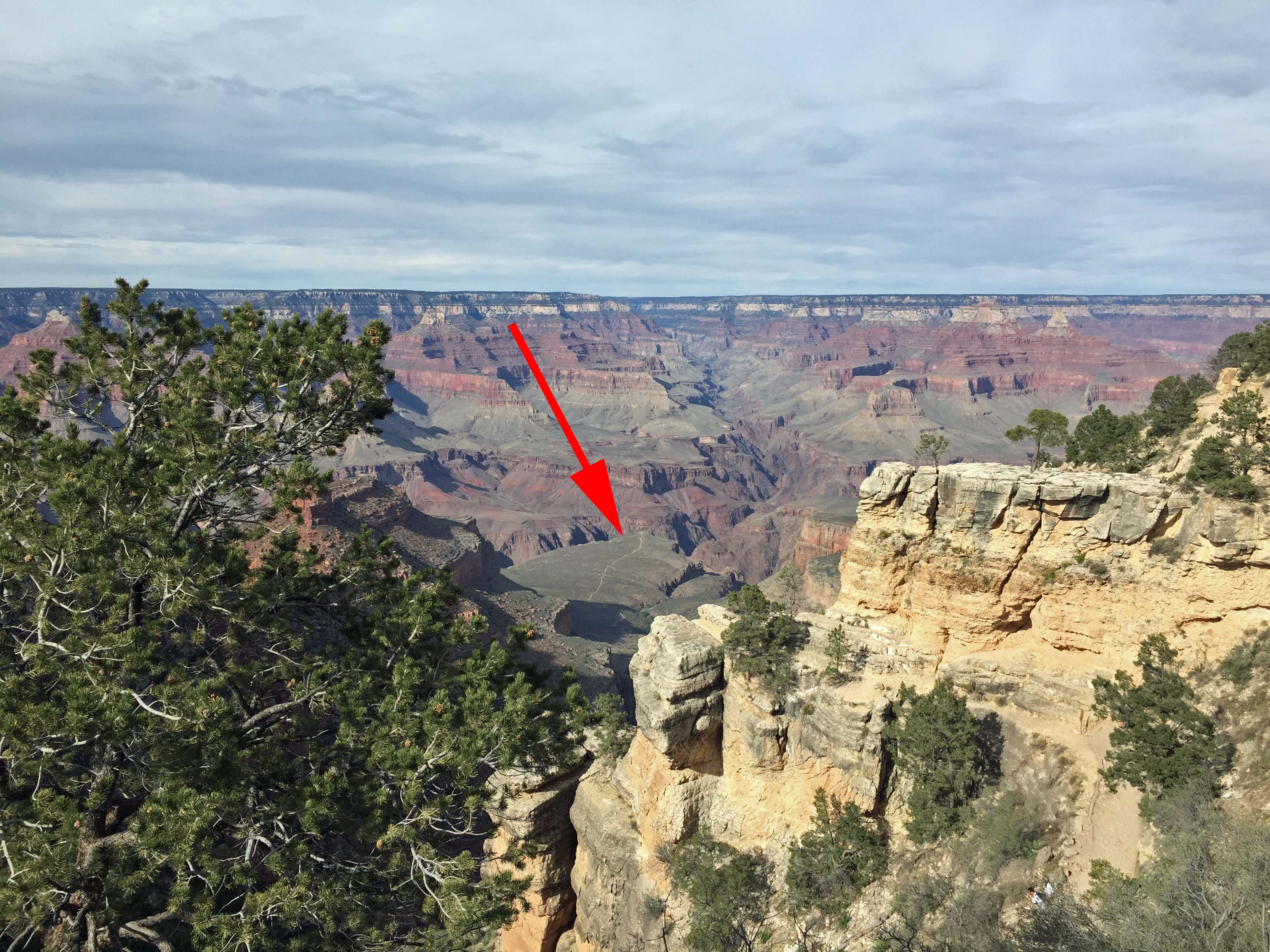 |
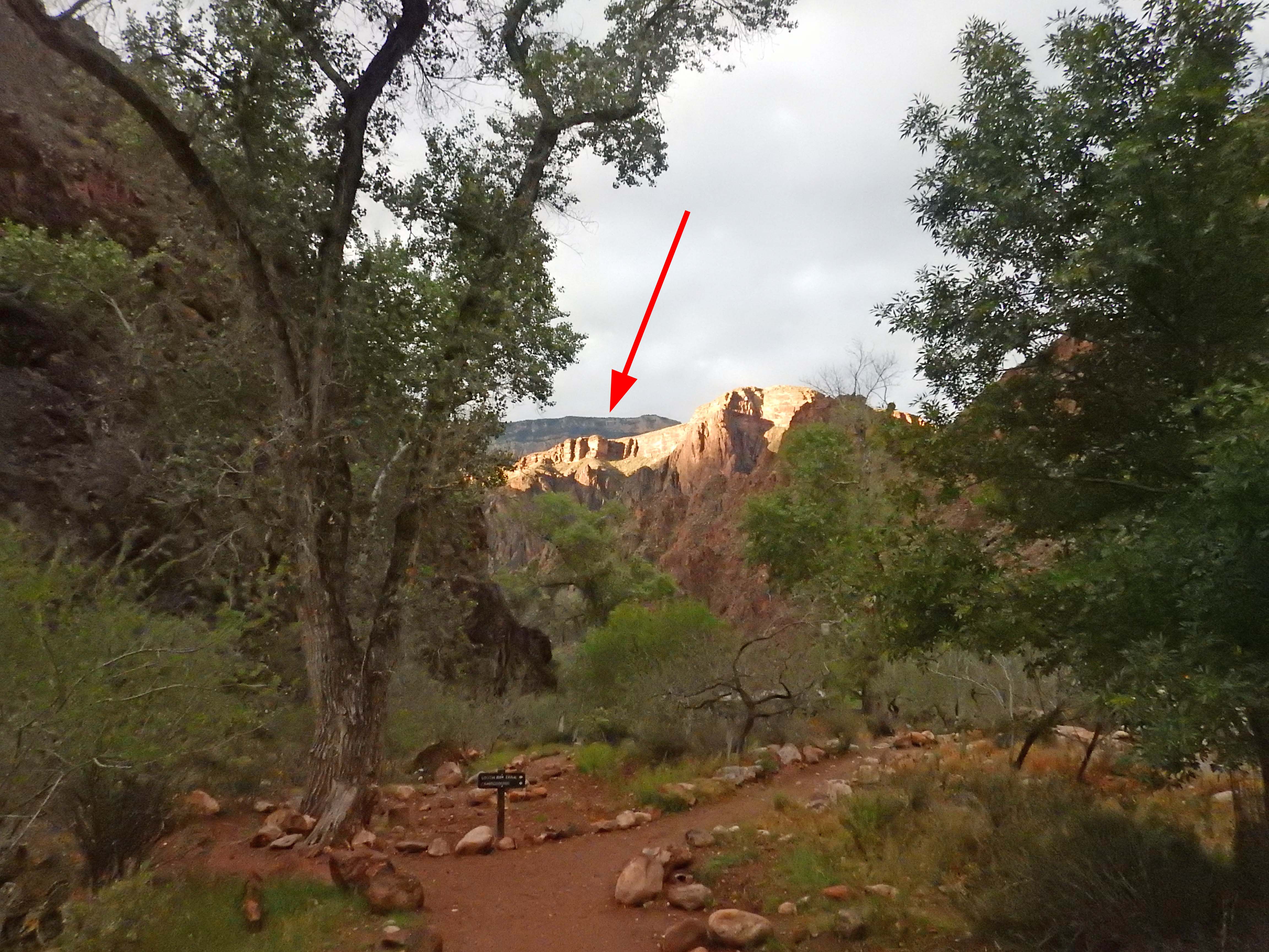
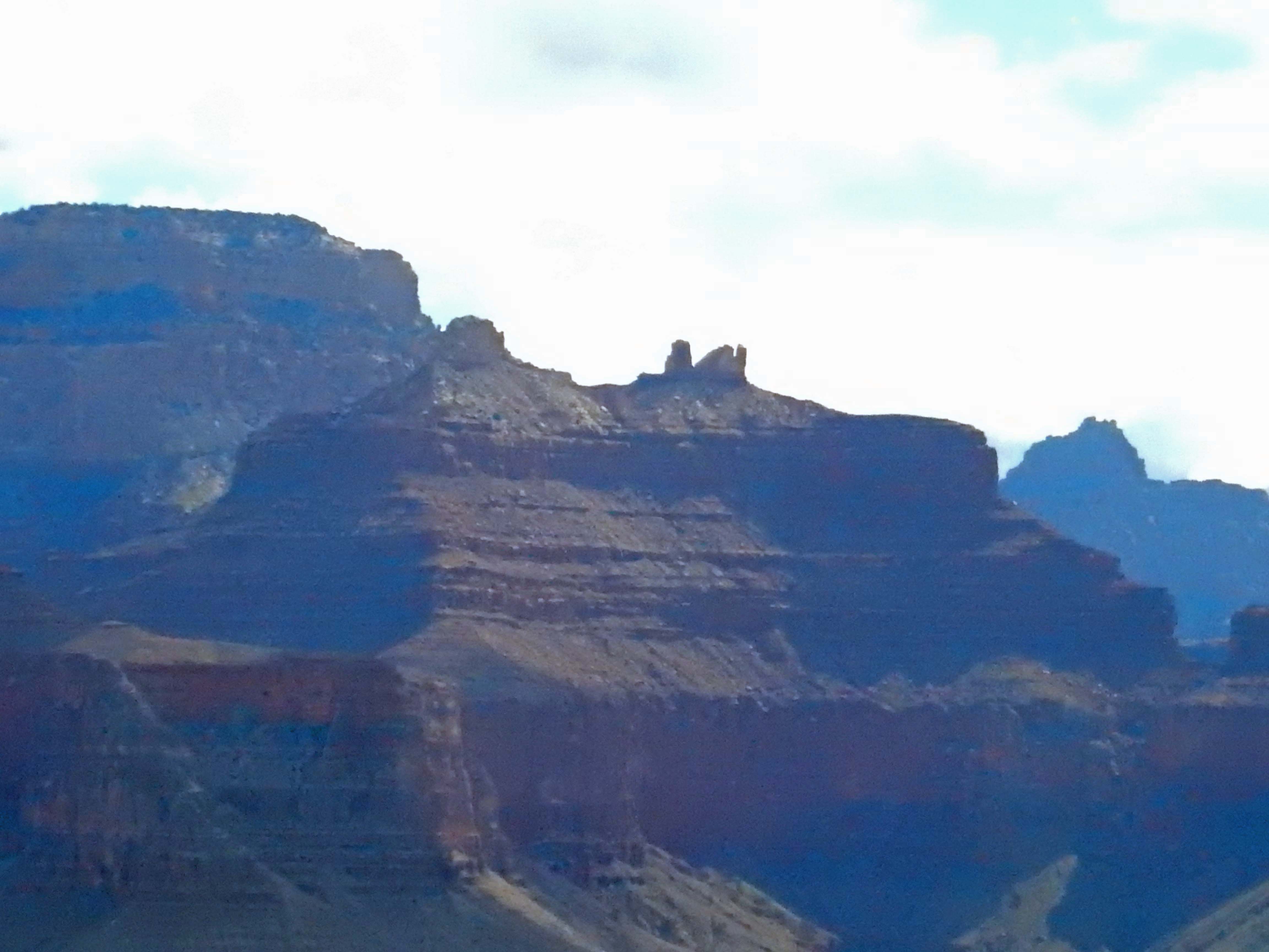
At left, a view from Phantom Ranch back toward the south rim. You see a distant, high edge, beyond the closer cliff lit up by the sun (red arrow). You might think that’s the south rim. It isn’t. You can’t see the south rim from Phantom Ranch, and you can’t see the Colorado River from the rim, except in a few places where you look right down side canyons. No, that’s the rim of the inner canyon— shown by the red arrow in the picture on the right, taken from the south rim.
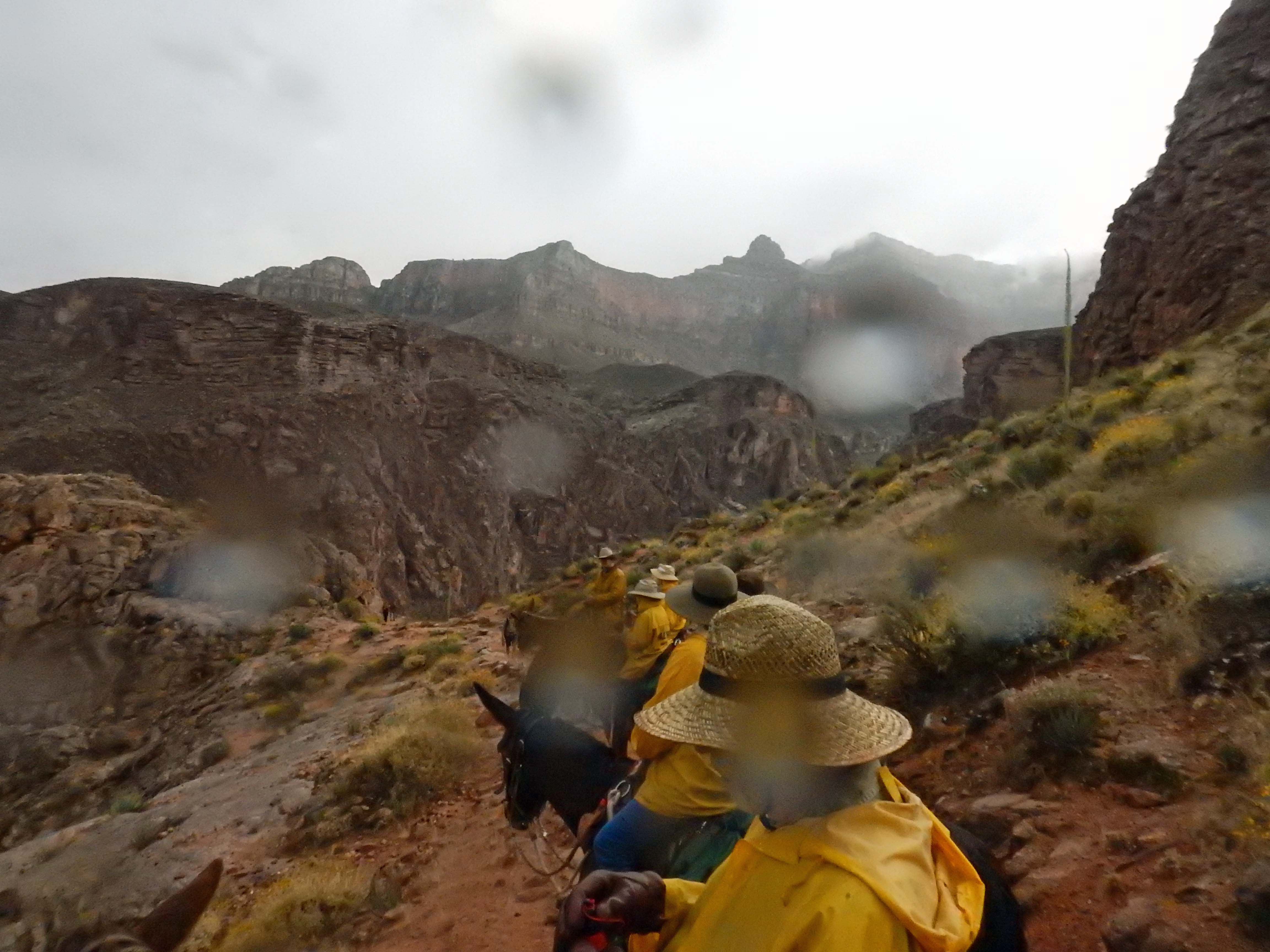
We would have more opportunity to appreciate the real scale of the canyon on the ride back up, Saturday morning, which took us up the South Kaibab Trail and past views that really showed off the Grand Canyon’s size.
| Here, a last glimpse of the Colorado River and the “Black Bridge” on our way up the trail. Saturday gave us sunny skies and mild temperatures for our ride, much more pleasant than yesterday’s freezing rain. | 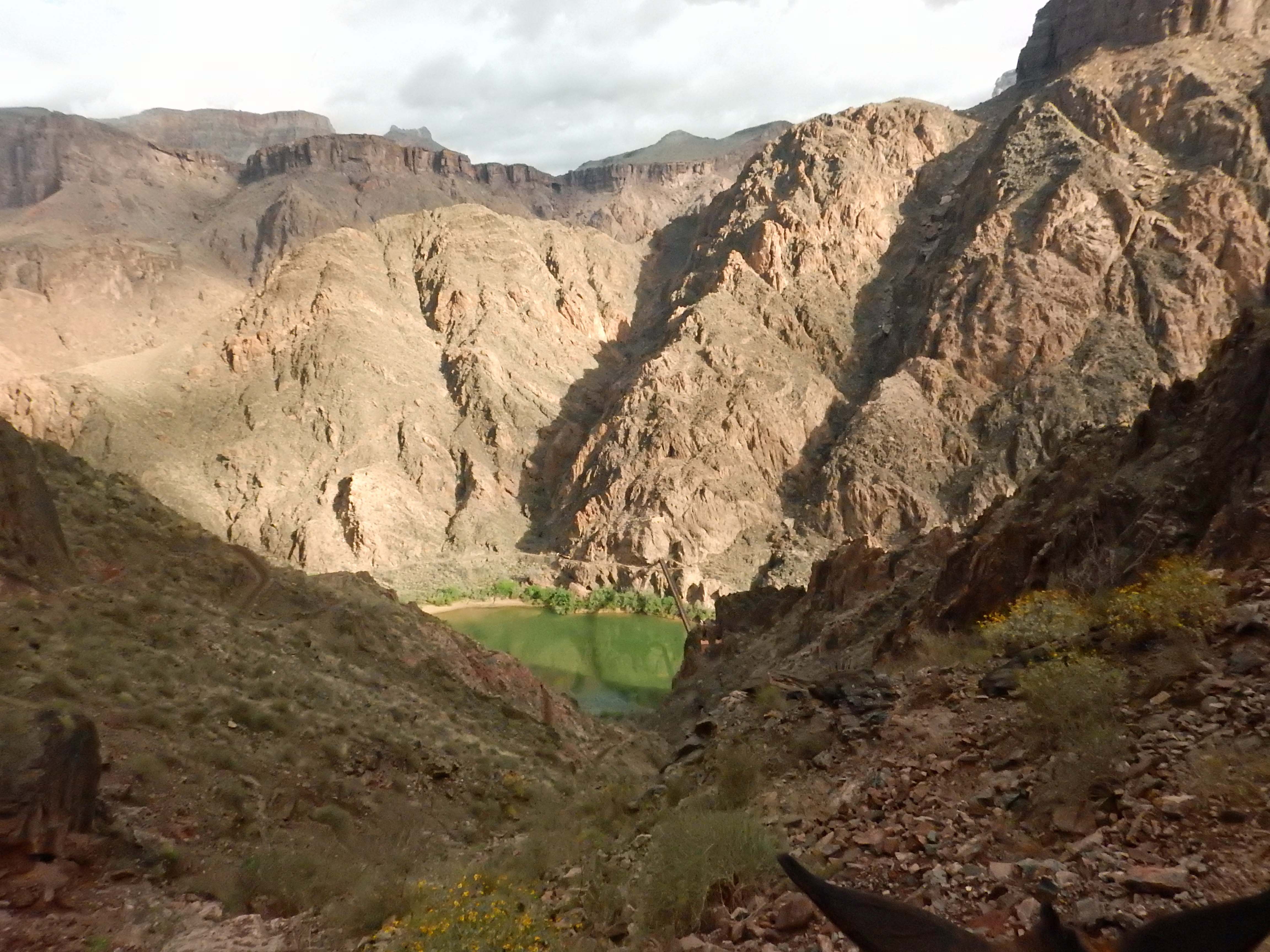 |
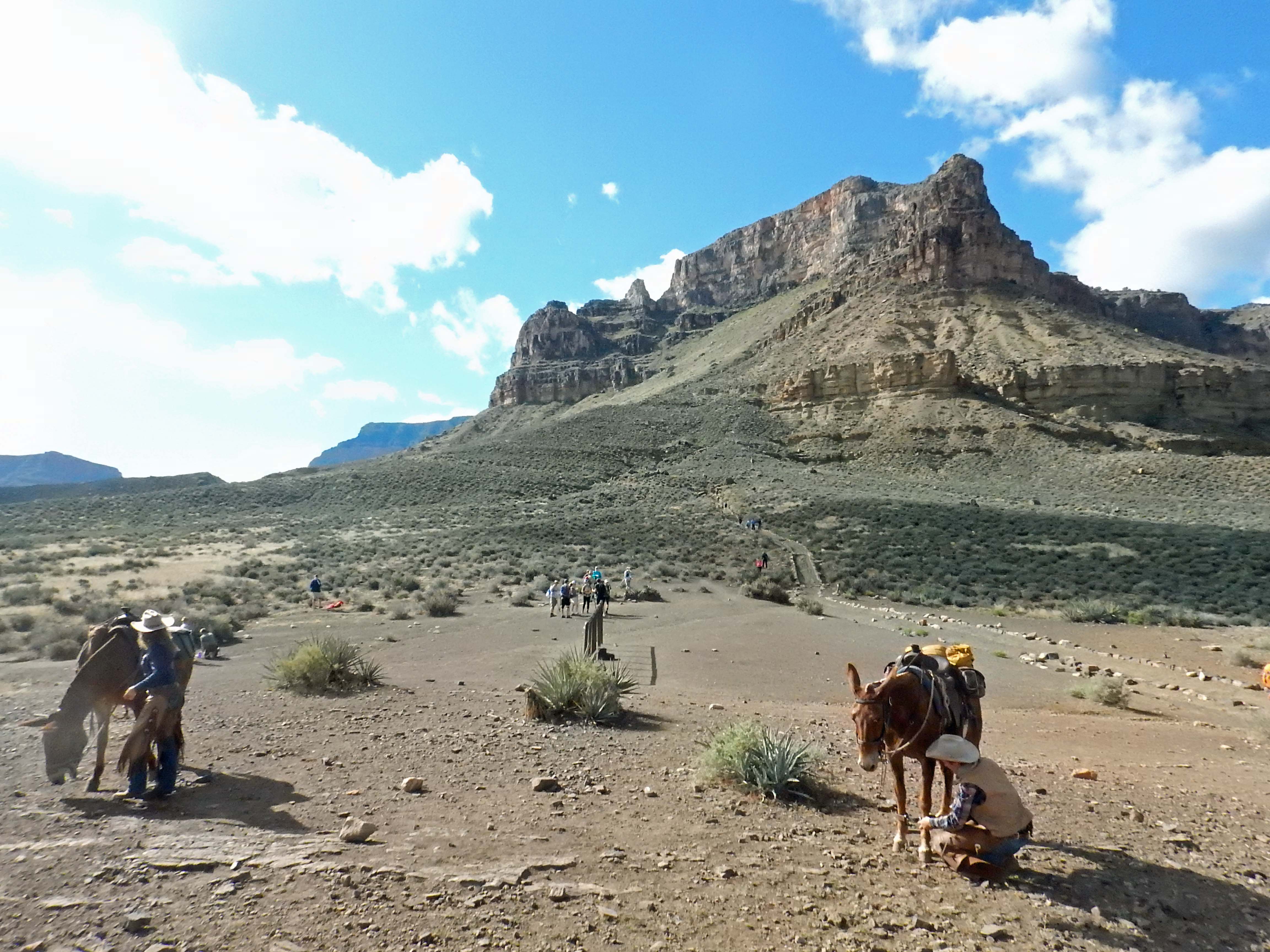
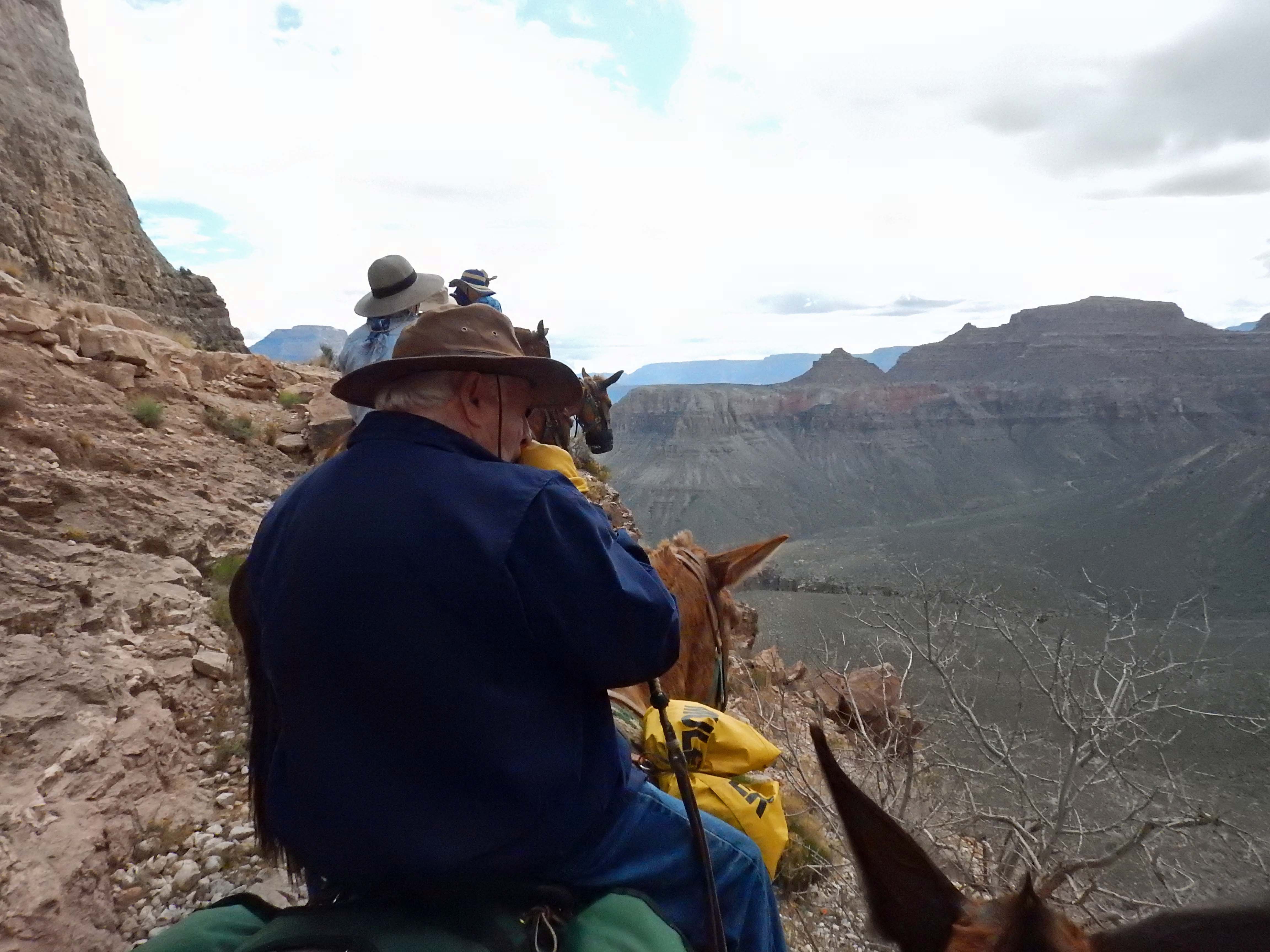
Hikers going down to Phantom Ranch generally descend South Kaibab trail, and climb out on Bright Angel. The reason is that South Kaibab is shorter (and therefore steeper), and has no drinkable water or shade along the route, while Bright Angel has plenty of both. The mules, however, take the opposite route. Unlike two-legged hikers, the four-legged variety find going downhill more difficult than up. So the same features that make Bright Angel the better uphill choice for humans make it the downhill choice for mules.
 |
Getting to the top of the inner canyon, and the transition from igneous granite to sedimentary layers. |
 |
 |
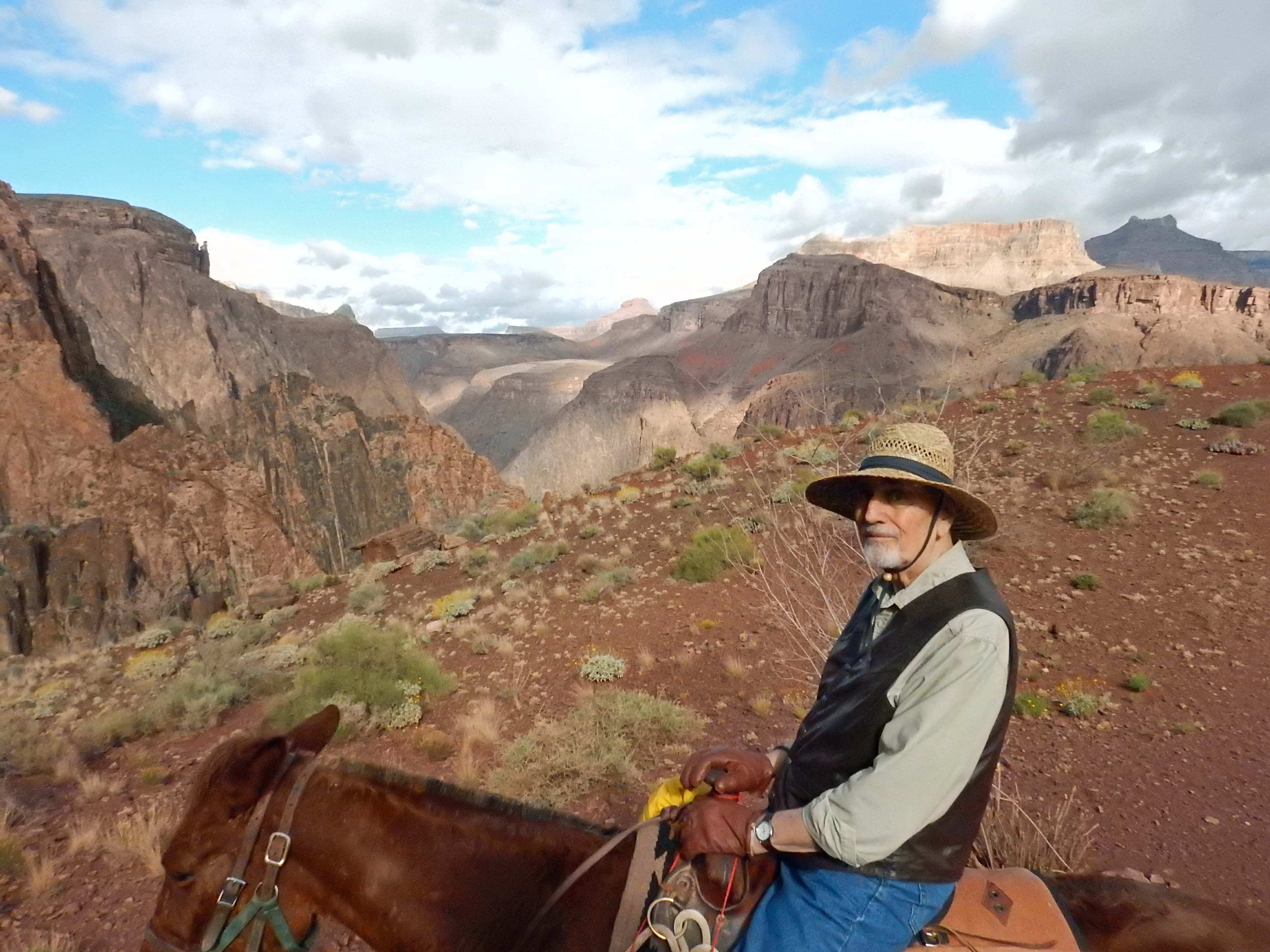 |
Is that my Dad, or is it legendary rancher Charles Goodnight come back to life? |
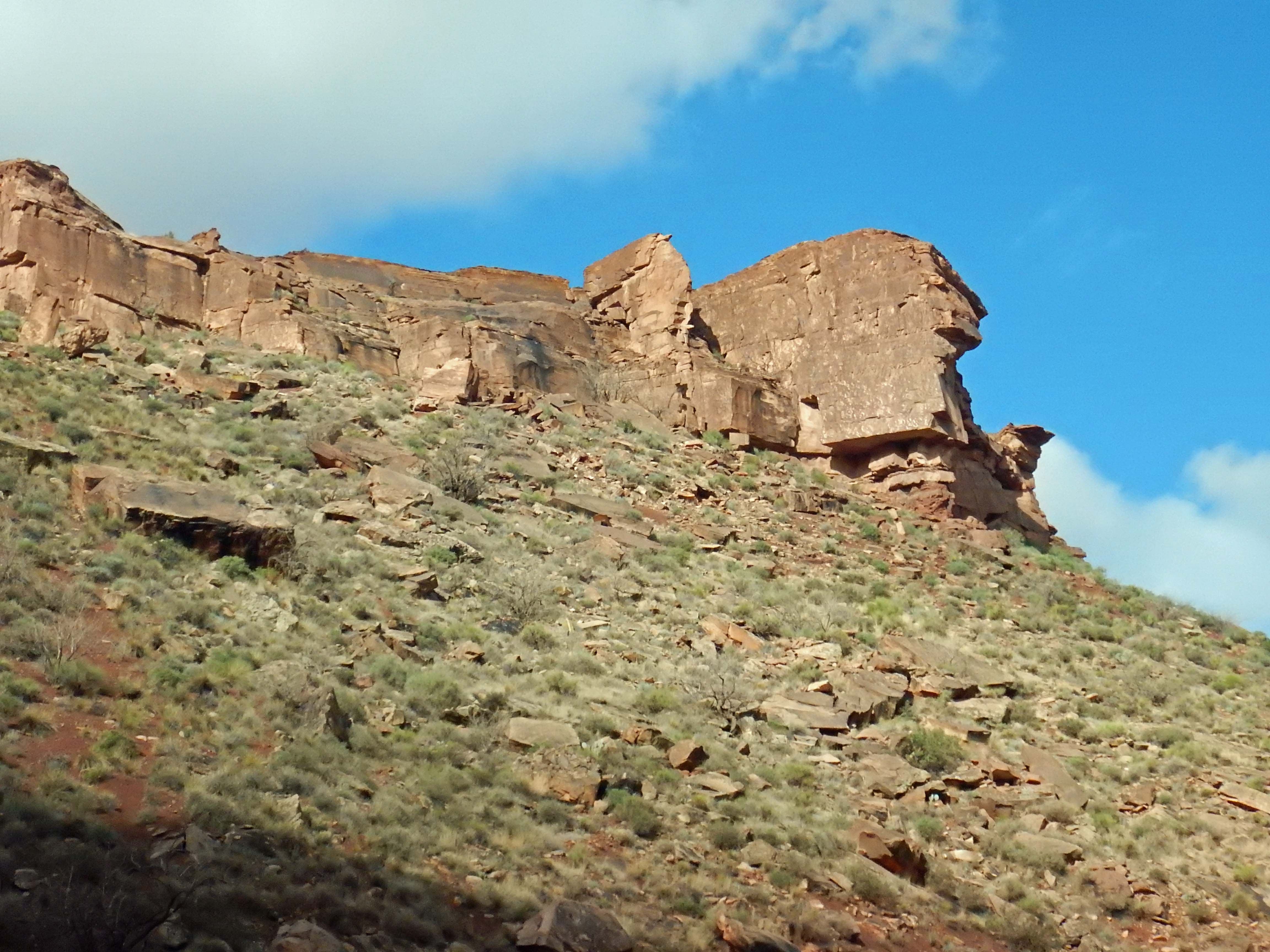
| Some rock formations in the canyon have venerable historic names; others have been named (or renamed) more recently. Josiah and Darby told us the formation on the far right of the picture is called “George Washington Using a TV Remote.” Also in the picture, to the left of Washington, you may see a very small outcrop (click for the full-size image) called the Pack Mule. |
 |
 |
The mules pause for a rest while Darby describes some of the sights. Or possibly tells a bad joke (there were plenty of those). |
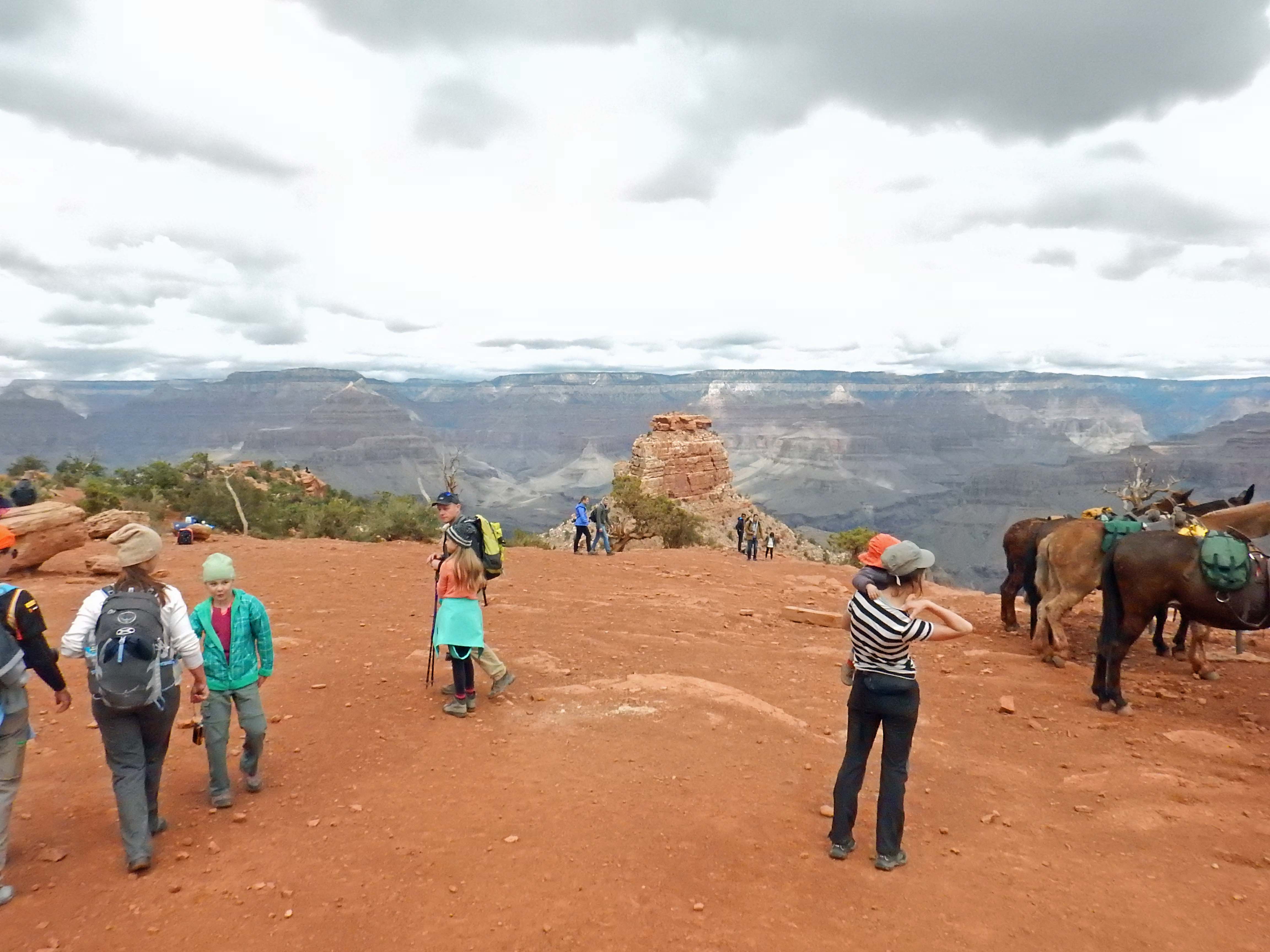
Some more perspective on the scale of the Grand Canyon. As we reach a rest stop where we dismounted the mules for a while, are we actually in a canyon, or somewhere in an open plain with mountains in the distance?
 |
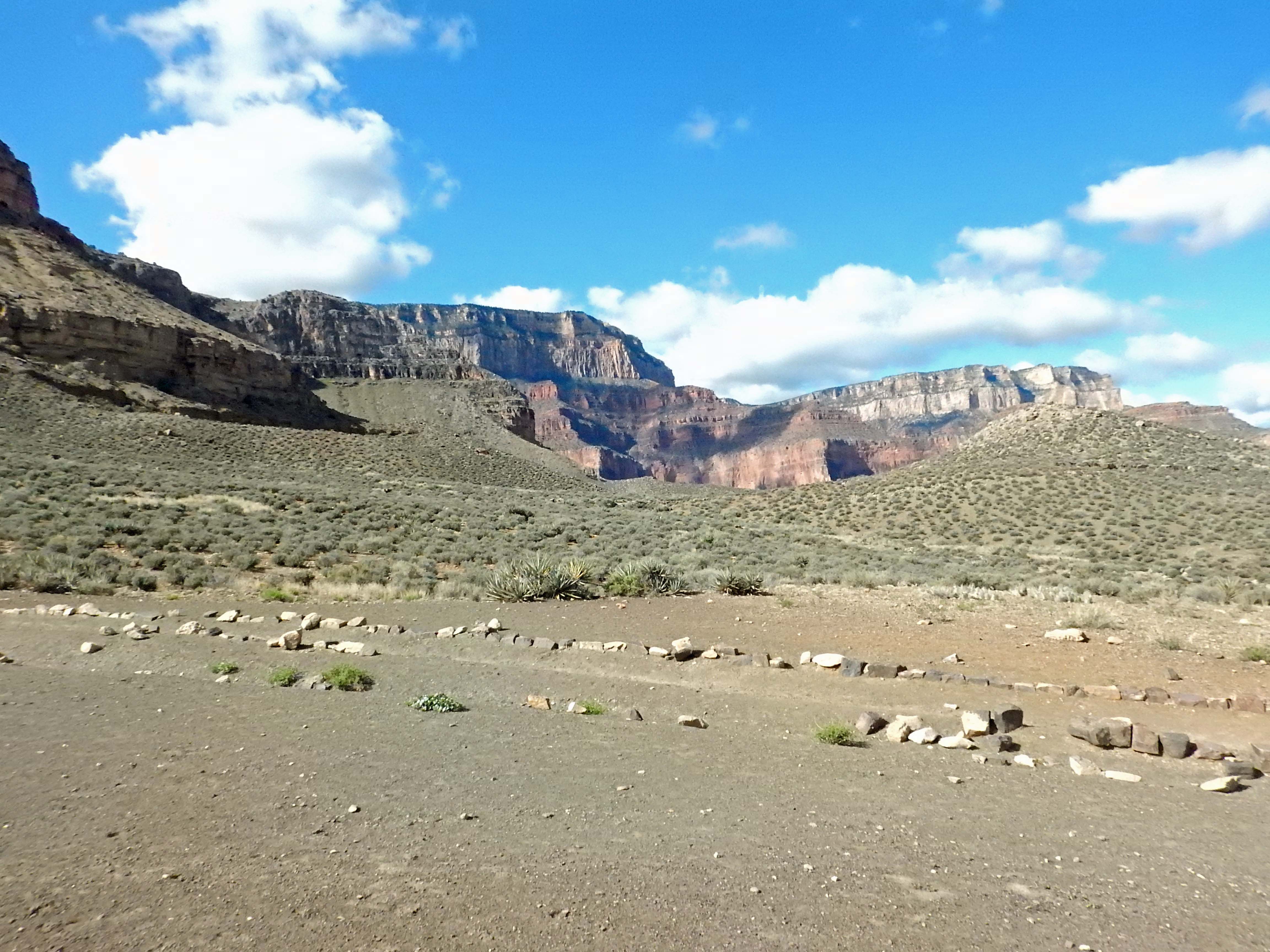 |
And in case you’re wondering: No, none of those rims against the sky is the actual rim of the canyon, which is still out of sight.
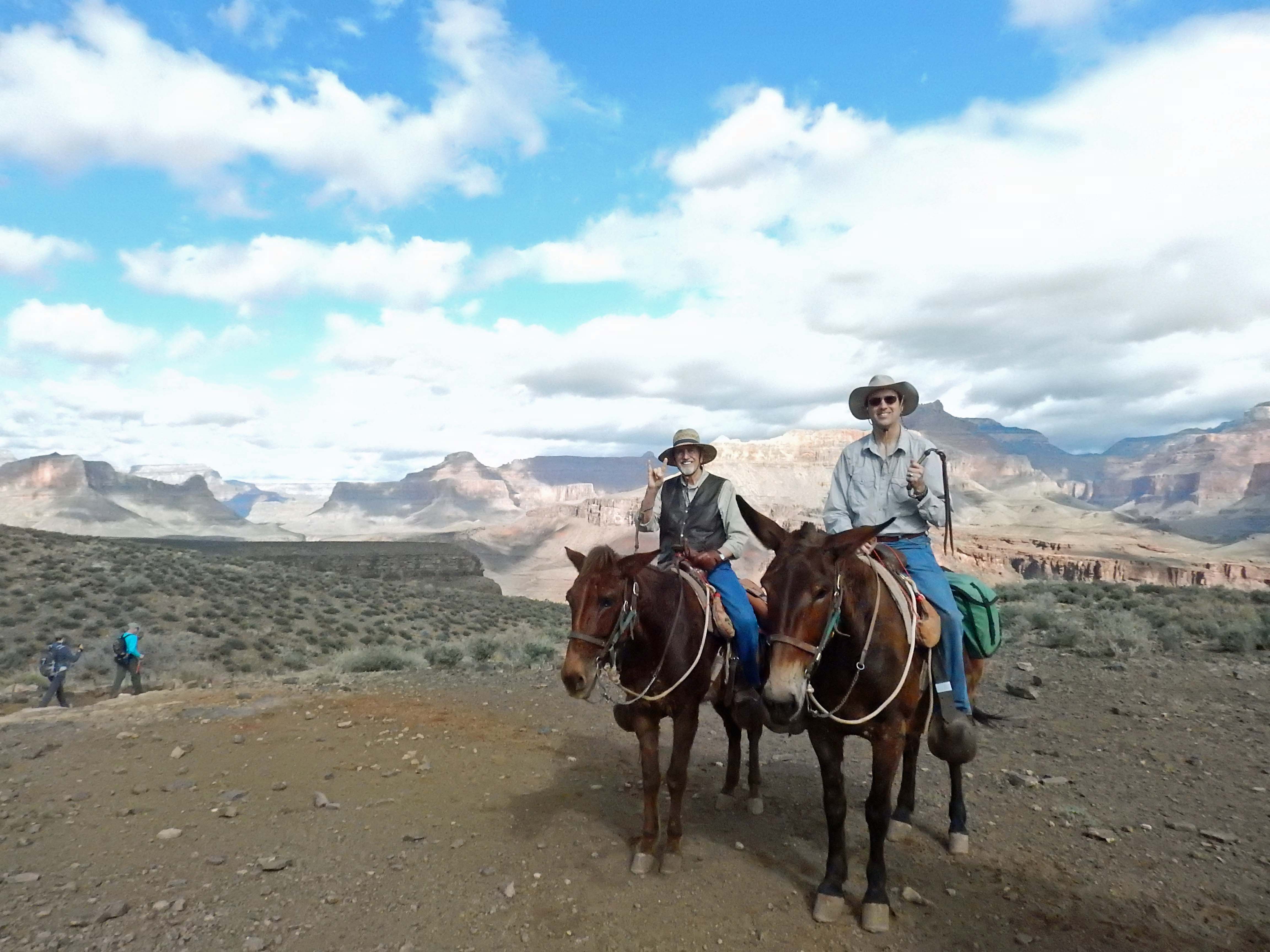 |
The intrepid mule riders! |
 |
 |
 |
 “Snoopy on his Doghouse” “Snoopy on his Doghouse” |
 |
At the second dismount stop, we know we’re finally getting near the top— because below this point, we passed only serious and well-equipped hikers, but here, and upward, we meet casual visitors and families with kids, hiking just this far for sightseeing. Our ride is almost done. |
| The guides call this view “the anthill.” The very last leg of the South Kaibab trail traverses up this cliff face, and the numerous tourists going up and down this part look like lines of ants on a wall. (Click for the full-size image to see better.) | 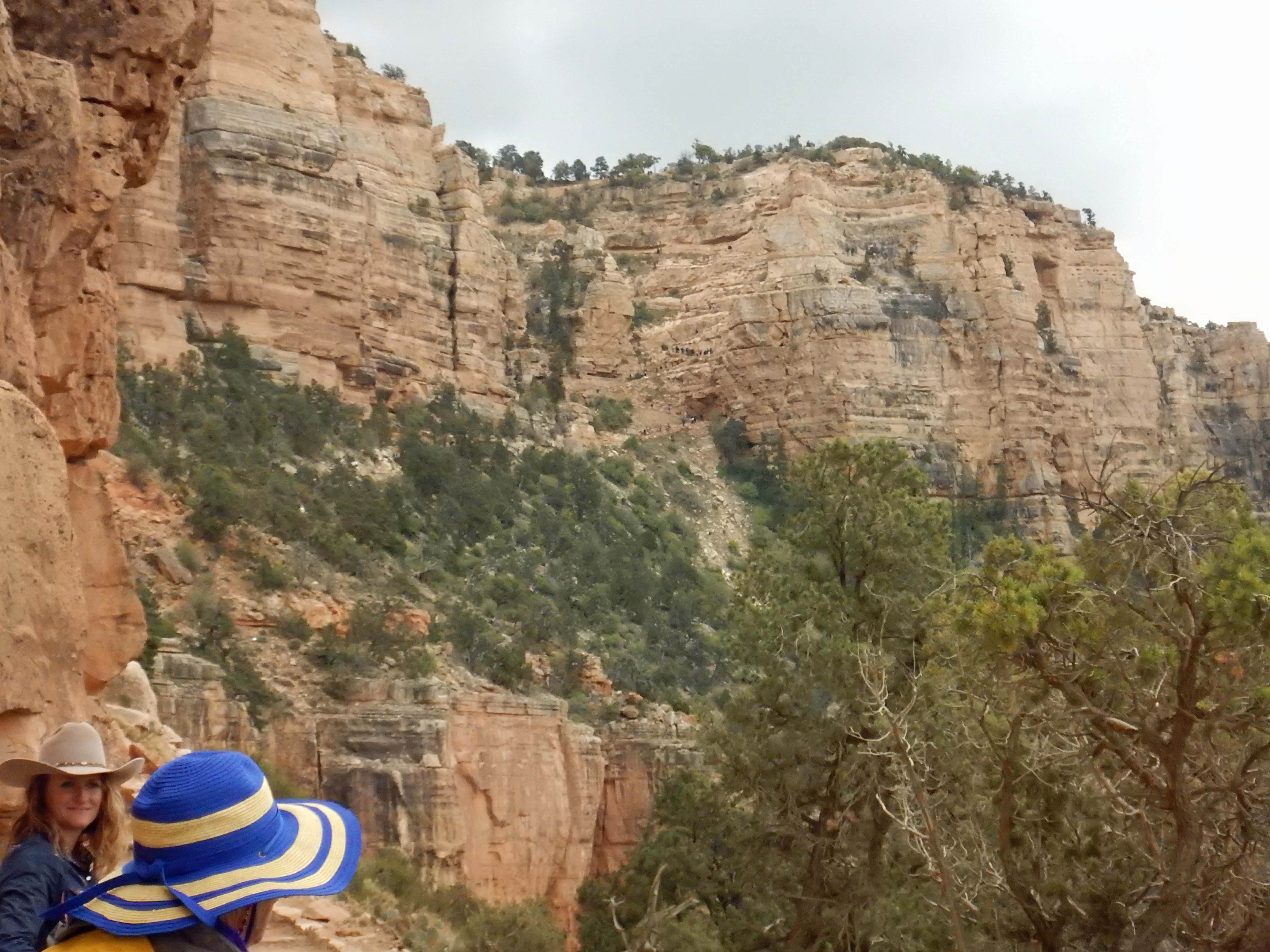 |
 |
After traversing our own way up the anthill, we reach the top at last, our mules headed back to their stable, and we boarded a van back to the Grand Canyon village. The adventure was over. |
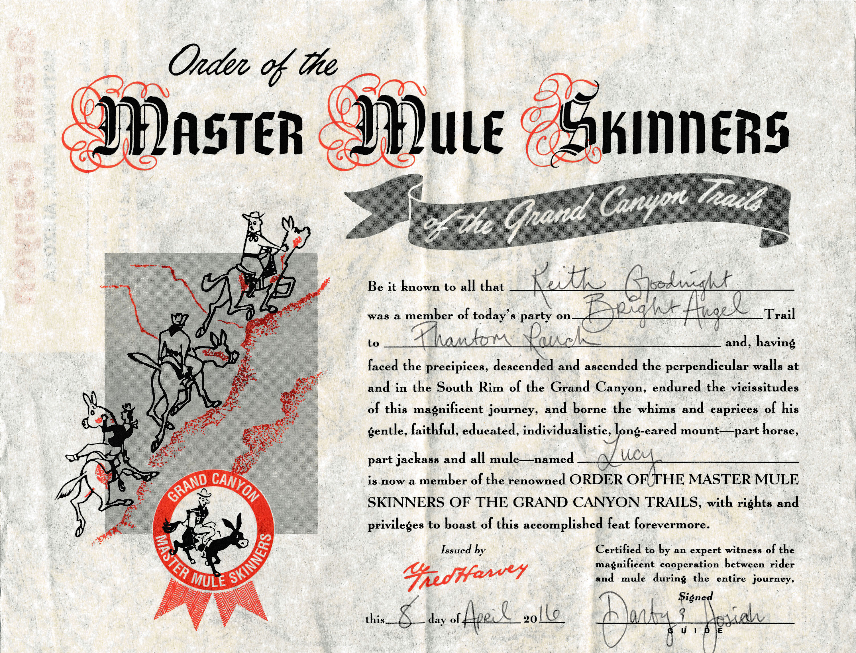
But not before we all received a certificate of our achievement, one that’s been handed out to every rider since the 1920s when the Harvey Company operated Grand Canyon village.
And so ends me and my Dad’s ride into history. Thanks for coming along; next week, this blog will go “back to the future” with the further history of the United Colonies. See you then!

1 comment for “Riding into History”