
July 19
Another driving day, heading south out of Moab and on to the Grand Canyon, by way of Monument Valley.
Another spectacular drive. This time I do have some pictures to share from a driving day, since I stopped at a couple of places.
My route south took me directly past the turnoff to The Needles section of Canyonlands National Park; I was sorely tempted to go see it, but I had other plans for the day and I knew if I let myself get sucked in I’d spend hours checking out everything. I did take a lesser turnoff to the Needles Overlook, which gives a panoramic view of that section of the park, dominated by the Colorado River and its canyons:
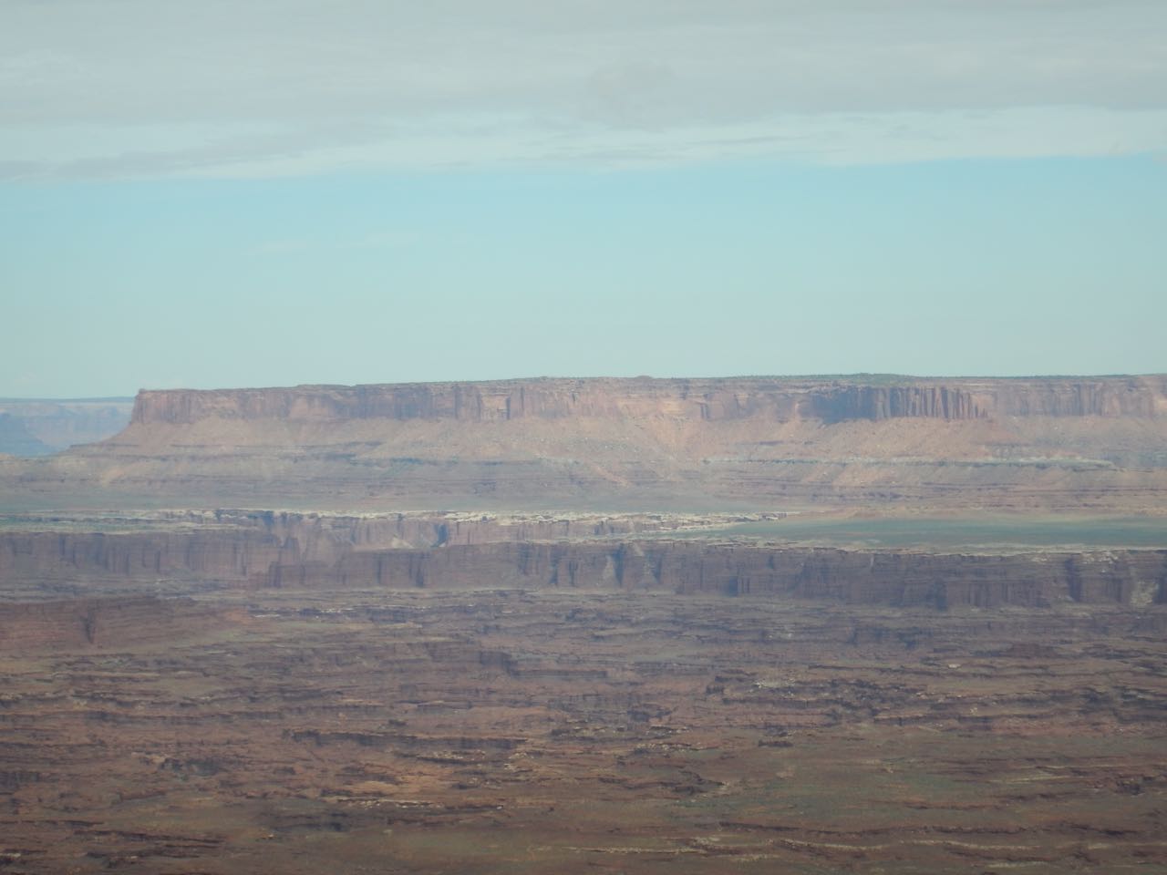
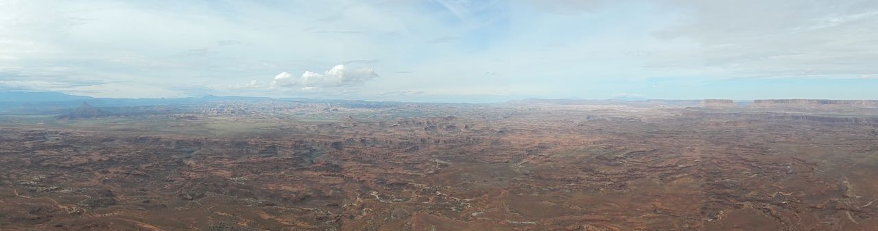 It was a bit of a misty morning, preventing the camera from picking out the details the eye could see. But by zooming in all the way, I could see the “Island in the Sky” mesa where I was yesterday:
Driving on, although I was headed south I entered a cooler and wetter climate than the desert around Moab, which I could tell because the mountainsides were once again covered in pine forests rather than desert brush. However this didn’t last long, and I was soon back in the desert again as I headed for the real treat of the trip: Monument Valley.
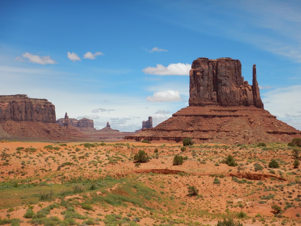
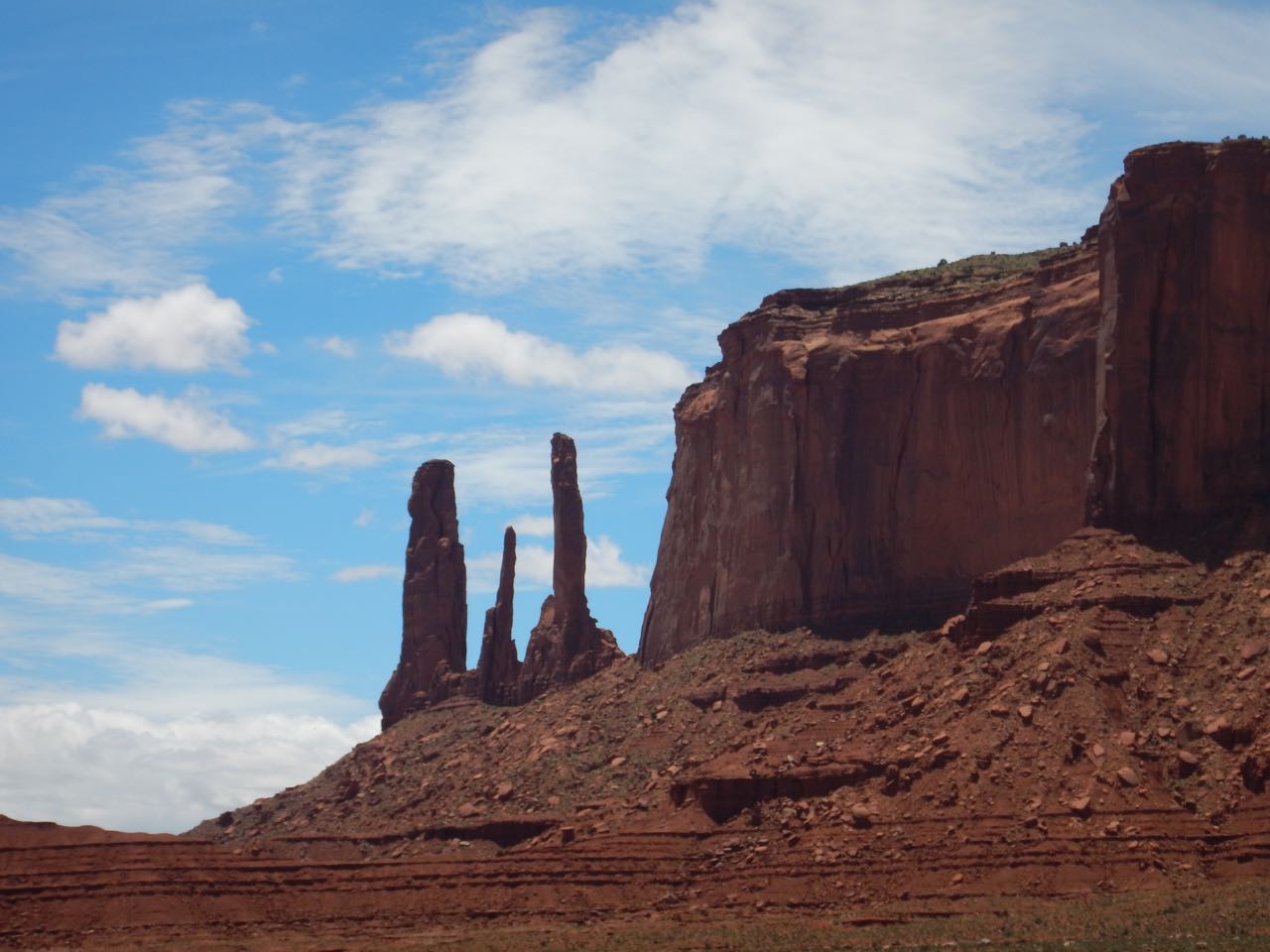
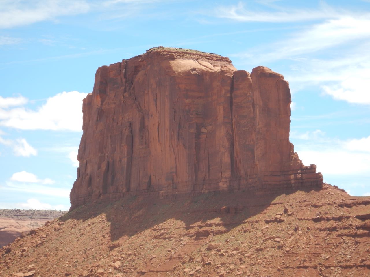
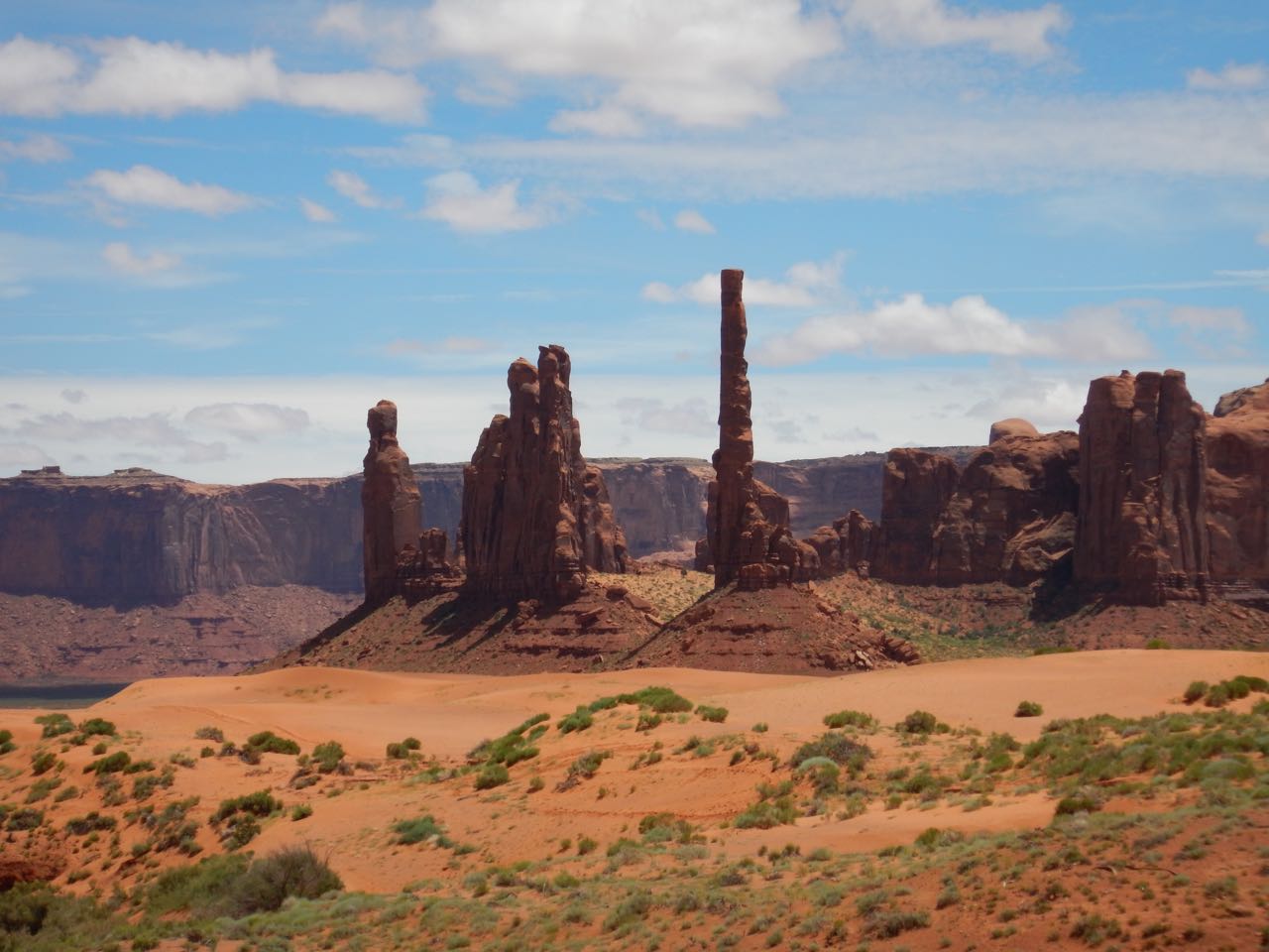
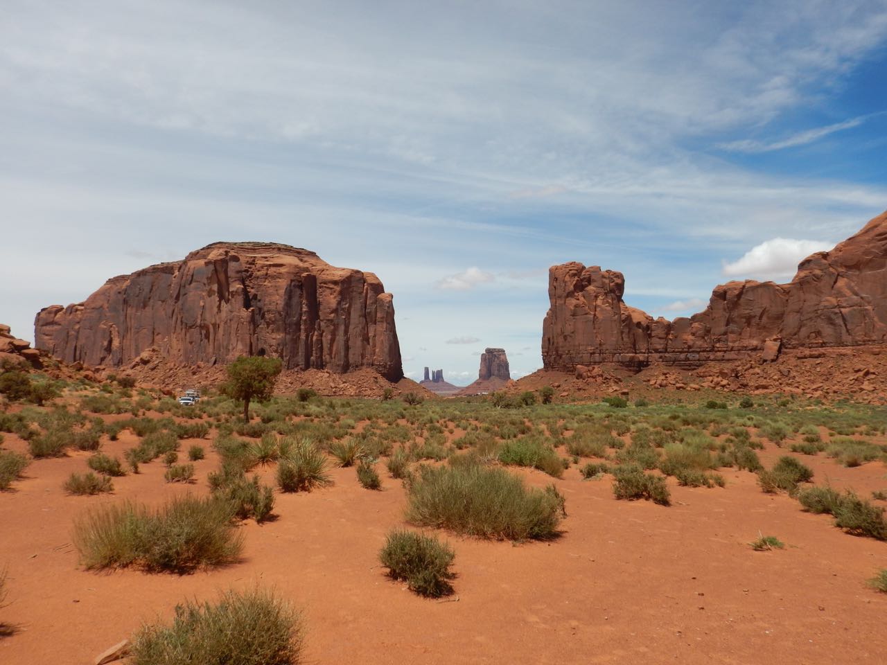
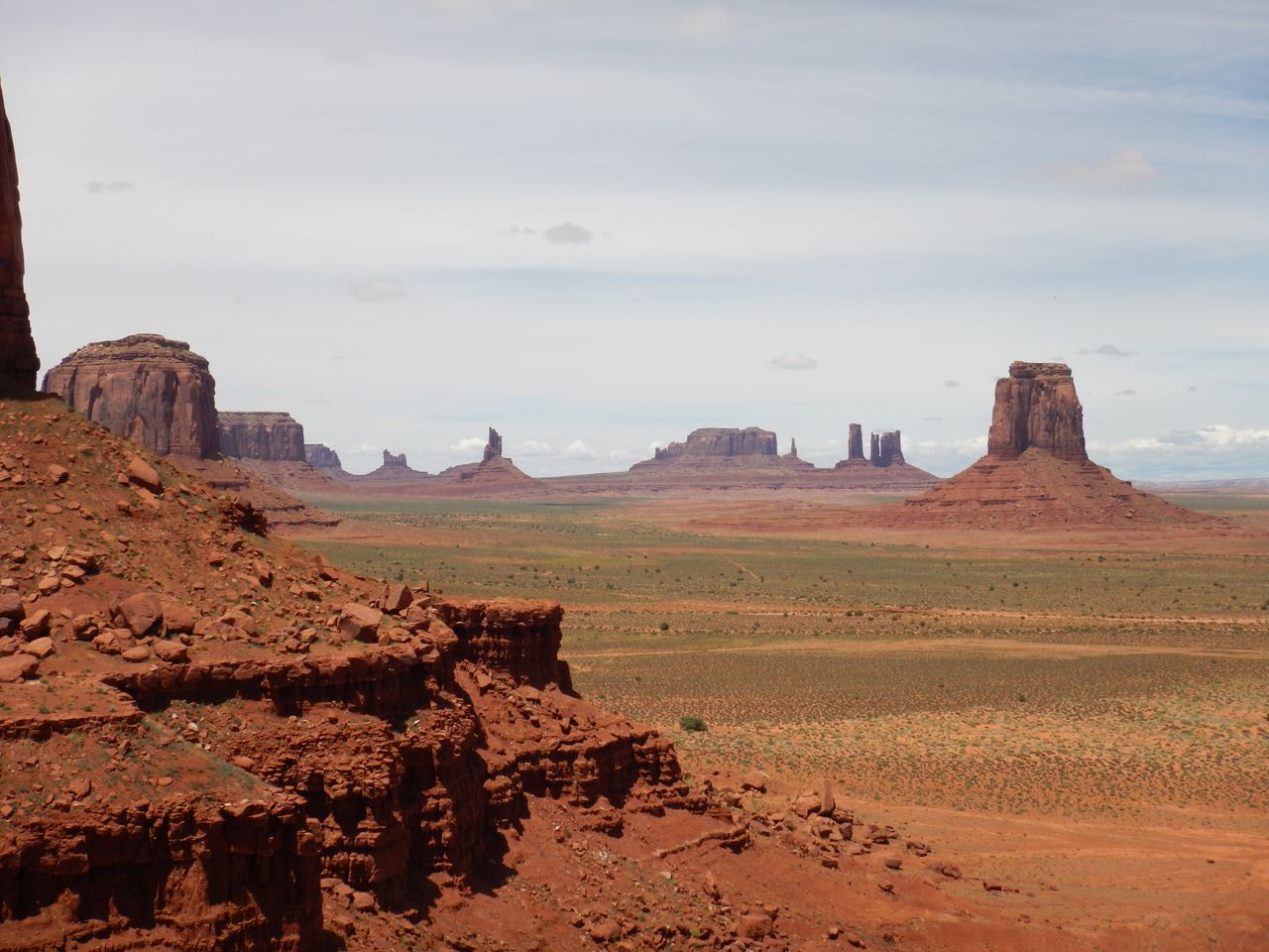
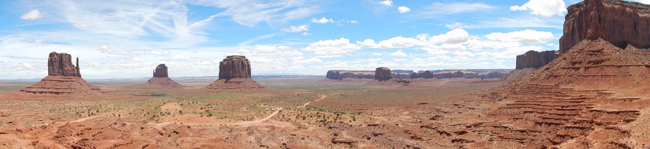 This place has been featured as the setting of so many westerns that everyone imagines the “Old West” just looked like this everywhere (forgetting that cowboys worked on cattle ranches and pioneers settled on good farmland, both meaning green grasslands, not deserts).
Monument Valley isn’t a national park— not a US one, anyway. It’s on Navajo land and is a Navajo Tribal Park. They have a large visitor center, hotel and restaurant alongside one end of it, and (I’m sad to observe) people in little plywood booths selling authentic Navajo jewelry at every pullout on the scenic drive. But they do have a scenic drive, and unpaved road winding among the stone towers, and I spent about two hours going around it.
 |
 |
 |
 |
 |
 |
From there it was on south, into Arizona. Approaching the Grand Canyon area, I once again noticed the plant life changing to suggest a cooler and wetter climate. I’m not sure why, since I was going south. I’m sure someone knows.
Just inside the East entrance to Grand Canyon National Park, I came to a turnoff labeled “First Look at the Grand Canyon.” The road leads to an overlook point featuring an observation tower designed by Mary Colter and built in the 1920s.
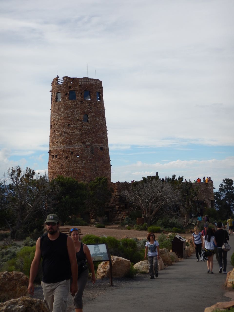 |
Mary Colter was one of the few female architects of her day, and was enormously influential in developing the distinctive “style” of structures in America’s National Parks. |
| Walking toward the tower, I noticed the canyon rim area was dominated by the same pinyon and juniper “dwarf forest” I’d seen at Island in the Sky. | 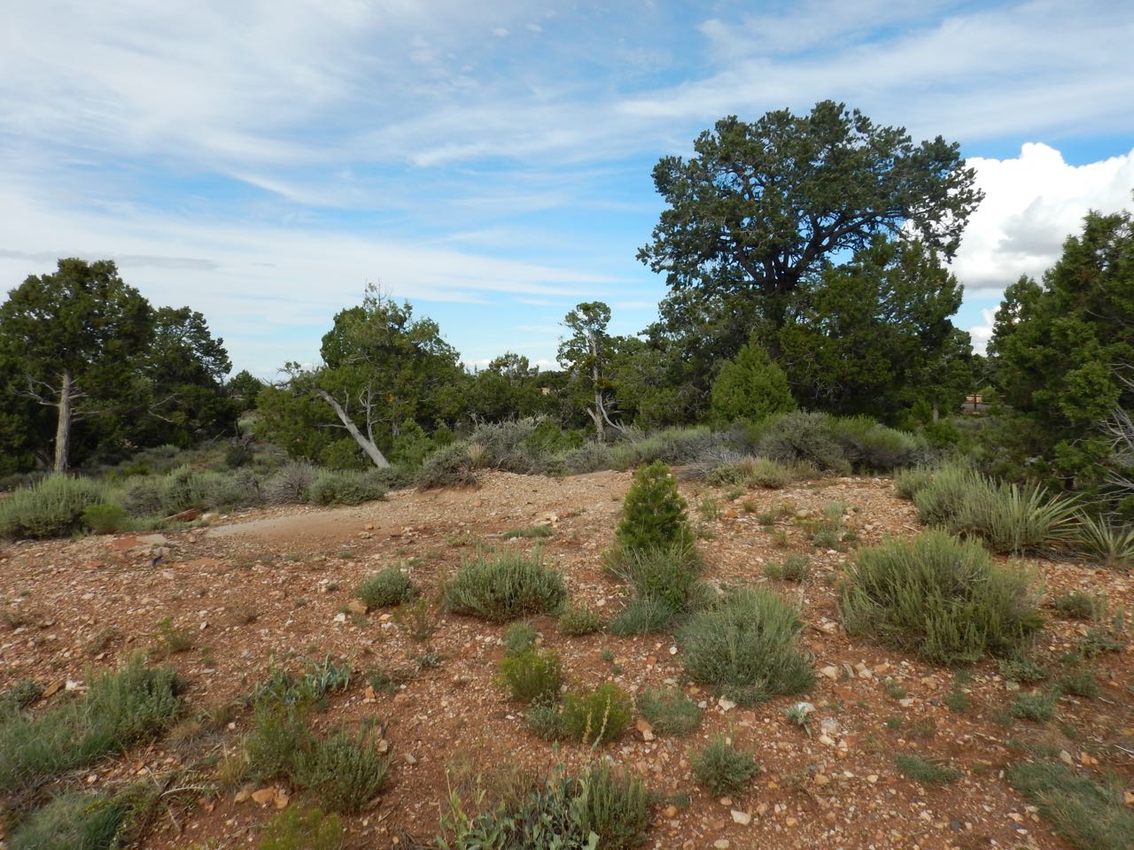 |
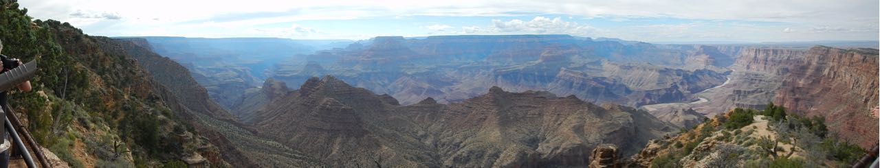
Okay, I’ll stop teasing. The first look view of the Grand Canyon:
I still had 30 miles of park road to go before reaching my hotel in Canyon Village. Mostly the road is out of sight of the canyon, and for now I drove past scenic turnouts along the way.
I’m now into the part of my trip that I’ve traveled before, during my similar expedition five years ago. I have 2 days here at the Grand Canyon and plan to do some different things than last time.
First up: tomorrow I have planned the most difficult hike of my trip. My ambition is to hike down Bright Angel trail into the canyon as far as Indian Springs campground, then come back up. (There’s no question of going all the way to the bottom: that’s a two-day trip and I’ll be back here in April to do that on one of Grand Canyon’s historic mule rides. For hiking on my own feet, Indian Springs will do.)
Here’s the details: the hike to Indian Springs is a 9 mile round trip. I’ve been deliberately trying to do 9 miles a day for much of my trip, once in two long hikes (3 miles and 6 miles, in RMNP), at other times by putting the mileage together piecemeal: a mile here, a half mile there, to various scenic points not directly on the park roads. I can do 9 miles.
However, this hike will have a far greater elevation change than any I’ve done before, and it’ll be downhill on the outbound journey— previous hikes were uphill first, when I was still fresh, and then downhill on the way back. How big a problem will this be?
Last time I was here, I walked down to the 1.5 mile rest house, a 3 mile round trip, and had no problems. My plan for tomorrow is to go at least as far as the 3 mile rest house, and then decide whether to go on. The danger is that since going downhill is the much easier part, I might be misled into thinking I can go farther than I really can. I’m going to try to be cautious and pay attention to how my legs are feeling.
I’m doing this hike right away, before I lose too many of the extra red blood cells I built up while getting used to much higher altitude in RMNP. We’ll see how it goes.
