Wi-fi at National Park lodges continues to be hit or miss. I have alleged internet access here at Mesa Verde, but the connection is painfully ssssllllllooooowwww. After the time spent waiting on today’s pictures to upload, I’m going to delay the next post until I move on to my next destination.
Day Twenty-three: July 2 (part 2)
I’ll start by reporting on yesterday’s sunset excursion into Arches National Park.
Wouldn’t you know it? I finally get the clear night I was looking for, and then up comes an almost full moon— almost as bad for washing out starlight as city lights would be. I got one really good picture out of it, but it wasn’t the sky full of stars and Milky Way that I was hoping for.
But first— some pictures of places the park ranger told me photograph better at sunset.
 |
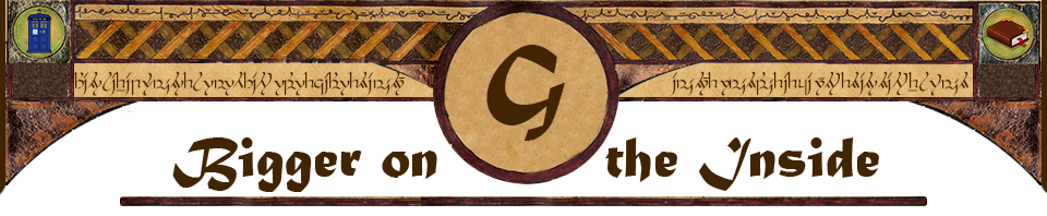
Here’s Park Avenue, where I hiked this morning, now with the sun on the opposite wall. |
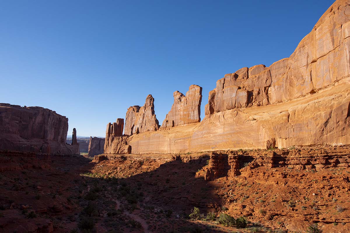
| Courthouse Tower, viewed from the La Sal Mountains overlook. | 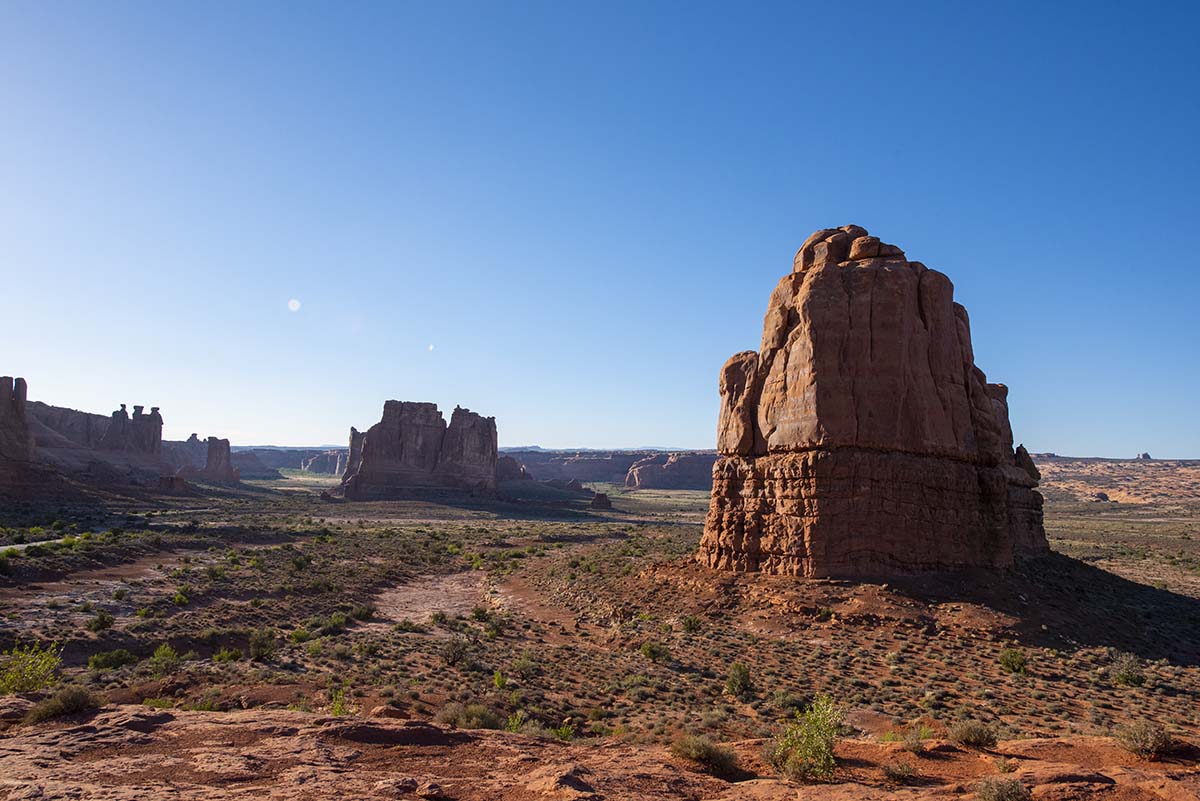 |
 |
The distant La Sal Mountains themselves. |
The “Fiery Furnace” gets its name from how it looks in the afternoon and evening:
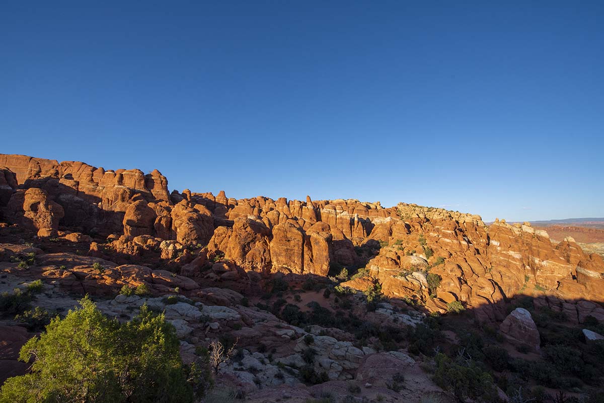
| This wasn’t on my list of sunset spots to photograph, but I noticed how you can really see the way Arches’ “fins” formed from parallel, vertical fractures in the rock. Most of the park’s 2000 known arches are in close-packed sets of fins like this, where they can only be seen by rock climbing among them. The scenic ones, out in the open, are the exceptions. | 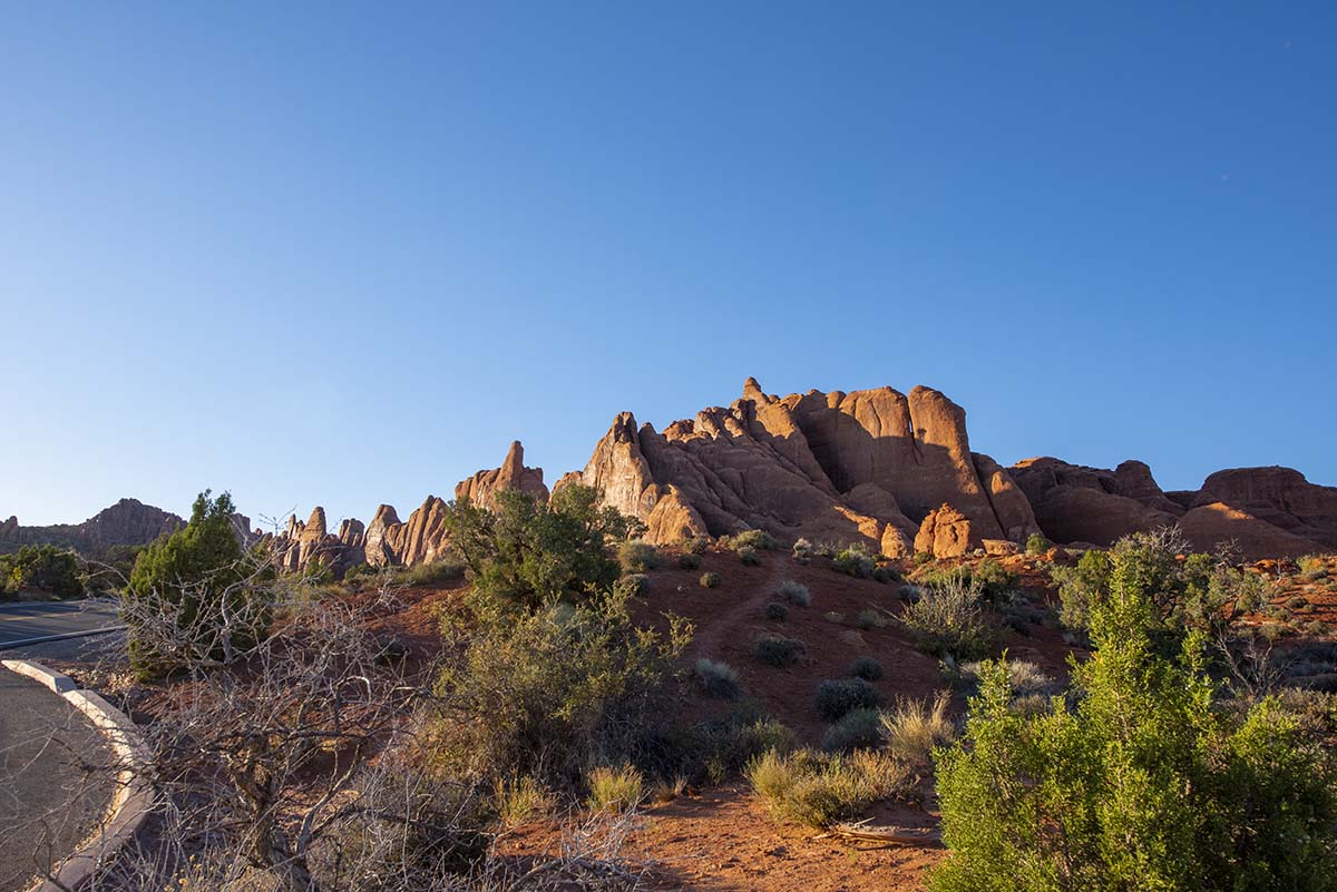 |
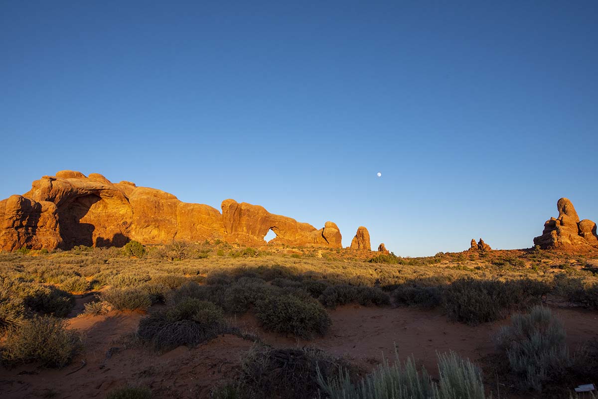 |
Here’s the North Window arch, where I was planning to take my star picture. You can see that moon rising above it! |
| In the opposite direction, the sun sets behind “The Elephants” (see the earlier Arches post for a photo of this formation in daylight) | 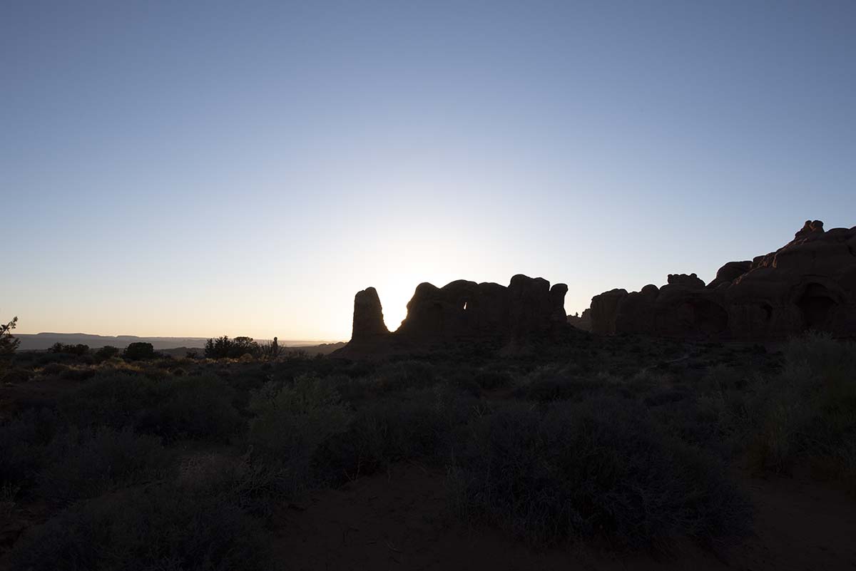 |
After the sun went down, twilight lingered a long time, but finally the skies were dark… but with that moon out, few stars could be seen. Still, here’s the one shot that I really like: the North Window by moonlight:
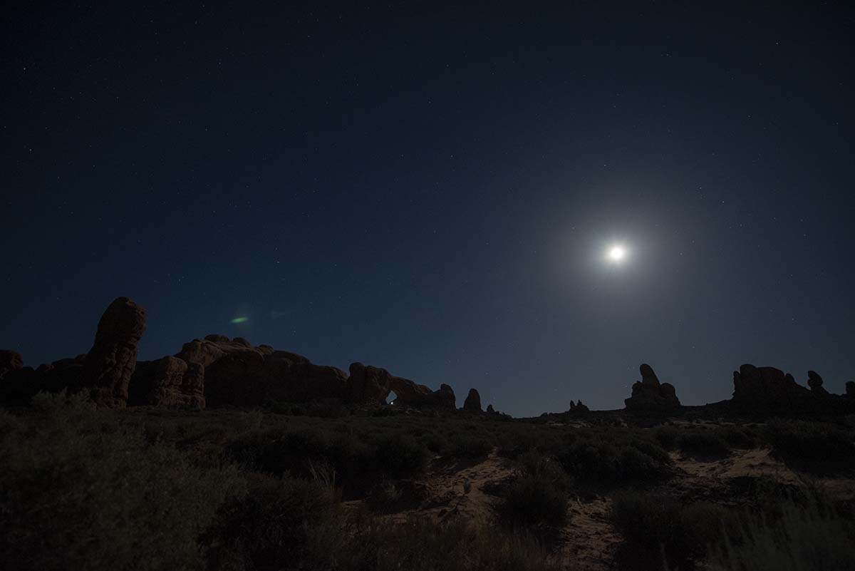
What’s not in that picture is a lot of stars. I tried a bunch of exposure settings, and mostly shot with the camera pointing away from the moon, but the bottom line is that the moon lights up the sky brighter than most of the stars. A long exposure gives me what looks like a daylight blue sky; a short exposure gives me just black; neither show many stars. The books I studied before this trip all pointed out that you need a moonless night for star photography, and they’re right.
It’ll take two weeks for the moon to wane, and by then I’ll be back home. Oh well, maybe next trip.
The mileage for tonight’s expedition will be added to day twenty-four’s trip report below.
Day Twenty-four: July 3
Today I drove from Arches to Mesa Verde. This was a short drive, and it turned out not to be as scenic as others. The road soon moved out of the interesting geology of the region I’ve been in for a while, and mostly crossed featureless plains. There were mountains in the distance, but not much more.
I decided to go by Four Corners— where Colorado, Utah, New Mexico and Arizona all meet— on the way. It wasn’t on my route, in fact I had to drive past Mesa Verde to get to it, but I had the time and since I was in the vicinity. I’ve heard it said that Four Corners is the most disappointing destination in the US (there’s nothing actually there except a marker and a gift shop) but that in itself is an achievement worth seeing, in an ironic sort of way, isn’t it?
| Unfortunately it turned out to be disappointing in the wrong way. I knew that the Navajo have closed all their parks and recreational areas for the duration of the epidemic— so I didn’t plan a route through Monument Valley, which is a Navajo park— but I didn’t know Four Corners was also inside a Navajo park. | 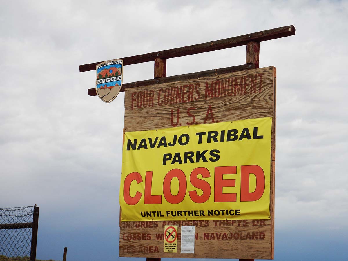 |
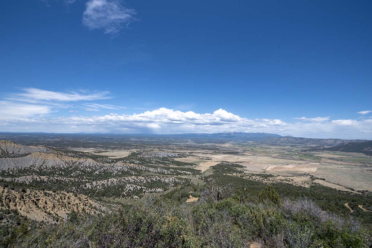
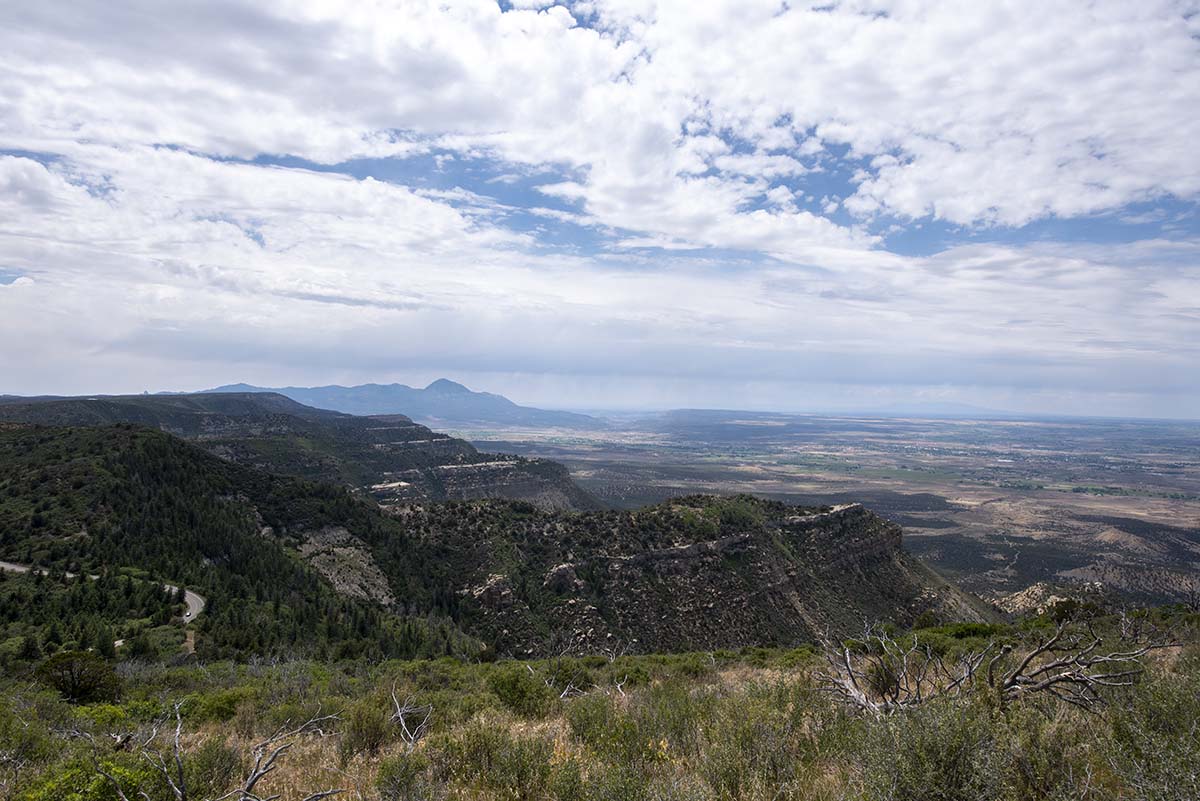
Nothing else happened on today’s drive. I did get some interesting pictures once I arrived at Mesa Verde, during the drive up onto the Mesa itself, where my lodge is.
 |
 |
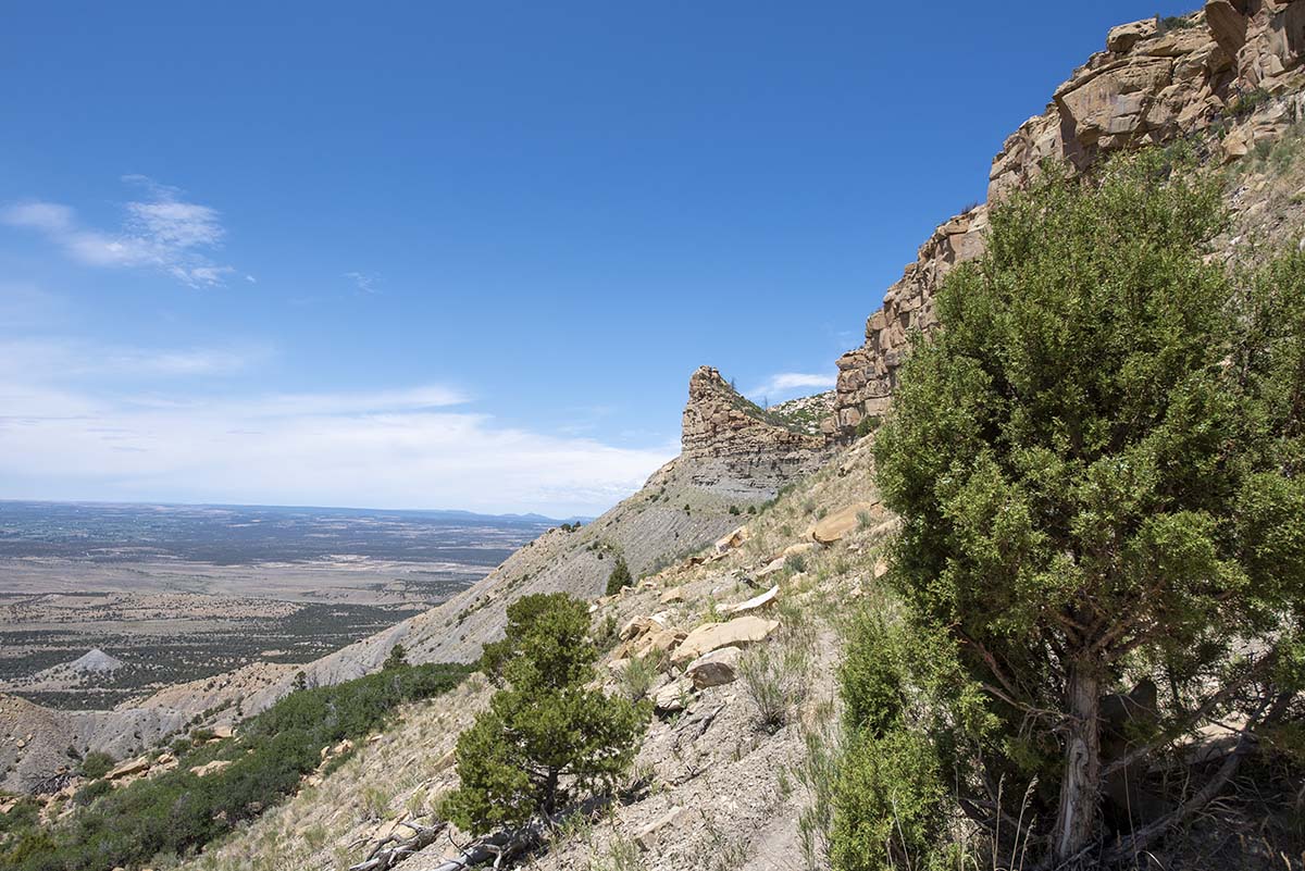 |
When Mesa Verde became a national park in 1906, it was only with great difficulty that they were able to construct a road to let visitors actually reach the cliff dwellings and other archaeological sites. The original road ran along here, in a section called “The Knife’s Edge,” but the ground was so unstable it required constant maintenance. They eventually found a better route, and since then the original road has washed away so thoroughly they can’t even maintain a hiking trail on its former path. (Though what looks like a trail is visible, there’s a warning sign that it’s unsafe and closed.) |
| At Park Point Overlook, the highest point in the national park (8500 feet), there’s a fire watch station. Especially important right now, as the fire danger is currently set at “extreme” due to a long period without rain, and none in the forecast. | 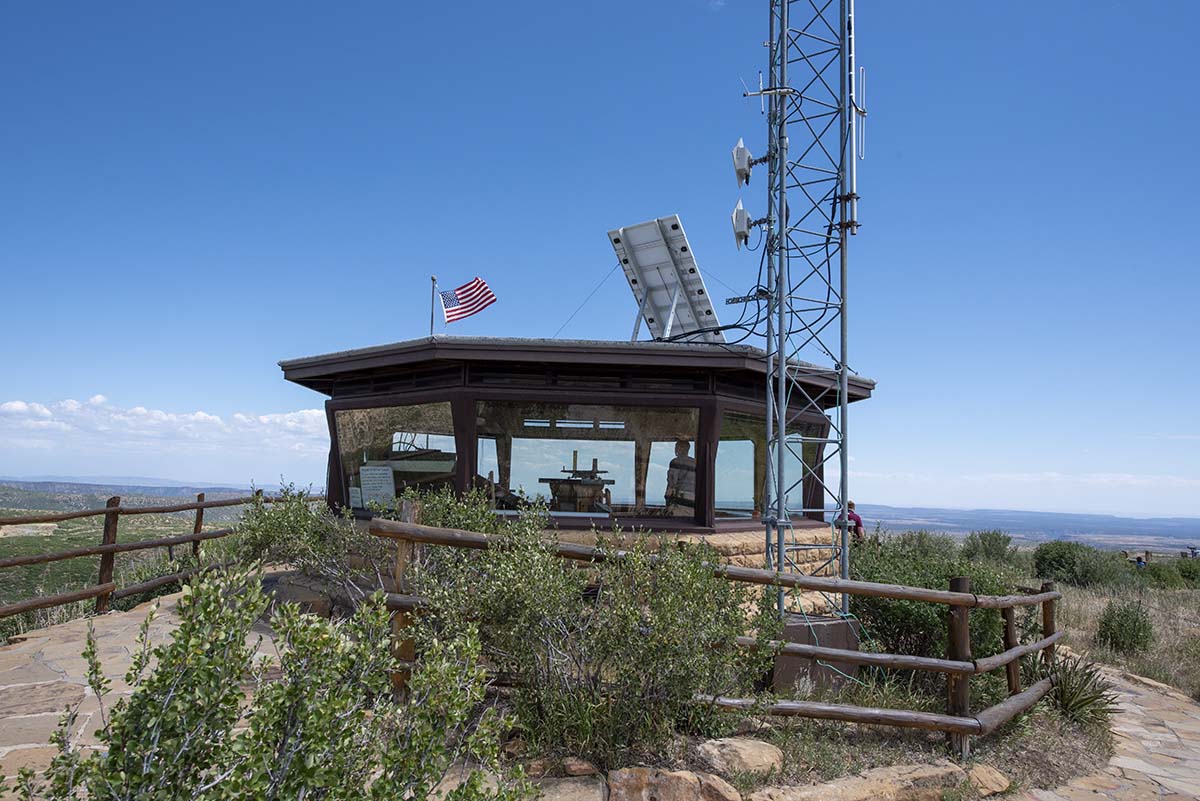 |
I have two full days scheduled at Mesa Verde, and that’s somewhat troublesome. Right now, all visitor centers and museums are closed, and so are the cliff dwellings. All range-guided tours are cancelled (normally I skip guided tours, but Mesa Verde is an exception— or would be). You can still see the cliff dwellings from roadside overlooks, but not go into them.
I knew all that before setting out on my trip. However, what I didn’t know is that standard procedure (nothing to do with the epidemic) is to close the hiking trails as well as one of the two main scenic drives whenever the fire danger is “extreme.” All but two short trails are currently closed due to the fire risk.
So that leaves… what? I don’t expect I can fill two days just on the drive between overlooks. I’ll do as much as is open tomorrow, and then try to figure out what to do with the following day. There are a number of archaeological sites in the area relating to the Ancestral Puebloans (who built the Mesa Verde cliff dwellings) and I may look into what’s within “commuting” range. That way I’d stay on topic for this stage of my trip.
Trip Report:
Miles driven today (plus last evening): 275.9
Total miles so far: 4671.2
