Day Twenty: June 29
A driving day today, technically, as I shifted headquarters from Torrey, Utah to Moab, Utah. I’ll be here in Moab for four nights— my longest stay at a single hotel in this entire trip, because two national parks from the same base camp, Arches and Canyonlands. Today’s drive would have gotten me to my hotel by around noon or so, but I passed by Canyonlands on the way so I took my first look at it. But before getting there, I had one last drive through Capitol Reef.
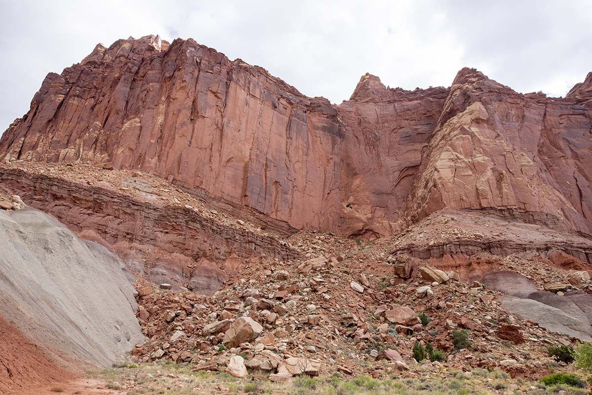 Highway 24 might not be award-winning as highway 12 was, but it was still a beautiful drive for most of the way. It led me through Capitol Reef National Park along the course of the Fremont River, which cuts all the way through to the other side of the formation.
| As I mentioned in yesterday’s post, the Fremont River creates an oasis along the bottom of its canyon, where nineteenth century settlers set up a farm community growing orchards of fruit trees. They named their settlement Fruita. | 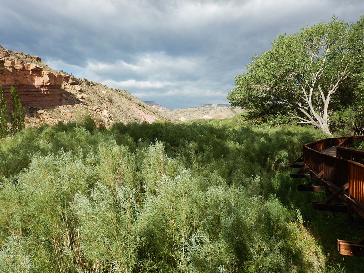 |
 |
Long before those settlers, Native Americans archaeologists call the Fremont Culture inhabited the canyon, leaving behind petroglyphs like these. This was once a larger display, but a natural rockfall in 1952 (the divot on the left of the picture shows where the rock broke loose) destroyed the drawings that were on that spot. |
| This set of carvings were very high up the cliff. How high? | 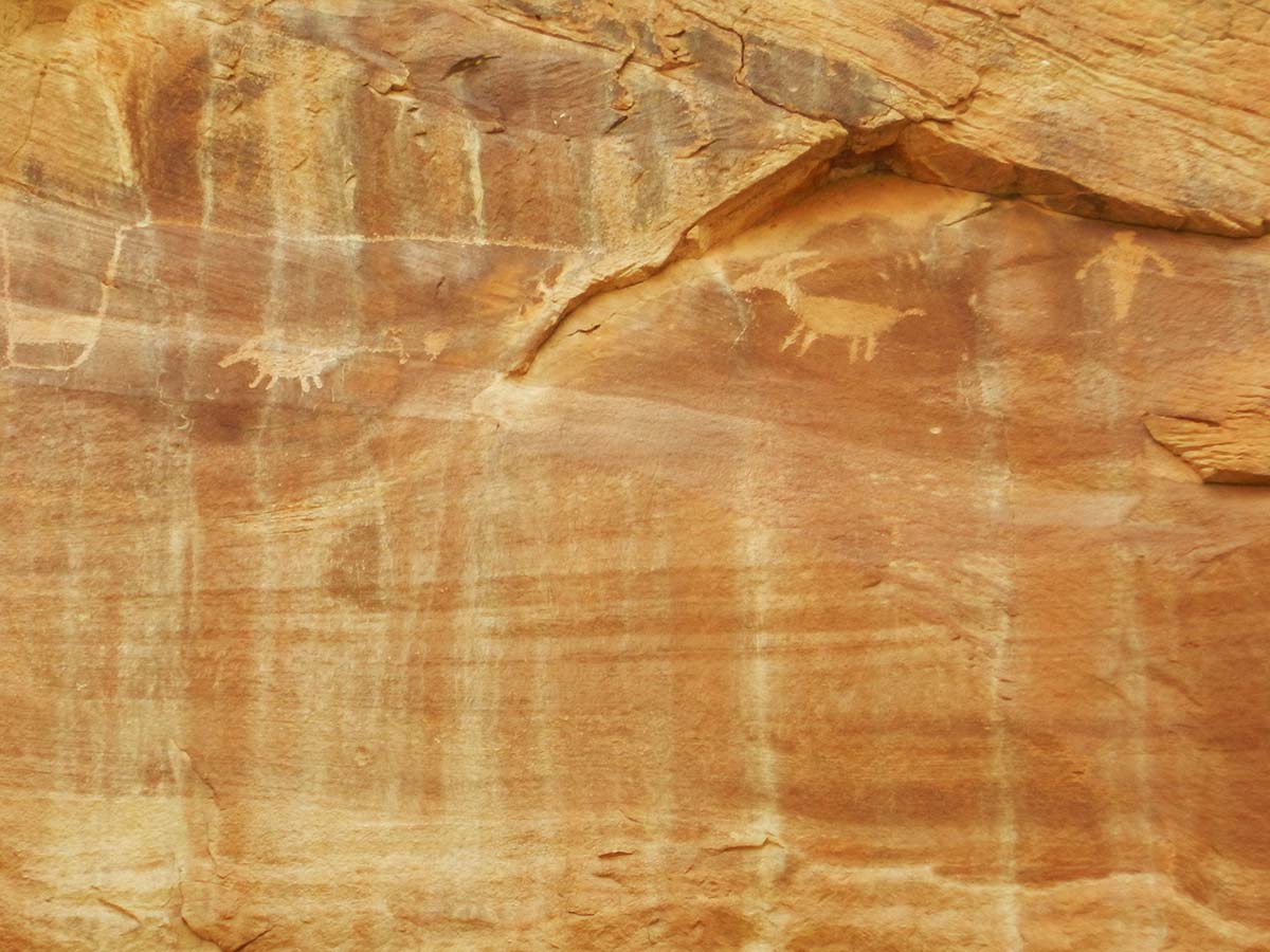 |
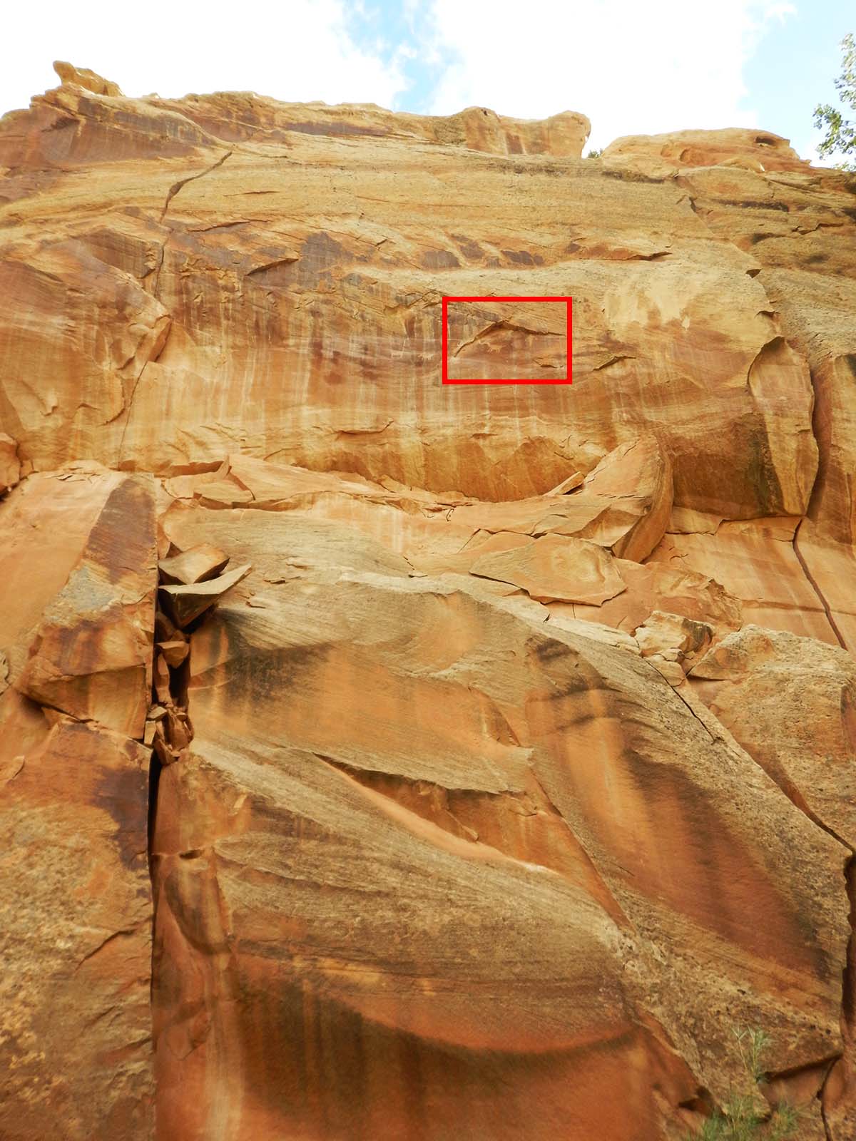 |
This high! |
The Fremont culture occupied the canyon from around 300 to 1300, then for unknown reasons they vanished, after a thousand successful years, leaving behind only their petroglyphs and other archaeological traces.
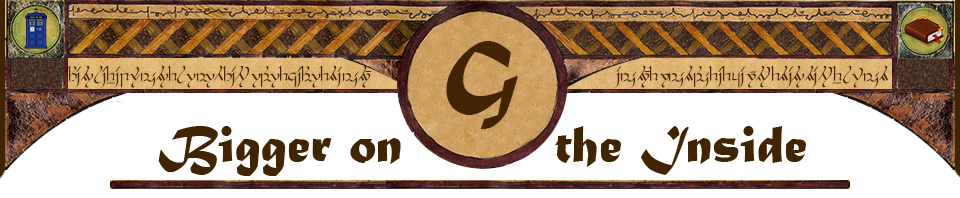
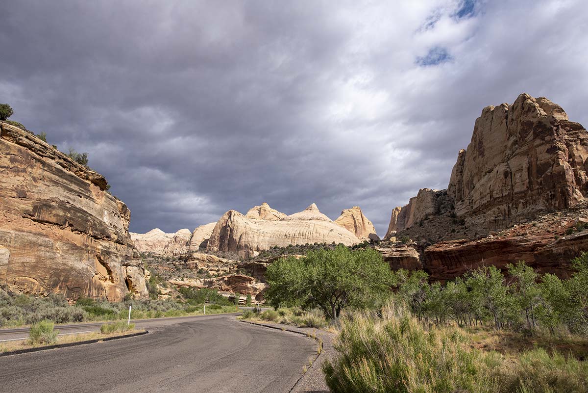
| Ahead, visible between canyon walls, is Capitol Dome— the rock formation that reminded early prospectors of the US Capitol and so gave Capitol Reef its name. | 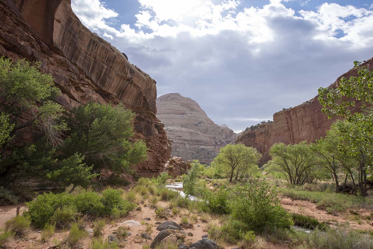 |
 |
The park service info signs say that the only way through Capitol Reef before the construction of highway 24 was through the narrow Capitol Gorge (which I went to the mouth of yesterday). Following the highway alongside the Fremont River today, I wonder why. The river’s canyon is wide and level, it doesn’t go through any narrows or run up against any cliffs. Granted they would have done some blasting and cutting to create the highway’s path, the natural river valley seems like a fine wy through the reef to me. But apparently, for some reason it wasn’t, until the highway. |
| Once out of Capitol Reef, the road settled into a straight line across flat lands, without a lot to see, although this one really amazing-looking ridge line was off to the left for quite a ways. The photo doesn’t show it as clearly as it looked to the eye, but you can see how huge plate-like layers of stone have been tilted upward and shattered to form the ridge. | 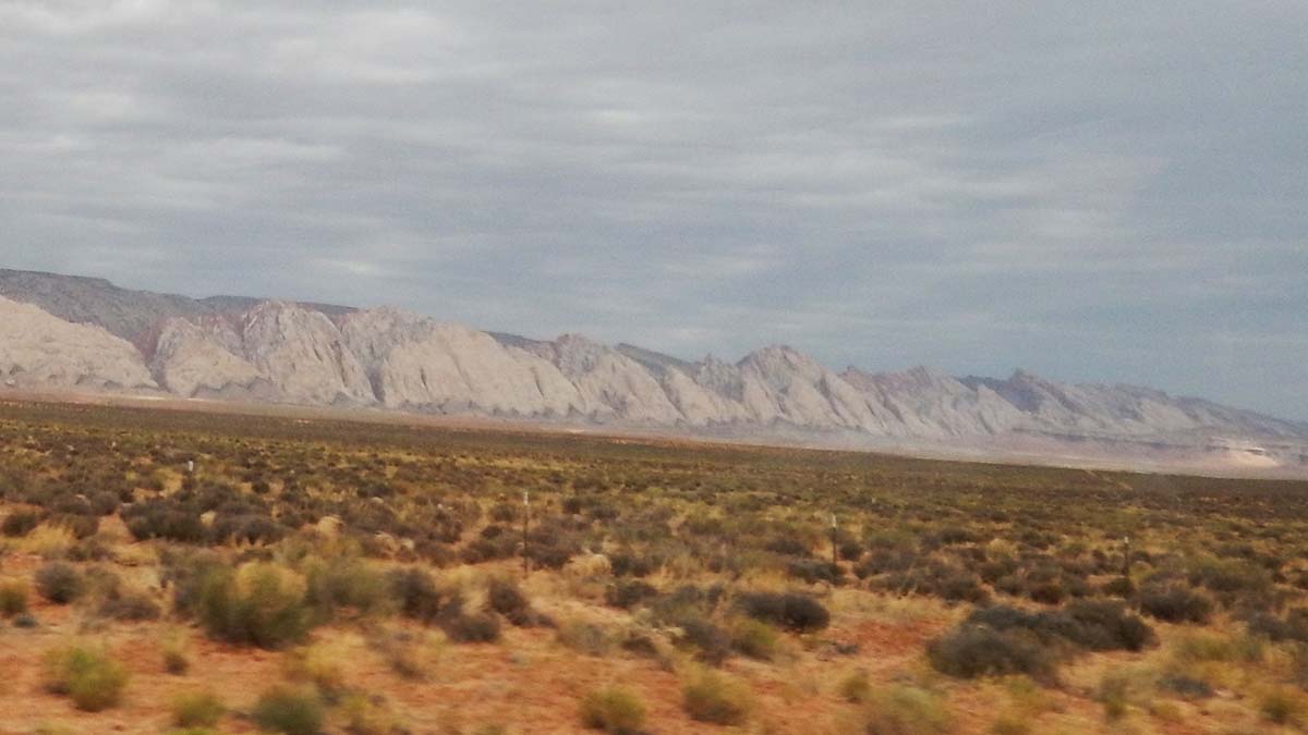 |
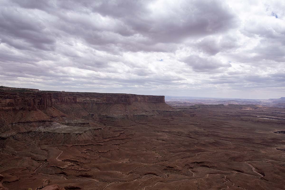
A hundred miles or so further along, I came to Canyonlands National Park— or a part of it, anyway. The National Park covers the place where the Green River flows into the Colorado River on its way to the Grand Canyon, and both rivers are already set in their canyon-making ways here. The confluence happens at the center of a high plateau that the rivers have carved up with their canyons. This gives the park four distinct districts, none of which can be reached from the others (except by leaving the park and driving the long way around).
Picture the rivers making a Y shape as they come together. North, between the arms of the Y, is “Island in the Sky.” Southeast is “The Needles,” and southwest is “The Maze.” The fourth district is the line of the rivers themselves, reachable only by white-water rafting.
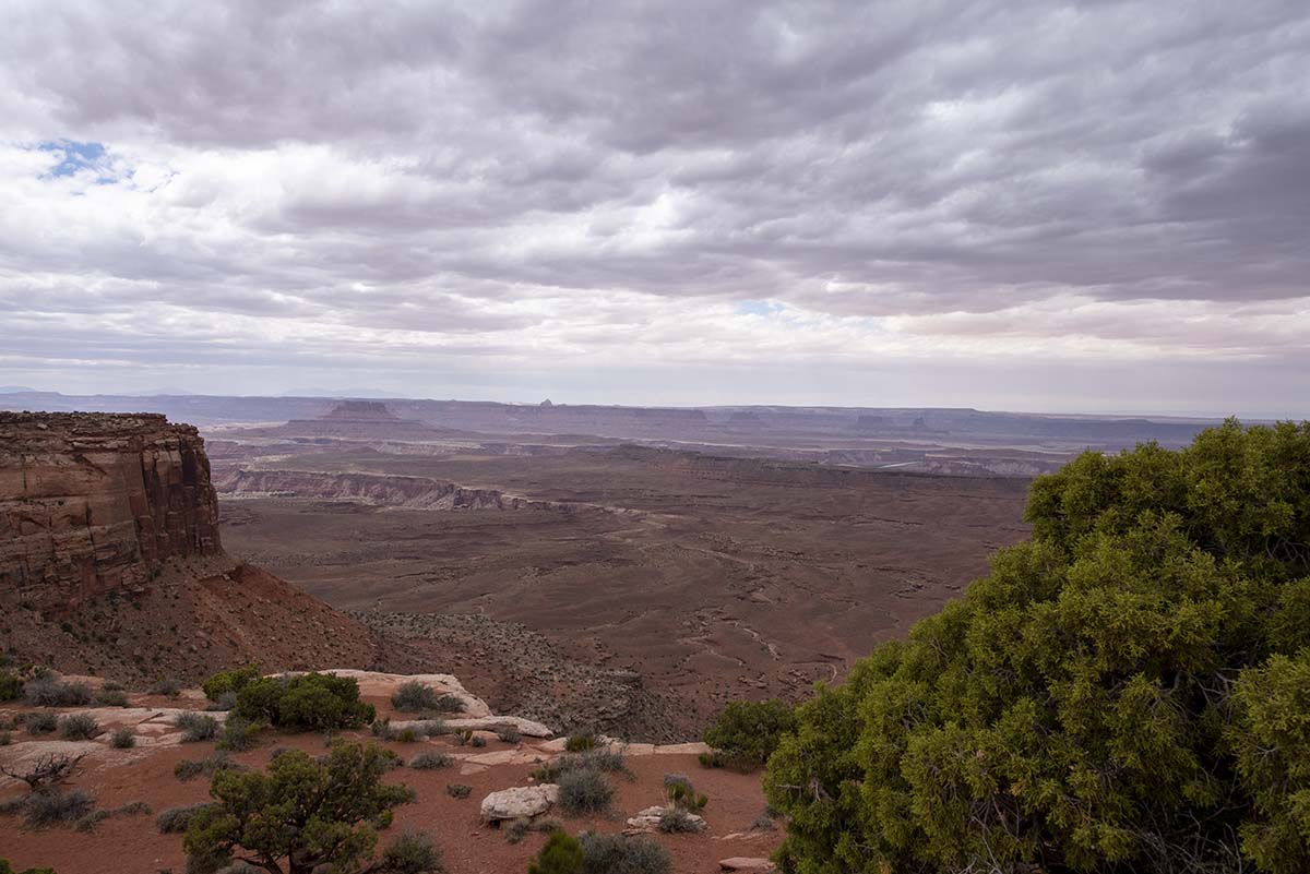
On my 2015 road trip, when I visited Arches National Park, I also did some hiking in Island in the Sky. That’s the section I passed on the road today, as well. I spent this afternoon revisiting its scenic spots; my plan for later is to drive down to The Needles. (The Maze would be a long drive around, and is mostly undeveloped in any case, so I don’t expect to visit it on this trip).
 |
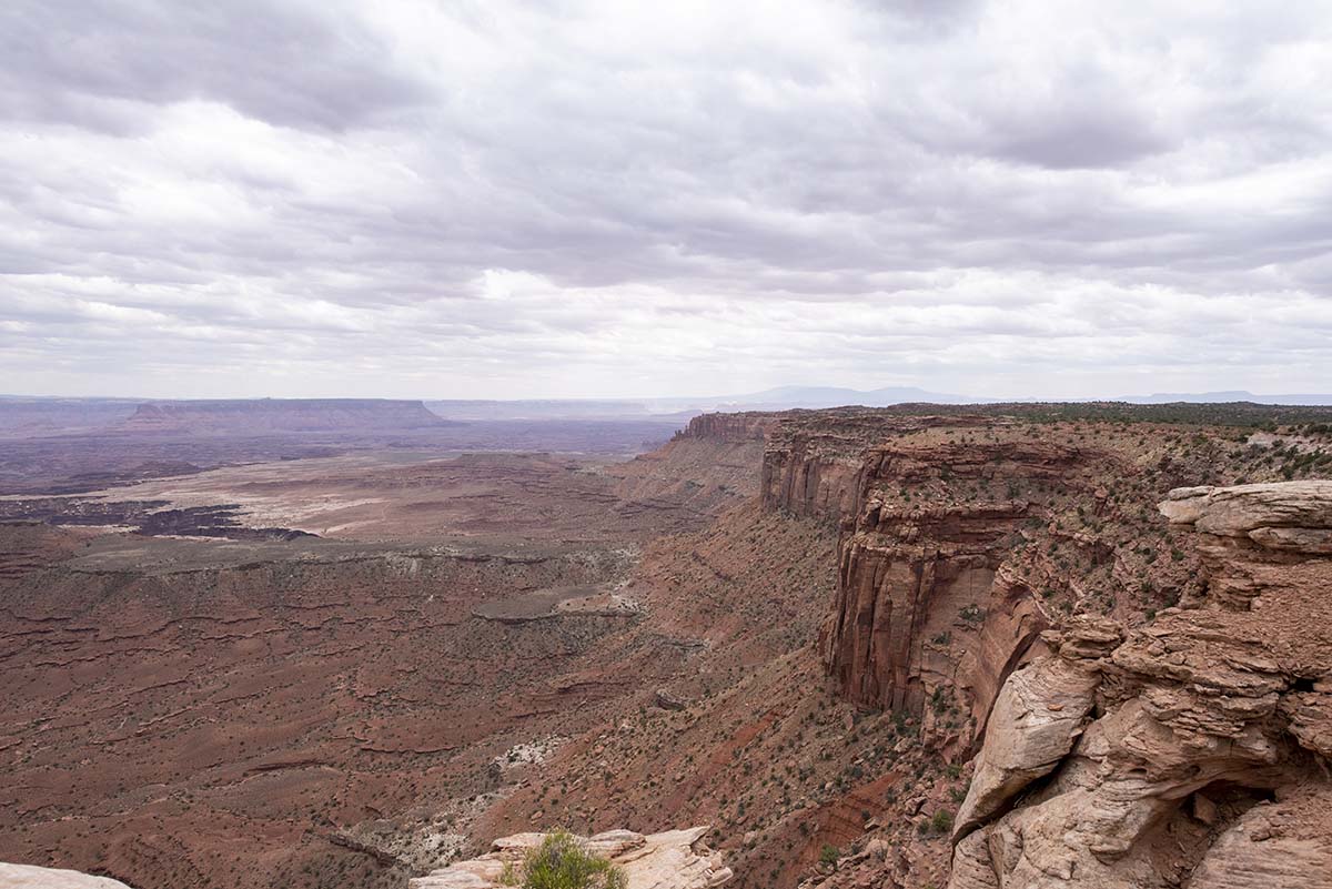
While driving atop the Island in the Sky plateau, you’d never know you were anywhere by an ordinary flat plain. (Although you’d have seen differently when driving up onto it.) |
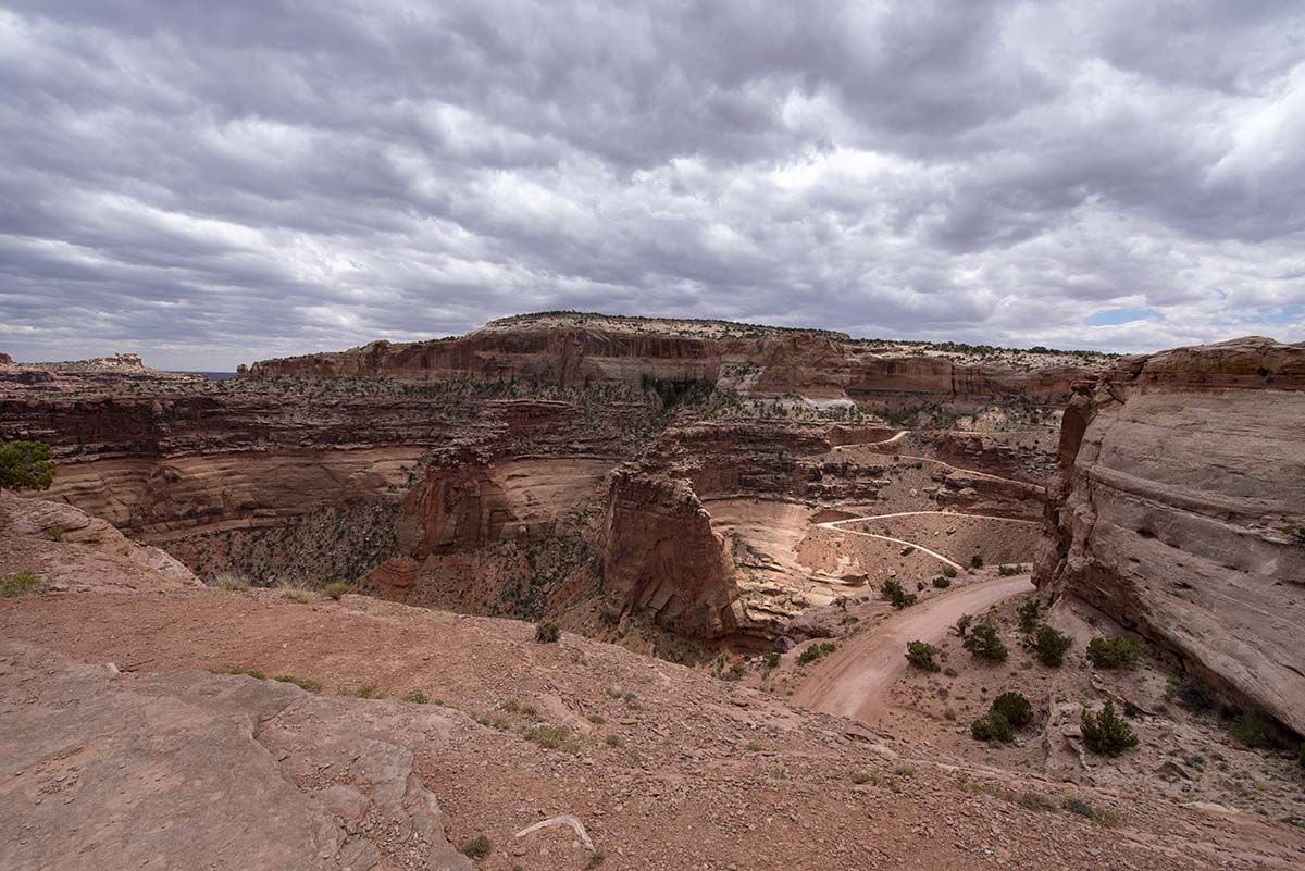
| But then you come to an edge… | 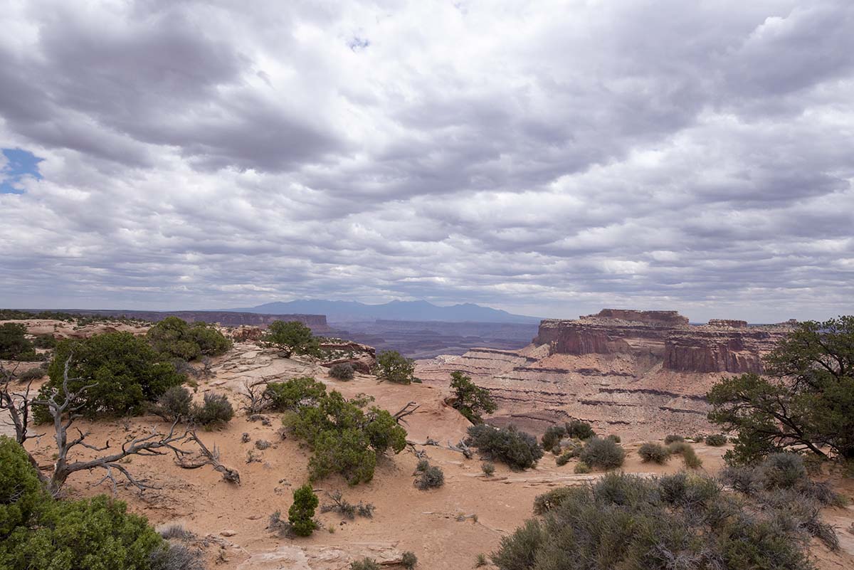 |
 |
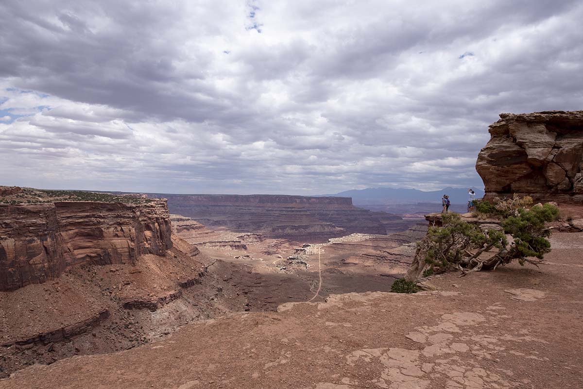 |
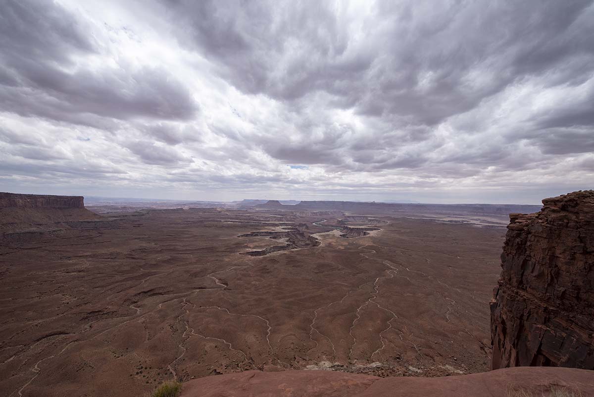
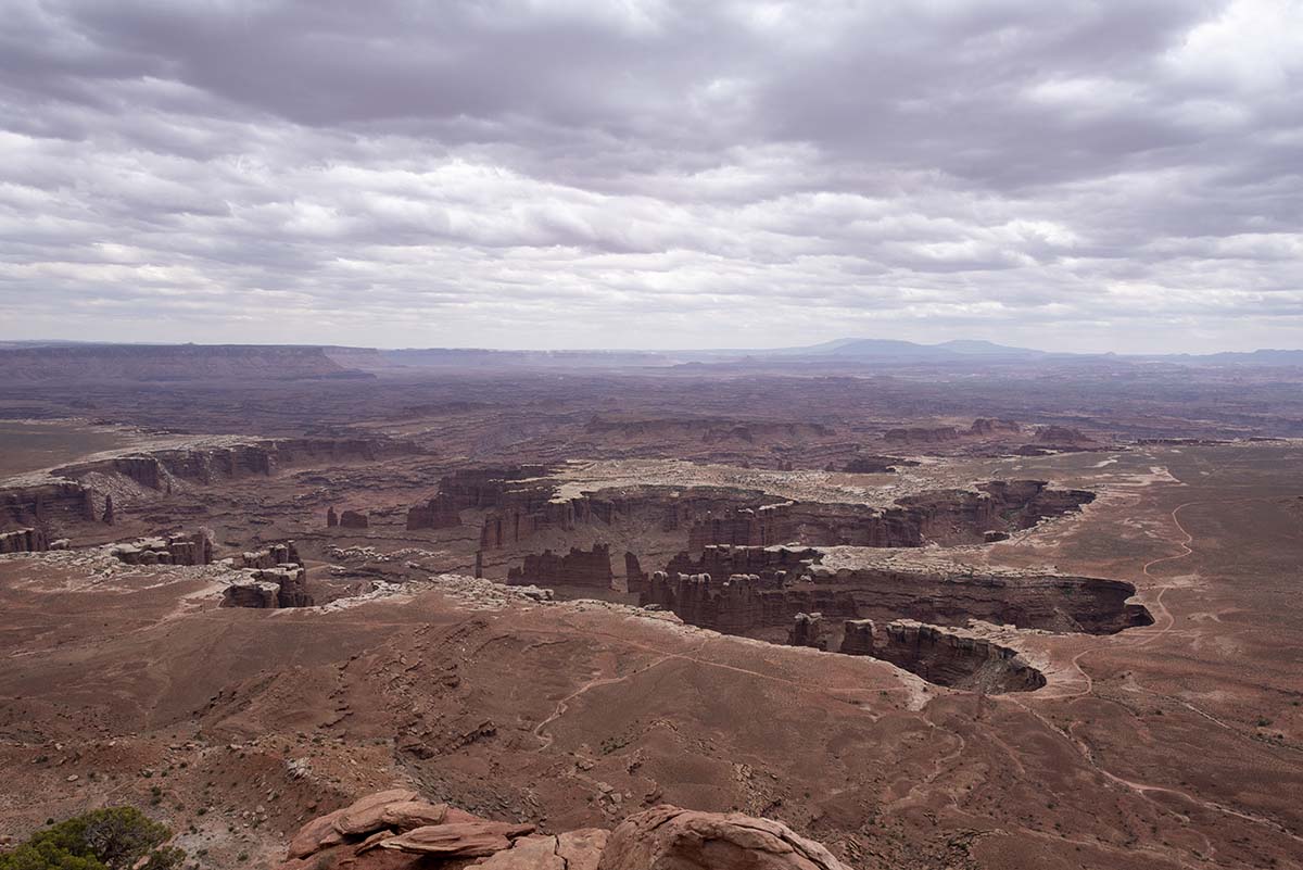
At the overlook point just below, a family was taking pictures and the father summed up the landscape perfectly: “Amazing, it’s canyons inside of canyons inside of canyons.”
 |
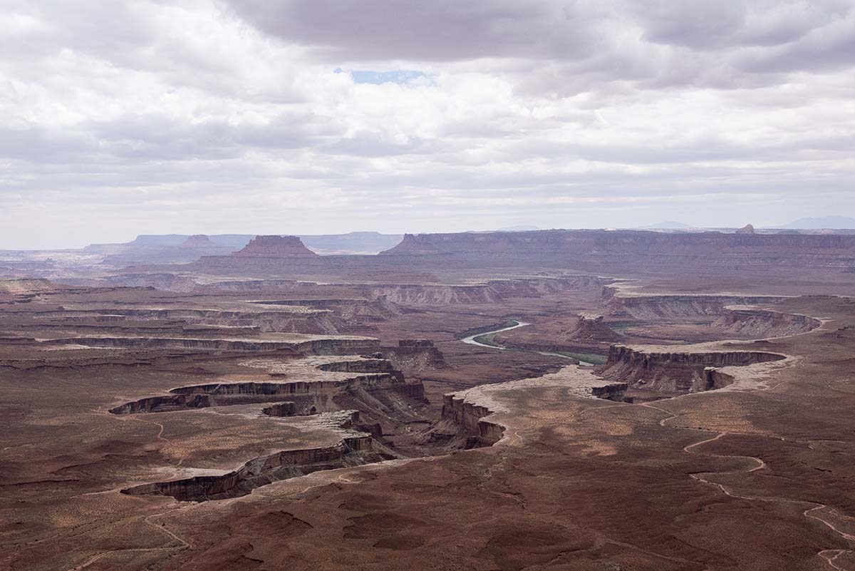 |
That’s the Green River, running in an inner canyon within the huge, wide space it carved out of the plateau some time in the past.
 |
 |
 |
 |
Tomorrow, my plan is to go into Arches National Park. Arches is one of the busiest parks, and its website warns that they close the entrance after a certain number of cars are inside (they haven’t set up a park-and-ride shuttle like some of the other parks have). So my plan is to get a bright and early start in order to get in. If I’m not early enough and can’t get in, I’ll drive down to see The Needles section of Canyonlands, and then try Arches even earlier the next day.
Trip Report
Miles driven today: 243.2
Total miles so far: 3932.7
