Day Twenty-two: July 1
As planned, I drove south to The Needles district of Canyonlands National Park. It was a longish drive— around an hour and a half each way, for a three-hour “commute” taken out of the day, and I added an extra ninety minutes or so with a side drive to a couple of scenic overlooks on the way. So my time at the actual park was limited.
The drive itself was beautiful and scenic, though— as they’ve all been in this region— so I don’t feel like the commuting time was lost time. The road wound past some spectacular formations, among mesas and canyon walls. Unfortunately, as usual, roads outside the parks lack scenic pullouts to stop and take pictures, so I don’t have any pictures to show from the drive.
Let’s get to what I do have pictures of.
First, the detour: while still outside Canyonlands itself, a park service road heads off to a couple of points that look into the park from a distance. First, the “Anticline Overlook,” named for the geological formation it’s looking over.
 This is a view of the Colorado River, upstream of its confluence with the Green River inside Canyonlands.
 |
And here, looking in a different direction from the same overlook point, a smaller stream that feeds into the Colorado near this point. |
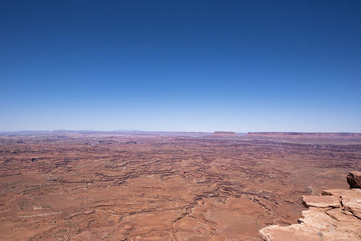
The second scenic point is the Needles Overlook, which as its name implies looks into the actual Needles section of the national park.
 |
 |
I think the view into the canyons would have been more dramatic if I’d arrived early in the morning; it wasn’t far off noon when I got there and the sun right overhead tends to flatten out the detail.
Then, on towards Canyonlands itself.
The drive into the park passes Newspaper Rock, a very well-used petroglyph stone.
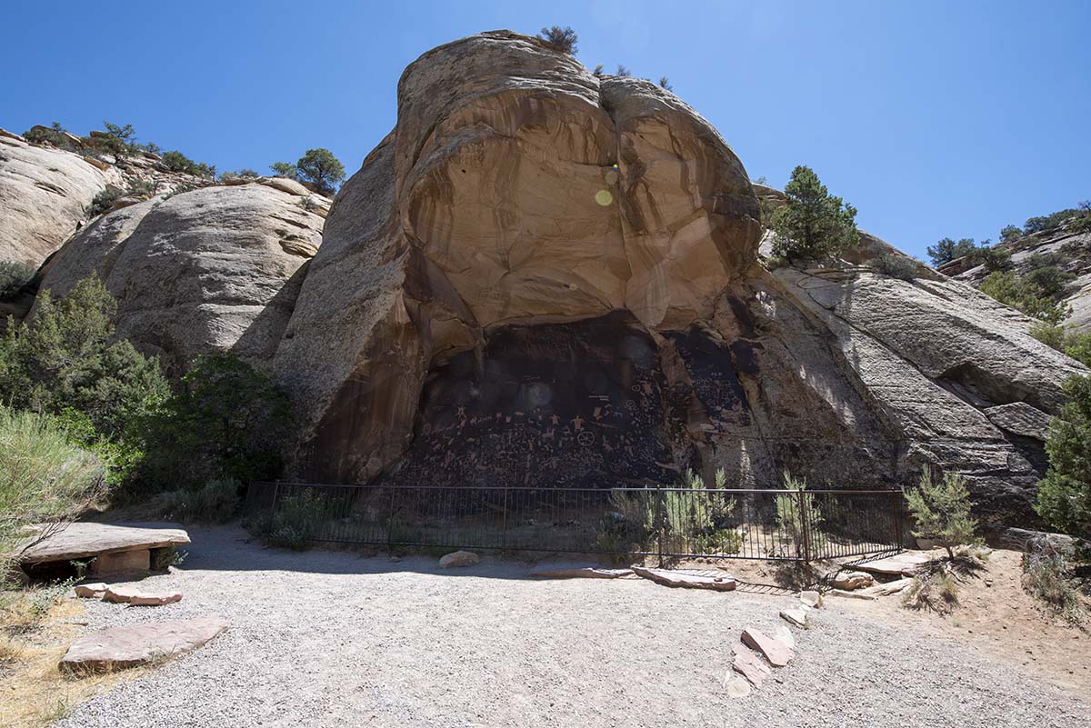 |
The rock under this overhang has petroglyphs carved on top of older, faded petroglyphs, going back centuries. |
| Archaeologists estimate that 2000 years of symbols and drawings are here. | 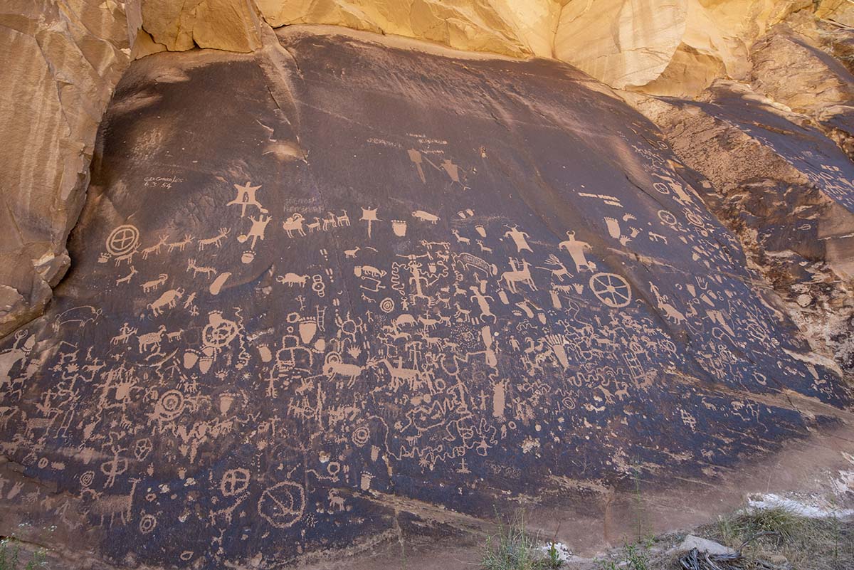 |
Of the sections of Canyonlands, “Island in the Sky” is so named because the plateau the Green and Colorado rivers cut into remains intact there, forming exactly what its name says. “The Needles” and “The Maze” are both regions where the plateau has been completely carved up into canyons and rock formations.
 |
Wooden Shoe Arch. |
I followed the park’s short scenic drive to an overlook called Pothole Point, with about a half mile loop trail leading to it from the road— the closest I came to a hike today.
| Potholes form in the rock for the same reason they do on roads: wherever water can seep in, it freezes in winter and cracks the stone. Once started, a pothole just gets bigger and bigger, part of the process of erosion that will eventually wear away the stone altogether. |  |
But in the meantime, these potholes are home to their own little worlds. The dry sand at the bottom contains eggs of insects, crustaceans, and snails that can lie dormant and desiccated for years, waiting for the rare desert rain. When the rain finally comes and the pothole fills with water, an entire miniature ecosystem springs into action, organisms racing through an accelerated life cycle to get the eggs for the next generation laid before the puddle dries up. This area hasn’t seen rain in some time, so I wasn’t able to see any of these little ponds in action.
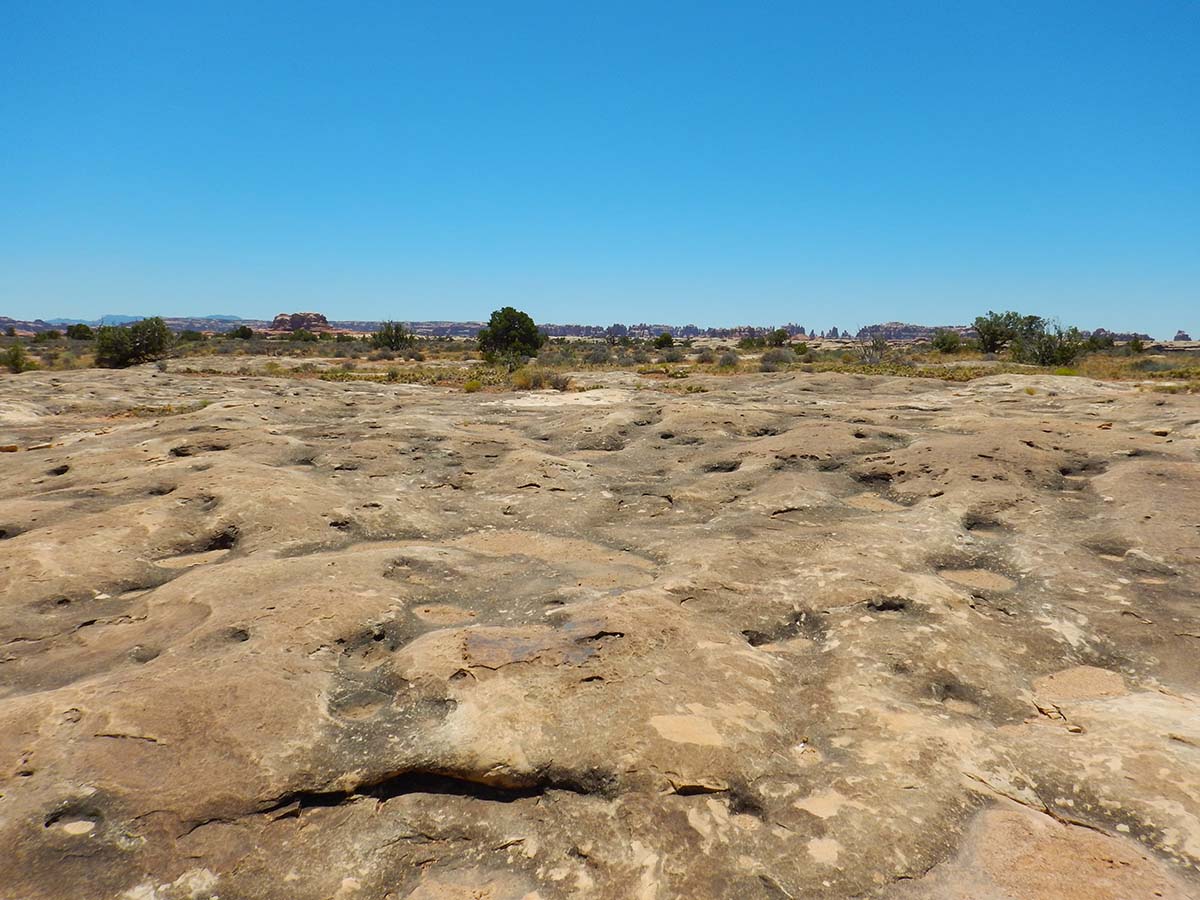 |
But there were quite a lot of them across the surface of the aptly named Pothole Point. |
| As well as some rocks strangely carved by wind and water. |  |
 |
The actual view from the overlook was almost the least interesting part. |
From Pothole Point the scenic road continued to the Big Spring Canyon Overlook. From here, a 4 miles hiking trail leads to an view of the actual confluence of the Green and Colorado rivers, but the trail was closed (due to the Bighorn Sheep mating season, the sign said).
 |
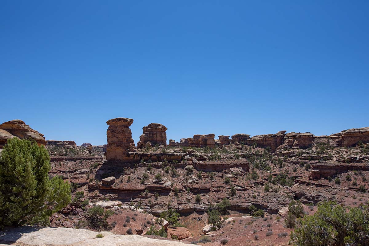 |
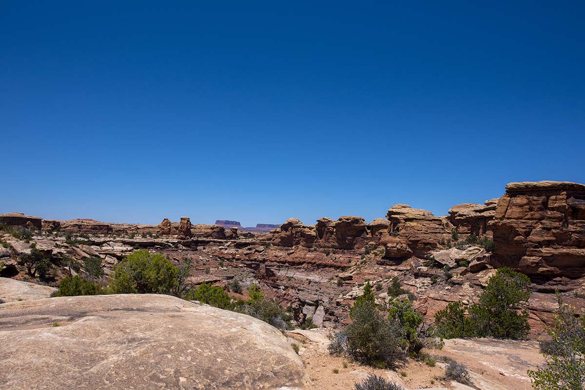
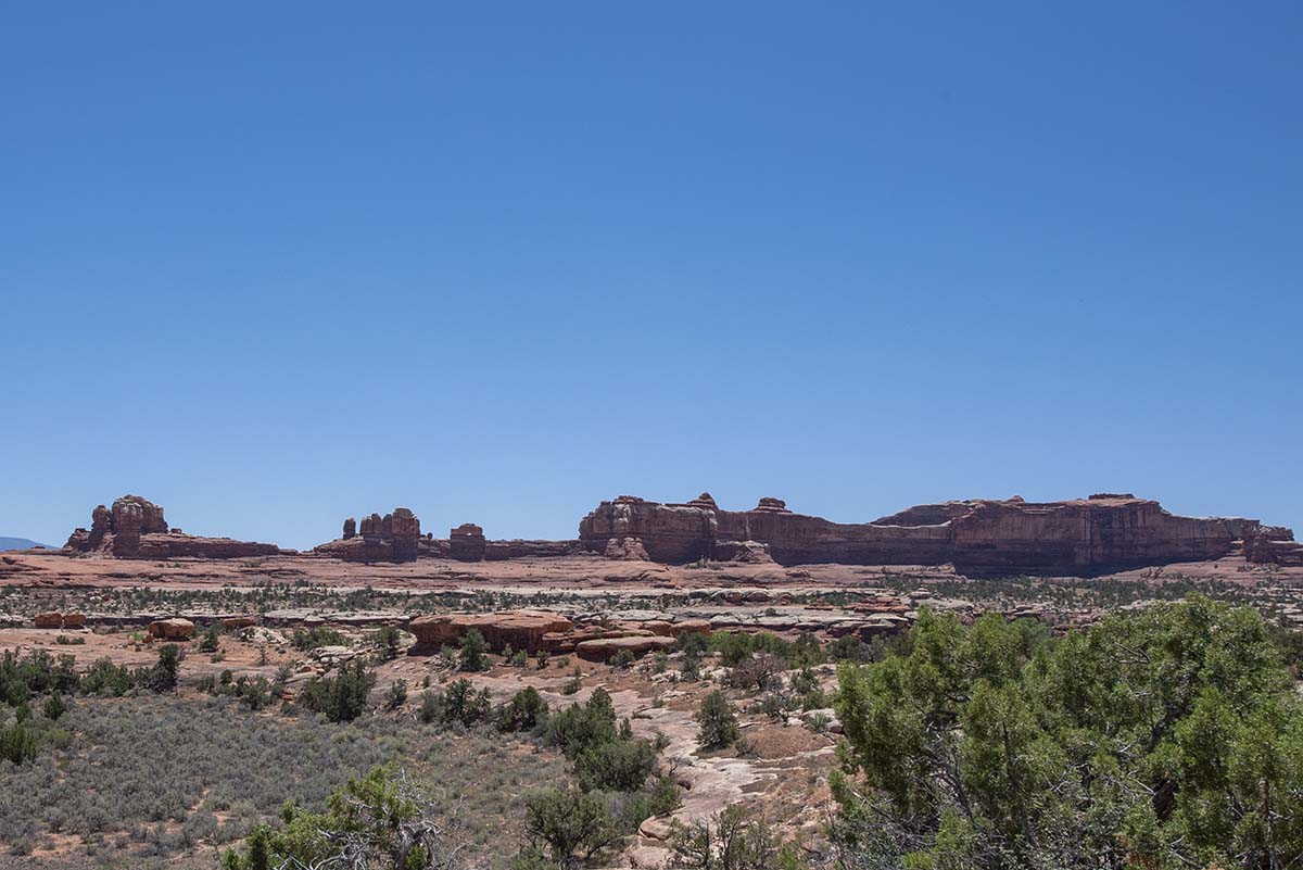
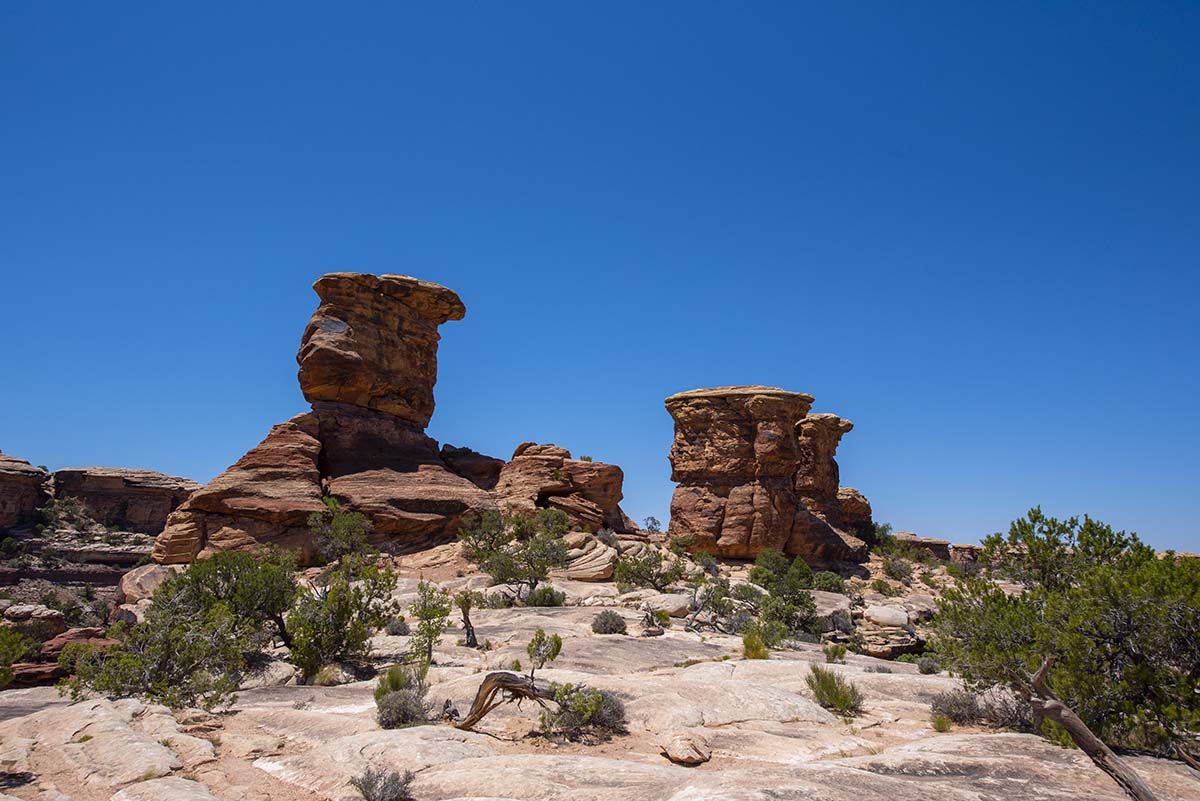
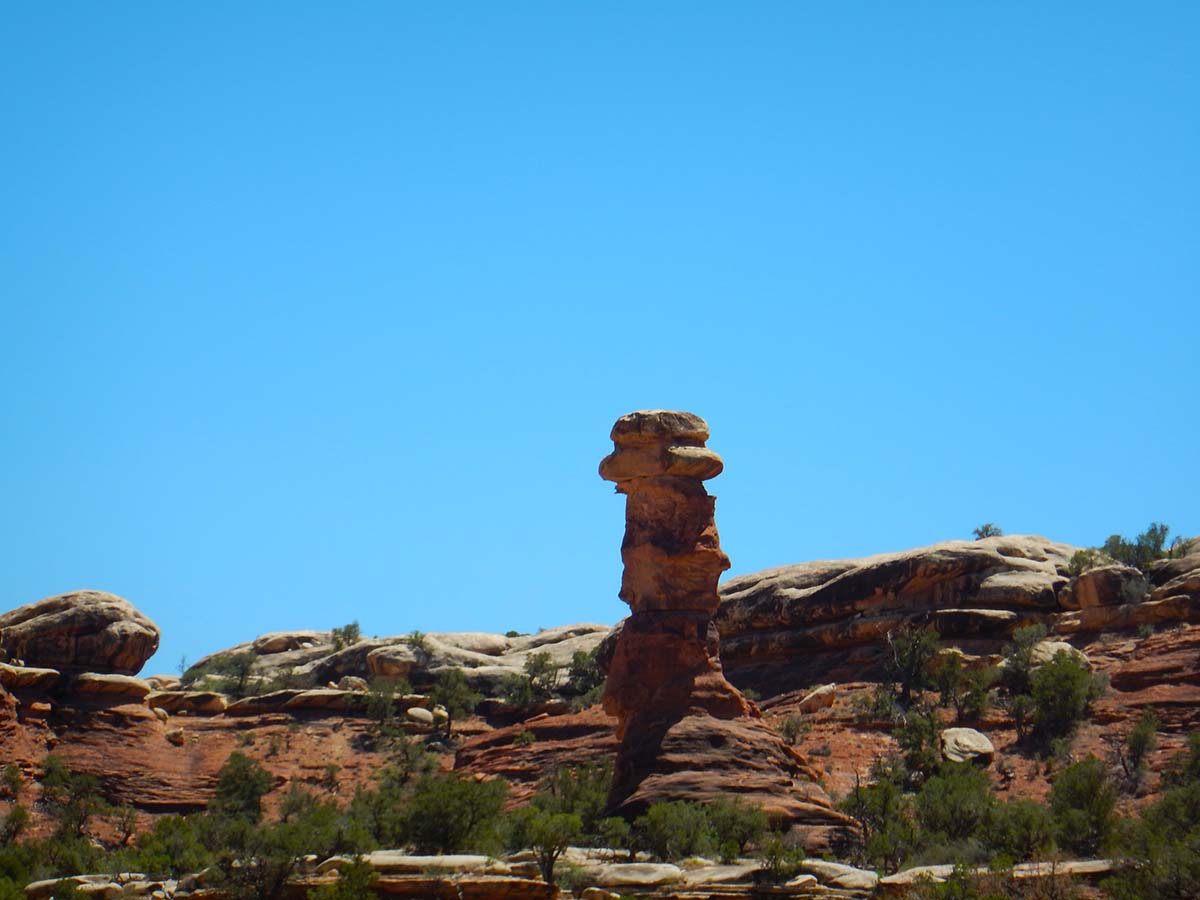
From Big Spring Canyon, I drove down a dirt road to Elephant Hill (that’s sort of car-hiking, isn’t it?). Along that route you get a good, though distant, view of the formation that gives this part of Canyonlands its name: The Needles.
 (Be sure to click on the above image to see the full size version.)
A ranger told me that when Canyonlands was first put up for a national park, it was the Needles that prompted the proposal; the other sections were added later. Unfortunately the only way to get closer to them is by hiking, and a fairly long hike at that, which I didn’t have time for.
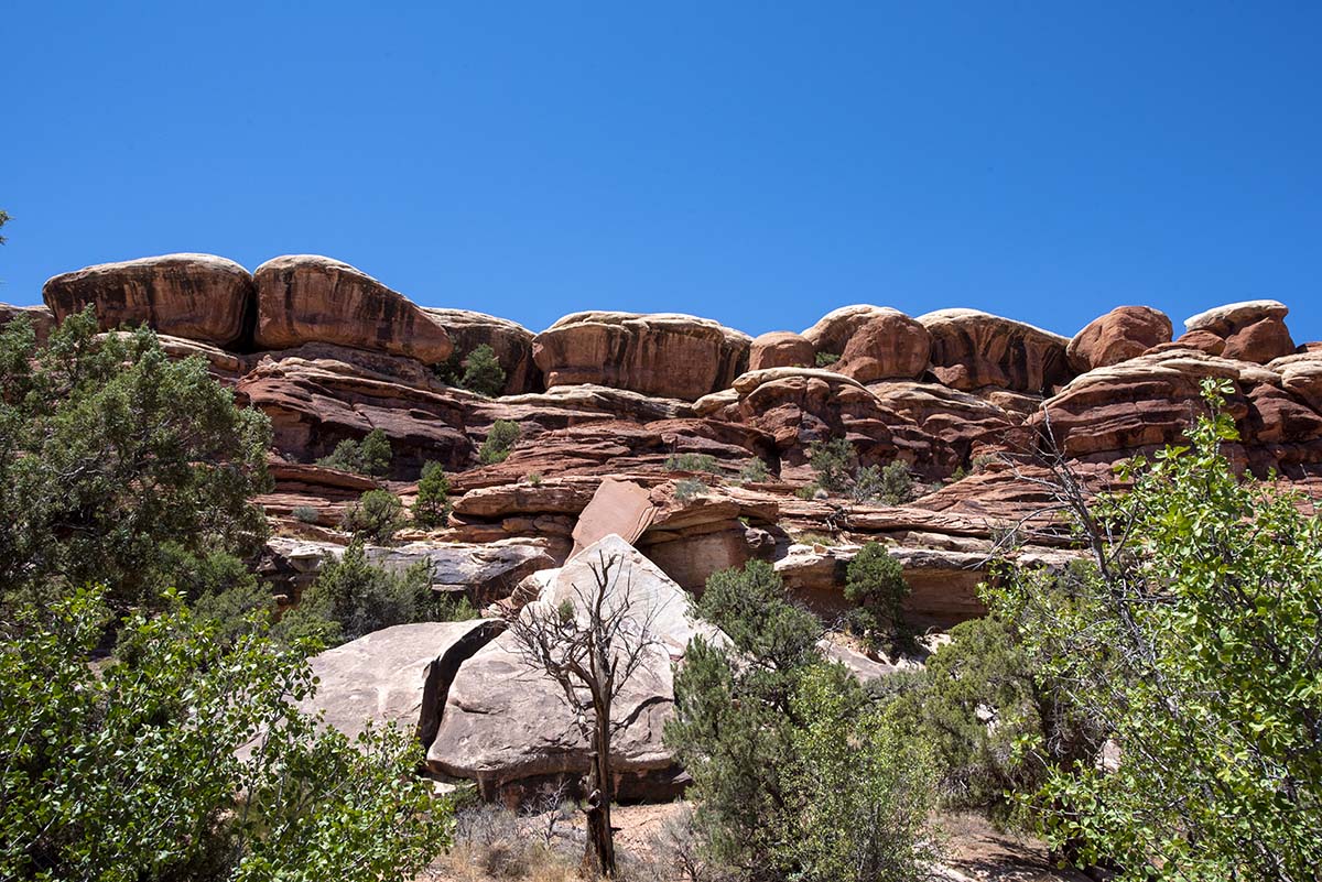 |
Elephant Hill had its own interesting sights to see. |
 |
 |
 |
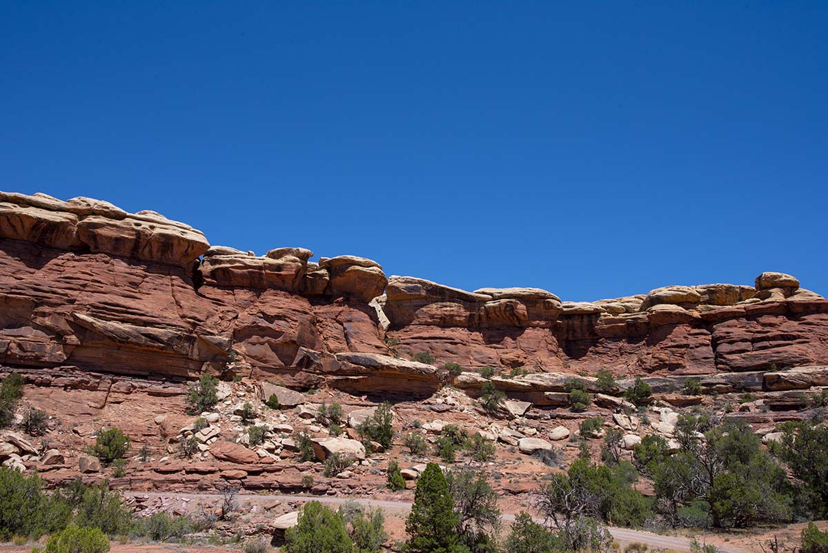
After checking out Elephant Hill, it was time to head for home. |
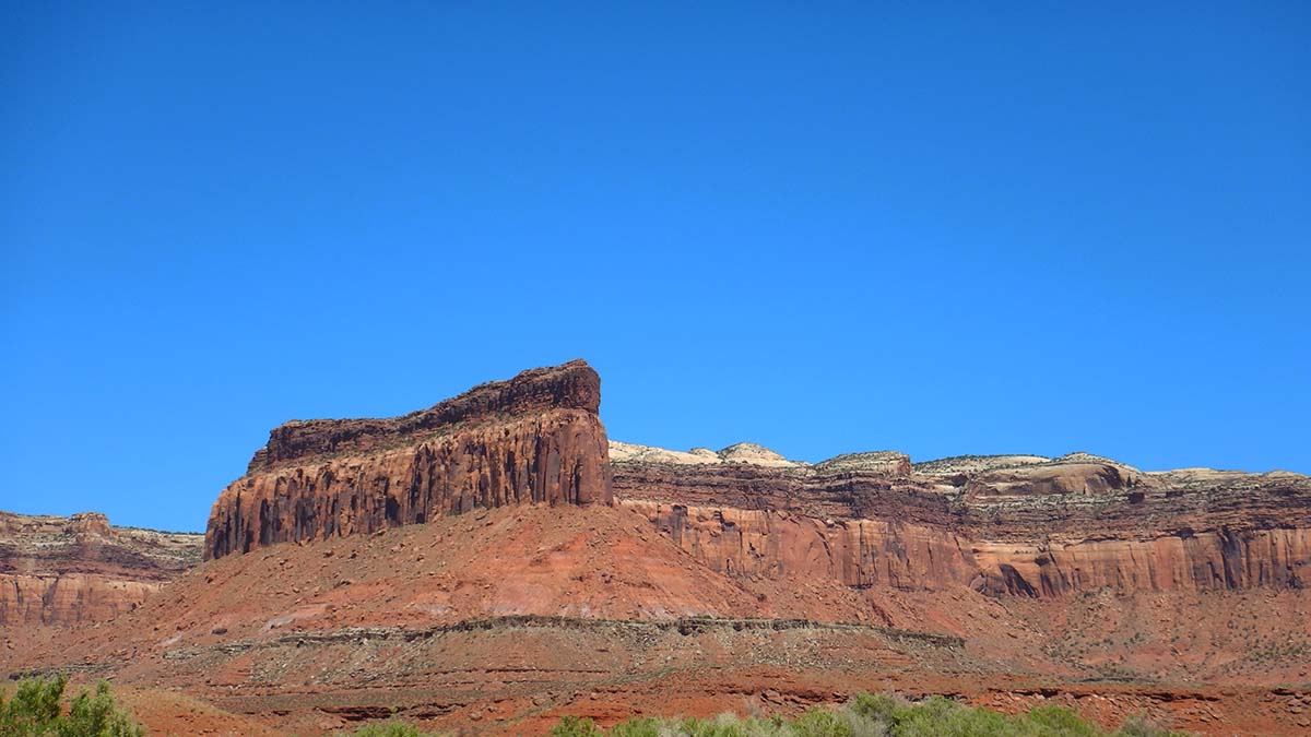
But even outside the park I find a chance to get a good picture along the road. A whole lot of today’s drive looked this good.
Tomorrow, my plan is to go back into Arches and take in the scenic spots I drove past on the way to Delicate Arch yesterday. I don’t expect that to take more than the morning, so for the afternoon I’ll think about finding an interesting hike. Afternoons are hot around here, but there are some possibilities that offer shade along the trail. I’ll decide when I come to it.
Trip Report
Miles driven today: 264.8
Total miles so far: 4272.9
